


 Philippines
National
LPA outside PAR unlikely to develop into tropical depression—PAGASA
Philippines
National
LPA outside PAR unlikely to develop into tropical depression—PAGASA
LPA outside PAR unlikely to develop into tropical depression—PAGASA


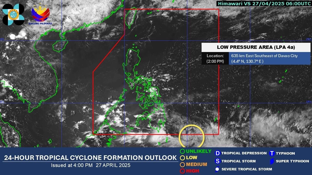
The Philippine Atmospheric, Geophysical and Astronomical Services Administration (PAGASA) said on Sunday, April 27, that a Low Pressure Area (LPA) outside the Philippine Area of Responsibility (PAR) is unlikely to develop into a tropical depression within the next 24 hours.
As of 2 p.m., the state weather bureau said the LPA, designated as LPA 04A, was located 635 kilometers east-southeast of Davao City.
“All are advised to monitor updates from PAGASA,” PAGASA stated.
In its latest weather bulletin, PAGASA said that the Intertropical Convergence Zone (ITCZ) continues to affect Mindanao, while Easterlies are bringing warm and humid winds across the rest of the country.
Mindanao and Palawan, the agency said, may experience cloudy skies with scattered rains and thunderstorms due to the ITCZ, while Eastern Samar, Leyte, and Southern Leyte will also have cloudy skies and possible thunderstorms caused by Easterlies.
Metro Manila and the rest of the country will have partly cloudy to cloudy skies with isolated rain showers or thunderstorms, which could trigger flash floods or landslides during severe thunderstorms, PAGASA warned.
Winds across the country are expected to be light to moderate, blowing from east to northeast, with slight to moderate coastal water conditions.