


Manila Bulletin
 Philippines
National
'Verbena' intensifies into tropical storm; Signal No. 2 raised over parts of Palawan
Philippines
National
'Verbena' intensifies into tropical storm; Signal No. 2 raised over parts of Palawan
Philippines
National
'Verbena' intensifies into tropical storm; Signal No. 2 raised over parts of Palawan
'Verbena' intensifies into tropical storm; Signal No. 2 raised over parts of Palawan
Published Nov 25, 2025 08:27 pm


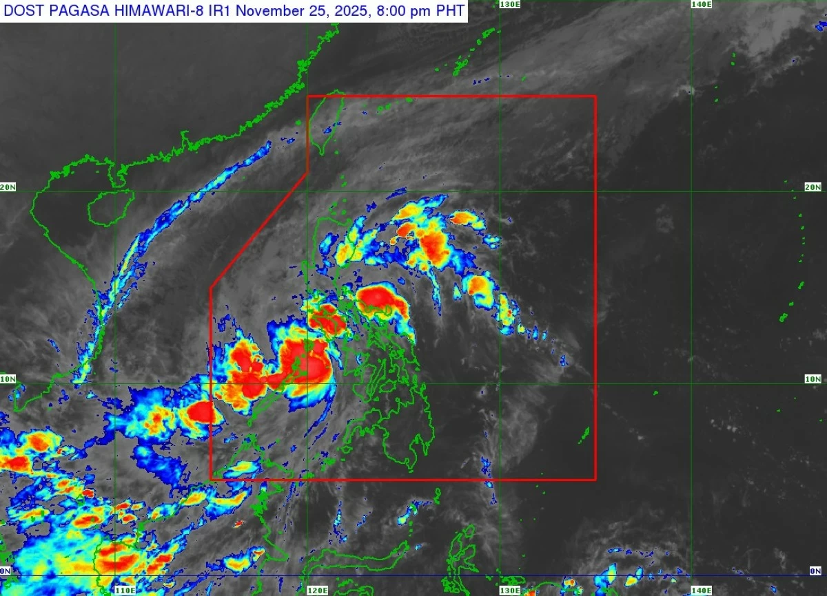
Satellite image of Tropical Storm Verbena (Courtesy of PAGASA)
The Philippine Atmospheric, Geophysical and Astronomical Services Administration (PAGASA) said Tropical Depression Verbena intensified into a tropical storm as it approaches Calamian Islands and the northern part of mainland Palawan on Tuesday evening, Nov. 25.
This prompted the issuance of Tropical Cyclone Wind Signal No. 2 over Calamian Islands and extreme northern portion of mainland Palawan (El Nido, Taytay, Araceli).
Signal No. 1 remains hoisted over Occidental Mindoro, Oriental Mindoro, southern Romblon (Santa Fe, Ferrol, Looc, San Jose), northern and central Palawan (Dumaran, Roxas, San Vicente, Puerto Princesa City, including Cuyo and Cagayancillo Islands), Antique, and northwestern Aklan (Malay, Buruanga, Nabas).
PAGASA said Verbena is currently packing maximum sustained winds of 65 kilometers per hour (kph) near the center and gustiness of up to 80 kph, up from 55 kph maximum winds and 70 kph gusts earlier.
As of 8 p.m., the center of the storm was located over the coastal waters of Linapacan, Palawan.
Verbena is expected to move west-northwestward over the Sulu Sea and make landfall over the northern portion of Palawan on Tuesday evening.
It will then emerge over the West Philippine Sea on early Wednesday morning, Nov. 26.
Afterward, Verbena will pass north of Kalayaan Islands on Wednesday evening, exit the Philippine Area of Responsibility early Thursday morning, Nov. 27, and turn west-southwestward from Thursday until Friday morning, Nov. 28.
PAGASA said Verbena may reach severe tropical storm strength as early as Wednesday and could continue to intensify until Thursday due to favorable environmental conditions.
A weakening trend may follow as the northeast monsoon, or “amihan,” begins to surge.