


TD Verbena makes landfall over Surigao del Sur — PAGASA
28 areas under Signal No. 1
Published Nov 24, 2025 04:30 pm


PAGASA
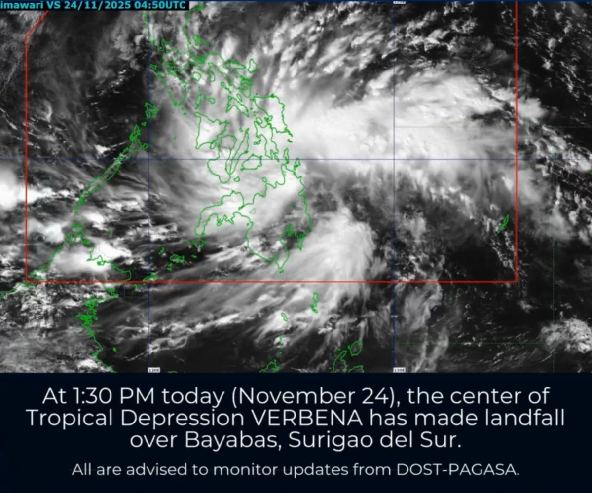
Tropical Depression Verbena made landfall over Bayabas, Surigao del Sur at 1:30 p.m. on Monday, Nov. 24, the Philippine Atmospheric, Geophysical and Astronomical Services Administration (PAGASA) said.
The weather disturbance had maximum sustained winds of 45 kilometers per hour (kph) near the center and gusts of up to 75 kph.
After crossing Surigao del Sur, PAGASA said Verbena is expected to move across the Visayas and northern Palawan between Monday and Tuesday evening, Nov. 25, before entering the West Philippine Sea on Wednesday morning, Nov. 26.
It is forecast to turn westward, pass north of the Kalayaan Islands, and leave the Philippine Area of Responsibility on Thursday, Nov. 27.
In its 5 p.m. bulletin, PAGASA raised Tropical Cyclone Wind Signal No. 1 over 28 areas, including Occidental Mindoro, Oriental Mindoro, Romblon, northern and central Palawan (Araceli, Taytay, El Nido, Dumaran, Roxas, San Vicente, including the Calamian Islands, Cuyo Islands, and Cagayancillo Islands), mainland Masbate (Balud, Mandaon, Milagros, Cawayan, Placer, Pio V. Corpuz, Esperanza, Uson, Dimasalang, Mobo, Palanas, Aroroy, Cataingan, Baleno, and the City of Masbate), Antique, Aklan, Capiz, Iloilo, Guimaras, Negros Occidental, Negros Oriental, Siquijor, Cebu, Bohol, Samar, Eastern Samar, Biliran, Leyte, Southern Leyte, Dinagat Islands, Surigao del Norte, Surigao del Sur, Agusan del Norte, Agusan del Sur, Camiguin, Misamis Oriental, and northern Bukidnon (Baungon, Libona, Manolo Fortich, Sumilao, Impasug-Ong, Malitbog, Cabanglasan, and the City of Malaybalay).
PAGASA said the wind signals indicate the general threat of strong winds from the tropical depression and warned that local winds may be stronger in exposed coastal areas and in upland or mountainous communities.
From Monday noon to Tuesday noon, heavy to intense rainfall (100 to 200 millimeters) may prevail over Eastern Samar, Northern Samar, Samar, Leyte, Biliran, Southern Leyte, Capiz, Iloilo, Cebu, Bohol, Negros Occidental, Surigao del Norte, Surigao del Sur, Dinagat Islands, Masbate, Albay, and Sorsogon.
Romblon, Palawan, Occidental Mindoro, Marinduque, Camarines Norte, Camarines Sur, Catanduanes, Antique, Aklan, Guimaras, Negros Oriental, Siquijor, Agusan del Norte, Agusan del Sur, Misamis Oriental, Bukidnon, Lanao del Norte, Misamis Occidental, and Camiguin may also receive moderate to heavy rainfall (50 to 100 millimeters).
From Tuesday noon to Wednesday noon, Romblon, Oriental Mindoro, Batangas, Negros Occidental, Capiz, Aklan, Antique, and Iloilo may experience heavy to intense rainfall, while Occidental Mindoro, Marinduque, Albay, Sorsogon, Masbate, Catanduanes, Camarines Norte, Camarines Sur, Palawan, Northern Samar, Samar, Eastern Samar, Southern Leyte, Leyte, Biliran, Cebu, Bohol, Negros Oriental, Siquijor, Guimaras, and Dinagat Islands may receive moderate to heavy rainfall.
PAGASA said heavy rainfall due to the shear line is also expected.
From Monday noon to Tuesday noon, Oriental Mindoro may receive 100 to 200 millimeters of rain, while Cagayan, Isabela, Aurora, and Quezon may receive 50 to 100 millimeters.
From Tuesday noon to Wednesday noon, Cagayan, Isabela, Aurora, and Quezon may receive 100 to 200 millimeters of rainfall, while Quirino, Nueva Vizcaya, Apayao, Kalinga, Mountain Province, Ifugao, Nueva Ecija, Bulacan, Metro Manila, Rizal, Laguna, and Cavite may to receive 50 to 100 millimeters.
From Wednesday noon to Thursday noon, Cagayan may continue to receive 100 to 200 millimeters of rainfall, while Isabela, Aurora, Apayao, and Kalinga may see 50 to 100 millimeters of precipitation.