


Manila Bulletin
 Philippines
National
PAGASA warns of heavy rains, rough seas as 'Verbena' nears land
Philippines
National
PAGASA warns of heavy rains, rough seas as 'Verbena' nears land
Philippines
National
PAGASA warns of heavy rains, rough seas as 'Verbena' nears land
PAGASA warns of heavy rains, rough seas as 'Verbena' nears land
Published Nov 24, 2025 09:02 am


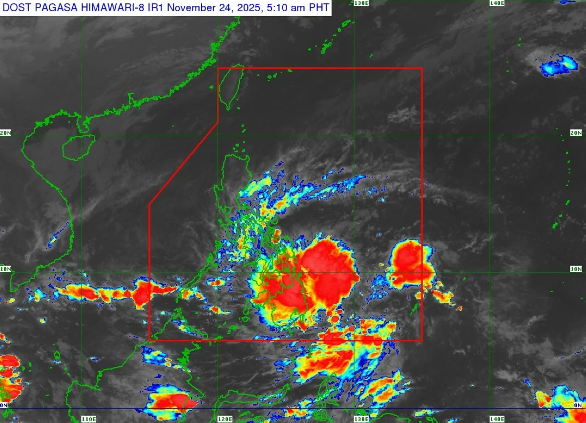
Satellite image of Tropical Depression Verbena (Courtesy of PAGASA)
The Philippine Atmospheric, Geophysical and Astronomical Services Administration (PAGASA) on Monday, Nov. 24, warned that Tropical Depression Verbena is likely to bring heavy rainfall and rough seas across parts of the country.
Verbena is expected to reach northeastern Mindanao around this noon or afternoon, before moving across the Visayas and northern Palawan and emerging over the West Philippine Sea by Wednesday, Nov. 26.
Heavy to intense rainfall (100 to 200 millimeters) is forecast in Eastern Samar, Samar, Leyte, Biliran, Southern Leyte, Surigao del Norte, Surigao del Sur, and Dinagat Islands as early as Monday.
Moderate to heavy rain (50–100 millimeters) may also affect Camarines Norte, Camarines Sur, Albay, Sorsogon, Masbate, Capiz, Iloilo, Guimaras, Negros Occidental and Oriental, Cebu, Bohol, Siquijor, Northern Samar, Agusan del Norte and Sur, Misamis Oriental, Bukidnon, and Camiguin.
On Tuesday, Nov. 25, heavy to intense rainfall may continue in Albay, Sorsogon, Masbate, Romblon, Oriental Mindoro, Southern Leyte, Leyte, Biliran, Cebu, Bohol, Negros Occidental, Capiz, Iloilo, and Dinagat Islands.
Moderate to heavy precipitation may prevail over Batangas, Occidental Mindoro, Marinduque, Catanduanes, Camarines Norte, Camarines Sur, Palawan, Northern Samar, Samar, Eastern Samar, Southern Leyte, Bohol, Negros Oriental, Siquijor, Antique, Guimaras, and Dinagat Islands.
By Wednesday, Nov. 26, heavy to intense rainfall is forecast in Aklan, Palawan, Antique, Occidental Mindoro, and Oriental Mindoro.
Moderate to heavy rainfall may persist in Quirino, Nueva Vizcaya, Cavite, Batangas, Laguna, Oriental Mindoro, Marinduque, Palawan, Romblon, Aklan, and Antique.
The shear line, a boundary where warm and cold air masses meet, producing rain-bearing clouds, is also expected to bring moderate to heavy rainfall over Cagayan, Isabela, Aurora, and Quezon on Monday; over Cagayan, Isabela, Quirino, Apayao, Kalinga, Aurora, and Quezon on Tuesday; and over Metro Manila, Rizal, Quezon, Nueva Ecija, Apayao, Kalinga, Mountain Province, Ifugao, and Bulacan on Wednesday.
PAGASA warned that rainfall may be heavier in mountainous areas and warned that flooding could worsen in locations that have already received significant rain in recent days.
Residents and local disaster offices are urged to take all necessary precautions.
Rough seas
PAGASA also warned of very rough seas of up to 4.5 meters along the northern seaboard of Batanes.
Rough seas with wave heights of up to 3 to 3.5 meters may occur along the seaboards of Cagayan, Isabela, Aurora, Northern Samar, Eastern Samar, Dinagat Islands, Babuyan Islands, Albay, Sorsogon, Camarines Norte, Camarines Sur, Surigao del Sur, Leyte, Southern Leyte, Biliran, Cebu, Bohol, Negros Occidental, Capiz, and Iloilo.
Wave heights of 2 to 2.5 meters are forecast for other coastal areas, including Zambales, Occidental Mindoro, Palawan, Oriental Mindoro, Romblon, Aklan, Antique, Masbate, Davao Oriental, and Samar.
Mariners are advised not to venture out, and small-craft operators are strongly urged to exercise caution or suspend operations until conditions improve.
PAGASA said Verbena may strengthen slightly before reaching Mindanao but is forecast to remain a tropical depression while crossing the country.
It is expected to intensify into a tropical storm once over open waters.