


Manila Bulletin
 Philippines
National
'Life-threatening conditions' in Homonhon, Dinagat Islands due to Typhoon Tino — PAGASA
Philippines
National
'Life-threatening conditions' in Homonhon, Dinagat Islands due to Typhoon Tino — PAGASA
Philippines
National
'Life-threatening conditions' in Homonhon, Dinagat Islands due to Typhoon Tino — PAGASA
'Life-threatening conditions' in Homonhon, Dinagat Islands due to Typhoon Tino — PAGASA
Published Nov 3, 2025 11:45 pm


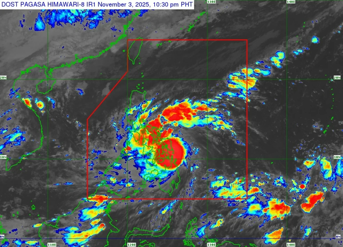
Satellite image of Typhoon Tino (Kalmaegi) (Courtesy of PAGASA)
Typhoon Tino (international name: Kalmaegi) steadily intensified as it passed close to Homonhon and the Dinagat Islands late Monday, Nov. 3, prompting the Philippine Atmospheric, Geophysical and Astronomical Services Administration (PAGASA) to warn of life-threatening conditions that began affecting these areas.
In its 11 p.m. bulletin, PAGASA said Tino had maximum sustained winds of 150 kilometers per hour (kph) near the center and gustiness of up to 205 kph, up from 140 kph winds and 170 kph gusts just three hours earlier.
The typhoon was moving westward at 30 kph over the coastal waters of Loreto, Dinagat Islands.
Tino is expected to make its initial landfall at or near peak intensity of 150–155 kph, with gustiness potentially higher, over Leyte or Southern Leyte by midnight or early Tuesday morning, Nov. 4.
It will then cross the Visayas and northern Palawan from Tuesday to early Wednesday morning, Nov. 5, before emerging over the West Philippine Sea and leaving the Philippine Area of Responsibility by Wednesday evening or Thursday, Nov. 6.
While slight intensification before landfall is still possible, Tino may no longer reach super typhoon status.
PAGASA said the interaction with the terrain might cause minor weakening, but it is expected to remain at typhoon strength throughout its passage over the country.
Signal No. 4, which warns of typhoon-force winds of 118 to 184 kph and a significant to severe threat to life and property, remained hoisted over the following areas:
* Extreme southeastern portion of Eastern Samar (Guiuan, Mercedes)
* Western portion of Leyte (Mahaplag, Abuyog, Baybay City, Inopacan, Javier, Macarthur)
* Southern Leyte
* Northern portion of Cebu (Lapu-Lapu City, Cordova, Mandaue City, Cebu City, Balamban, Asturias, Danao City, Compostela, Liloan, Consolacion, Borbon, Carmen, Tuburan, Catmon, Sogod, Tabuelan, Tabogon, San Remigio, Bogo City, Toledo City, Talisay City, Minglanilla, including Camotes Islands)
* Northeastern portion of Bohol (Pres. Carlos P. Garcia, Getafe, Trinidad, Ubay, Bien Unido, Talibon)
* Northern portion of Negros Oriental (Vallehermoso, Canlaon City)
* Northern portion of Negros Occidental (San Carlos City, Salvador Benedicto, Calatrava, Toboso, Escalante City, Sagay City, Cadiz City, Manapla, Victorias City, Enrique B. Magalona, Silay City, Talisay City, Bacolod City, Murcia, Bago City, Pulupandan, Valladolid, La Carlota City, San Enrique, Pontevedra, La Castellana)
* Guimaras
* Dinagat Islands
* Siargao and Bucas Grande Islands
Signal No. 3, which warns of strong winds capable of posing a moderate to significant threat to life and property, remained hoisted over the following areas:
* Southern portion of Eastern Samar (Lawaan, Balangiga, Giporlos, Quinapondan, Salcedo)
* Southern portion of Samar (Marabut)
* Central portion of Leyte (Tanauan, Palo, Tabontabon, Ormoc City, Dagami, Pastrana, Tolosa, Matag-Ob, Villaba, Kananga, Jaro, Alangalang, Santa Fe)
* Extreme northern and central portions of Cebu (Medellin, Daanbantayan, Sibonga, Carcar City, San Fernando, Aloguinsan, Pinamungahan, Barili, Dumanjug, Argao, Alcantara, Moalboal, Ronda, Naga City, including Bantayan Islands)
* Central and eastern portions of Bohol (San Miguel, Mabini, Buenavista, Inabanga, Danao, Dagohoy, Guindulman, Pilar, Alicia, Candijay, Anda, Jagna, Duero, Sierra Bullones, Carmen, Sagbayan, Clarin, Tubigon, Batuan, Catigbian, San Isidro, Calape, Loon)
* Northern portion of Negros Oriental (Guihulngan City, La Libertad, Jimalalud)
* Central portion of Negros Occidental (Hinigaran, Moises Padilla, Isabela, Binalbagan)
* Iloilo
* Southern portion of Capiz (Tapaz, Mambusao, Jamindan, Dumalag, Dumarao, Cuartero, Dao, Panitan, Pontevedra, Sigma, President Roxas, Ma-Ayon, Pilar)
* Central and southern portions of Antique (Tobias Fornier, Anini-Y, Hamtic, San Jose, Sibalom, Belison, Patnongon, San Remigio, Valderrama, Bugasong, Tibiao, Laua-An, Barbaza)
* Rest of Surigao del Norte
Signal No. 2, which warns of winds that may cause minor to moderate damage, remained hoisted over the following areas:
* Southern portion of Masbate (Esperanza, Pio V. Corpuz, Placer, Balud, Cawayan)
* Southern portion of Romblon (San Jose, Santa Fe, Alcantara, Looc)
* Southern portion of Oriental Mindoro (Bulalacao)
* Southern portion of Occidental Mindoro (Magsaysay, San Jose)
* Northern portion of Palawan (El Nido, Taytay, Dumaran, Araceli, including Cuyo Islands and Calamian Islands)
* Central portion of Eastern Samar (Can-Avid, Borongan City, Taft, Llorente, Maydolong, Balangkayan, Sulat, San Julian, General Macarthur, Hernani), including Cuyo and Calamian Islands
* Central portion of Samar (San Sebastian, Santa Rita, Villareal, Zumarraga, Pinabacdao, Talalora, Jiabong, Catbalogan City, Motiong, Calbiga, Daram, Paranas, Basey, Hinabangan, Santo Niño, Almagro, Tarangnan)
* Rest of Leyte
* Biliran
* Rest of Bohol
* Rest of Cebu
* Central portion of Negros Oriental (Tayasan, Manjuyod, Tanjay City, Bais City, Mabinay, Bindoy, Ayungon, Jimalalud, La Libertad, Sibulan, San Jose, Amlan, Pamplona, Bayawan City, Basay, Valencia, Dumaguete City, Bacong)
* Rest of Negros Occidental
* Siquijor
* Rest of Capiz
* Aklan
* Rest of Antique including Caluya Islands
* Northern portion of Surigao del Sur (Carrascal, Cantilan, Madrid, Carmen, Lanuza, Cortes, Tago, San Miguel, Marihatag, Cagwait, Bayabas, Tandag City)
* Northern portion of Agusan del Sur (Sibagat)
* Northern portion of Agusan del Norte (Kitcharao, Jabonga, Santiago, Tubay, Cabadbaran City, Remedios T. Romualdez, Magallanes)
* Camiguin
Signal No. 1, which warns of light to moderate winds posing minimal to minor threat to life and property, remained hoisted over the following areas:
* Albay
* Sorsogon
* Rest of Masbate including Ticao and Burias Islands
* Southern portion of Quezon (San Francisco, San Andres)
* Southern portion of Marinduque (Torrijos, Buenavista, Gasan, Boac)
* Rest of Romblon
* Rest of Oriental Mindoro
* Rest of Occidental Mindoro
* Central portion of Palawan (San Vicente, Roxas, Puerto Princesa City, Aborlan, including Cagayancillo Islands)
* Northern Samar
* Rest of Eastern Samar
* Rest of Samar
* Rest of Negros Oriental
* Rest of Surigao del Sur
* Central portion of Agusan del Sur (Bayugan City, Prosperidad, Esperanza, San Luis, Talacogon, San Francisco, Rosario)
* Rest of Agusan del Norte
* Misamis Oriental
* Northern portion of Bukidnon (Baungon, Malitbog, Impasug-Ong, Libona, Manolo Fortich, Sumilao)
* Northern portion of Misamis Occidental (Baliangao, Plaridel, Sapang Dalaga, Calamba, Lopez Jaena, Concepcion, Oroquieta City, Aloran)
* Northern portion of Zamboanga del Norte (Sibutad, Rizal, Dipolog City, Manukan, Pres. Manuel A. Roxas, Katipunan, Polanco, Dapitan City, Piñan, La Libertad, Mutia, Jose Dalman)
PAGASA also warned of heavy rainfall over large parts of the country due to Typhoon Tino.
From Monday evening until Tuesday evening, more than 200 millimeters of rain (intense to torrential) are expected in Eastern Samar, Southern Leyte, Leyte, Dinagat Islands, Cebu, Negros Occidental, Surigao del Norte, Aklan, Iloilo, Guimaras, and Capiz.
Heavy to intense rainfall (100 to 200 millimeters) may affect Northern Samar, Oriental Mindoro, Sorsogon, Biliran, Samar, Bohol, Camiguin, Antique, Siquijor, Negros Oriental, Romblon, Masbate, Misamis Oriental, and Agusan del Norte, while moderate to heavy rainfall (50 to 100 millimeters) is expected in Surigao del Sur, Batangas, Catanduanes, Albay, Palawan, Marinduque, Occidental Mindoro, Maguindanao del Norte, Maguindanao del Sur, Sultan Kudarat, Misamis Occidental, Zamboanga del Norte, Lanao del Norte, Agusan del Sur, Bukidnon, Sarangani, and Lanao del Sur.
From Tuesday evening until Wednesday evening, Palawan and Antique may receive more than 200 millimeters of rain.
Areas expecting 100 to 200 millimeters of rainfall are Romblon, Oriental Mindoro, Cebu, Negros Occidental, Guimaras, Iloilo, Aklan, and Capiz, while 50 to 100 millimeters of rainfall may affect Occidental Mindoro, Marinduque, Misamis Oriental, Camiguin, Zamboanga del Norte, Batangas, Lanao del Norte, Southern Leyte, Leyte, Samar, Biliran, Negros Oriental, Siquijor, Bohol, Misamis Occidental, and Masbate.
PAGASA said heavy rainfall due to the shear line is also expected.
From Monday until Tuesday evening, moderate to heavy rains may prevail over Cagayan, Isabela, Aurora, Quezon, Camarines Norte, and Camarines Sur.
From Tuesday evening until Wednesday evening, heavy to intense rainfall may persist in Aurora and Quezon, while moderate to heavy rainfall may continue in Isabela, Camarines Norte, and Camarines Sur.
From Wednesday evening until Thursday evening, moderate to heavy rainfall may prevail over Aurora and Quezon.