ADVERTISEMENT

'Tino' now a severe tropical storm; 9 areas under Signal No. 1

Published Nov 2, 2025 05:40 pm
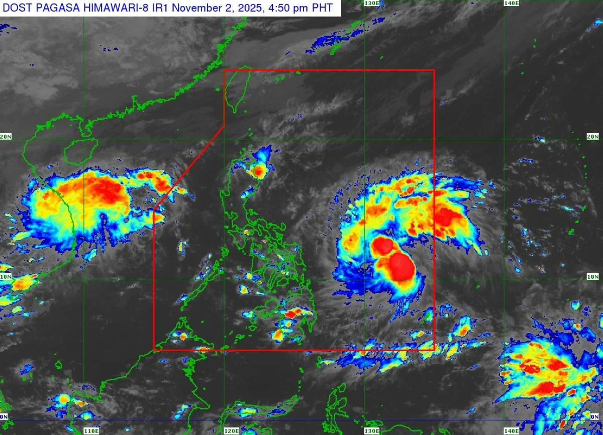
Satellite image of Severe Tropical Storm Tino (Kalmaegi) (PAGASA)
Nine areas were placed under Tropical Cyclone Wind Signal No. 1 as Tropical Storm Tino (international name: Kalmaegi) intensified into a severe tropical storm on Sunday afternoon, Nov. 2, while moving across the Philippine Sea.
In its 5 p.m. bulletin, the Philippine Atmospheric, Geophysical and Astronomical Services Administration (PAGASA) said Tino was located 805 kilometers east of Eastern Visayas, packing maximum sustained winds of 95 kilometers per hour (kph) near the center and gustiness of up to 115 kph.
It was moving westward at 30 kph.
Direct effects
Signal No. 1 was raised over Eastern Samar, Northern Samar, Samar, Biliran, Leyte, Southern Leyte, Camotes Islands, Dinagat Islands, and Surigao del Norte due to the anticipated strong winds from Tino.
PAGASA said higher wind signals may be hoisted in the coming days as Tino continues to intensify, with Signal No. 4 possibly being the highest during its passage.
It added that Tino may reach typhoon category within 24 hours as it moves closer to the Visayas.
“Rapid intensification within the next 48 hours is likely, and the possibility of the cyclone reaching super typhoon category is not ruled out,” PAGASA said.
Based on its latest forecast track, Tino will continue moving westward and may make its initial landfall over Eastern Samar or Dinagat Islands late Monday, Nov. 3, or early Tuesday, Nov. 4.
It is expected to cross the Visayas and northern Palawan before emerging over the West Philippine Sea by Wednesday, Nov. 5.
Flooding, landslide warnings
PAGASA warned of possible flooding and rain-induced landslides as Tino brings heavy rainfall to large parts of the Visayas and Mindanao in the coming days.
From Sunday to Monday afternoon, of 50 to 100 millimeters (mm) of rainfall (moderate to heavy) is expected over Dinagat Islands, Surigao del Norte, Eastern Samar, Northern Samar, Southern Leyte, and Leyte.
From Monday afternoon to Tuesday afternoon, 100 to 200 mm of rainfall (heavy to intense) may affect Eastern Samar, Southern Leyte, Leyte, Samar, Biliran, Cebu, Bohol, Dinagat Islands, Surigao del Norte, Agusan del Norte, Negros Occidental, Guimaras, Iloilo, and Capiz.
Meanwhile, 50 to 100 mm of rainfall is likely over Catanduanes, Albay, Masbate, Sorsogon, Northern Samar, Negros Oriental, Aklan, Antique, Romblon, Siquijor, Misamis Oriental, Camiguin, Bukidnon, Agusan del Sur, and Surigao del Sur.
From Tuesday afternoon to Wednesday afternoon, 100 to 200 mm of rainfall may persist in Cebu, Negros Occidental, Guimaras, Iloilo, Capiz, Aklan, Antique, Oriental Mindoro, Romblon, and Palawan.
Moderate to heavy rainfall may continue to affect Albay, Masbate, Sorsogon, Marinduque, Occidental Mindoro, Biliran, Leyte, Southern Leyte, Siquijor, Bohol, Agusan del Norte, Negros Oriental, Bukidnon, Camiguin, Lanao del Norte, Misamis Occidental, Misamis Oriental, Lanao del Sur, Maguindanao del Norte, Maguindanao del Sur, Sultan Kudarat, and Zamboanga del Norte.
Meanwhile, the shear line, a weather system formed by the collision of cold winds coming from the northeast monsoon (amihan) and warm air from the easterlies, may also bring significant rainfall over parts of Luzon.
From Sunday to Monday afternoon, moderate to heavy rains are expected in Quezon.
From Monday afternoon to Tuesday afternoon, moderate to heavy rainfall may affect Isabela, Aurora, Quezon, Camarines Norte, Camarines Sur, Oriental Mindoro, and Marinduque.
From Tuesday afternoon to Wednesday afternoon, moderate to heavy rains are expected over Cagayan, Isabela, Aurora, Quezon, and Camarines Norte.
Storm surge
PAGASA also warned of a high risk of life-threatening and damaging storm surges within the next 48 hours over low-lying coastal communities in Sorsogon, Masbate, Northern Samar, Eastern Samar, Samar, Biliran, Leyte, Southern Leyte, Cebu, Bohol, Siquijor, Negros Oriental, Negros Occidental, Capiz, Iloilo, Guimaras, Dinagat Islands, Surigao del Norte, Surigao del Sur, Agusan del Norte, Misamis Oriental, and Camiguin.
It added that a gale warning may be raised over the eastern seaboards of Eastern Visayas and Caraga Region Sunday evening or Monday morning.
PAGASA said seas may become very rough to high, reaching up to seven meters along the eastern coast of Eastern Samar, up to six meters along the northern and eastern seaboards of Siargao and Bucas Grande Islands, and up to 4.5 meters along the eastern coast of Northern Samar.
It added that sea travel will be risky for all types and sizes of vessels.
Mariners were advised to remain in port, or if already at sea, to seek shelter or safe harbor as soon as possible until winds and waves subside.

Related Tags

PAGASA TINO TROPICAL STORM TINO LANDFALL SIGNAL NO. 1
ADVERTISEMENT
.most-popular .layout-ratio{ padding-bottom: 79.13%; } @media (min-width: 768px) and (max-width: 1024px) { .widget-title { font-size: 15px !important; } }

{{ articles_filter_1561_widget.title }}

.most-popular .layout-ratio{ padding-bottom: 79.13%; } @media (min-width: 768px) and (max-width: 1024px) { .widget-title { font-size: 15px !important; } }

{{ articles_filter_1562_widget.title }}

.most-popular .layout-ratio{ padding-bottom: 79.13%; } @media (min-width: 768px) and (max-width: 1024px) { .widget-title { font-size: 15px !important; } }

{{ articles_filter_1563_widget.title }}

{{ articles_filter_1564_widget.title }}

.mb-article-details { position: relative; } .mb-article-details .article-body-preview, .mb-article-details .article-body-summary{ font-size: 17px; line-height: 30px; font-family: "Libre Caslon Text", serif; color: #000; } .mb-article-details .article-body-preview iframe , .mb-article-details .article-body-summary iframe{ width: 100%; margin: auto; } .read-more-background { background: linear-gradient(180deg, color(display-p3 1.000 1.000 1.000 / 0) 13.75%, color(display-p3 1.000 1.000 1.000 / 0.8) 30.79%, color(display-p3 1.000 1.000 1.000) 72.5%); position: absolute; height: 200px; width: 100%; bottom: 0; display: flex; justify-content: center; align-items: center; padding: 0; } .read-more-background a{ color: #000; } .read-more-btn { padding: 17px 45px; font-family: Inter; font-weight: 700; font-size: 18px; line-height: 16px; text-align: center; vertical-align: middle; border: 1px solid black; background-color: white; } .hidden { display: none; }
function initializeAllSwipers() { // Get all hidden inputs with cms_article_id document.querySelectorAll('[id^="cms_article_id_"]').forEach(function (input) { const cmsArticleId = input.value; const articleSelector = '#article-' + cmsArticleId + ' .body_images'; const swiperElement = document.querySelector(articleSelector); if (swiperElement && !swiperElement.classList.contains('swiper-initialized')) { new Swiper(articleSelector, { loop: true, pagination: false, navigation: { nextEl: '#article-' + cmsArticleId + ' .swiper-button-next', prevEl: '#article-' + cmsArticleId + ' .swiper-button-prev', }, }); } }); } setTimeout(initializeAllSwipers, 3000); const intersectionObserver = new IntersectionObserver( (entries) => { entries.forEach((entry) => { if (entry.isIntersecting) { const newUrl = entry.target.getAttribute("data-url"); if (newUrl) { history.pushState(null, null, newUrl); let article = entry.target; // Extract metadata const author = article.querySelector('.author-section').textContent.replace('By', '').trim(); const section = article.querySelector('.section-info ').textContent.replace(' ', ' '); const title = article.querySelector('.article-title h1').textContent; // Parse URL for Chartbeat path format const parsedUrl = new URL(newUrl, window.location.origin); const cleanUrl = parsedUrl.host + parsedUrl.pathname; // Update Chartbeat configuration if (typeof window._sf_async_config !== 'undefined') { window._sf_async_config.path = cleanUrl; window._sf_async_config.sections = section; window._sf_async_config.authors = author; } // Track virtual page view with Chartbeat if (typeof pSUPERFLY !== 'undefined' && typeof pSUPERFLY.virtualPage === 'function') { try { pSUPERFLY.virtualPage({ path: cleanUrl, title: title, sections: section, authors: author }); } catch (error) { console.error('ping error', error); } } // Optional: Update document title if (title && title !== document.title) { document.title = title; } } } }); }, { threshold: 0.1 } ); function showArticleBody(button) { const article = button.closest("article"); const summary = article.querySelector(".article-body-summary"); const body = article.querySelector(".article-body-preview"); const readMoreSection = article.querySelector(".read-more-background"); // Hide summary and read-more section summary.style.display = "none"; readMoreSection.style.display = "none"; // Show the full article body body.classList.remove("hidden"); } document.addEventListener("DOMContentLoaded", () => { let loadCount = 0; // Track how many times articles are loaded const offset = [1, 2, 3, 4, 5, 6, 7, 8, 9, 10]; // Offset values const currentUrl = window.location.pathname.substring(1); let isLoading = false; // Prevent multiple calls if (!currentUrl) { console.log("Current URL is invalid."); return; } const sentinel = document.getElementById("load-more-sentinel"); if (!sentinel) { console.log("Sentinel element not found."); return; } function isSentinelVisible() { const rect = sentinel.getBoundingClientRect(); return ( rect.top < window.innerHeight && rect.bottom >= 0 ); } function onScroll() { if (isLoading) return; if (isSentinelVisible()) { if (loadCount >= offset.length) { console.log("Maximum load attempts reached."); window.removeEventListener("scroll", onScroll); return; } isLoading = true; const currentOffset = offset[loadCount]; window.loadMoreItems().then(() => { let article = document.querySelector('#widget_1690 > div:nth-last-of-type(2) article'); intersectionObserver.observe(article) loadCount++; }).catch(error => { console.error("Error loading more items:", error); }).finally(() => { isLoading = false; }); } } window.addEventListener("scroll", onScroll); });

Sign up by email to receive news.