


Manila Bulletin
 Philippines
National
PAGASA raises Signal No. 2 as 'Tino' further intensifies over Philippine Sea
Philippines
National
PAGASA raises Signal No. 2 as 'Tino' further intensifies over Philippine Sea
Philippines
National
PAGASA raises Signal No. 2 as 'Tino' further intensifies over Philippine Sea
PAGASA raises Signal No. 2 as 'Tino' further intensifies over Philippine Sea
Published Nov 2, 2025 11:31 pm


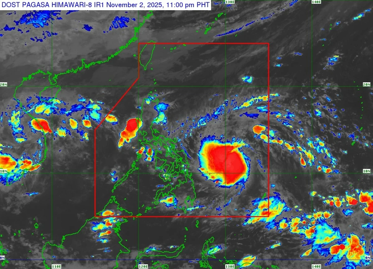
Satellite image of Severe Tropical Storm Tino (Kalmaegi) (Courtesy of PAGASA)
The Philippine Atmospheric, Geophysical and Astronomical Services Administration (PAGASA) on Sunday evening, Nov. 2, raised Tropical Cyclone Wind Signal No. 2 over parts of Eastern Visayas and Caraga as Severe Tropical Storm Tino (international name: Kalmaegi) continued to intensify while moving westward over the Philippine Sea.
In its 11 p.m. tropical cyclone bulletin, PAGASA hoisted Signal No. 2 over areas expected to experience winds of 62 to 88 kilometers per hour (kph) within 24 hours, posing a minor to moderate threat to life and property:
* Southeastern portion of Eastern Samar (Guiuan, Salcedo, Mercedes)
* Siargao and Bucas Grande Islands
* Dinagat Islands
Signal No. 1 remained in effect over areas expected to experience winds of 39 to 61 kph within 36 hours, posing minimal to minor threats:
* Southern portion of Sorsogon (Barcelona, Bulusan, Magallanes, Gubat, Santa Magdalena, Casiguran, Juban, Bulan, Irosin, Matnog)
* Masbate including Ticao Island
* The rest of Eastern Samar, Northern Samar, Samar, Biliran, Leyte, Southern Leyte
* Cebu including Camotes and Bantayan Islands
* Bohol
* Northern and central portions of Negros Oriental (Canlaon City, Vallehermoso, City of Guihulngan, La Libertad, Jimalalud, Tayasan, Ayungon, Bindoy, Mabinay, Manjuyod, Bais City, City of Tanjay, Amlan, San Jose)
* Northern and central portions of Negros Occidental (San Carlos City, Isabela, La Carlota City, Cadiz City, Bago City, Enrique B. Magalona, Toboso, Valladolid, Salvador Benedicto, Sagay City, San Enrique, City of Kabankalan, Hinigaran, Bacolod City, La Castellana, Moises Padilla, Murcia, City of Escalante, Binalbagan, Calatrava, Silay City, Pulupandan, City of Himamaylan, City of Victorias, City of Talisay, Pontevedra, Manapla)
* Guimaras
* Northern and central portions of Iloilo (Calinog, New Lucena, Maasin, Estancia, Batad, Oton, Concepcion, Pavia, Dueñas, Balasan, Barotac Nuevo, Ajuy, Iloilo City, Anilao, San Dionisio, San Miguel, Mina, Santa Barbara, Barotac Viejo, Leganes, Carles, Dingle, Zarraga, Bingawan, Cabatuan, Alimodian, Dumangas, San Rafael, San Enrique, Badiangan, Banate, City of Passi, Pototan, Lambunao, Lemery, Sara, Janiuay)
* Capiz
* The rest of Surigao del Norte, northern portion of Surigao del Sur (Carrascal, Cantilan, Madrid, Carmen, Lanuza, Cortes, City of Tandag, San Miguel, Tago, Bayabas, Cagwait)
* Northeastern portion of Agusan del Sur (Sibagat)
* Northern portion of Agusan del Norte (Kitcharao, Jabonga, Santiago, Tubay, City of Cabadbaran, Remedios T. Romualdez, Magallanes)
As of 10 p.m., the center of Tino was located 605 kilometers east of Guiuan, Eastern Samar, with maximum sustained winds of 100 kph near the center and gustiness of up to 125 kph.
The storm was moving westward at 30 kph.
PAGASA said Tino may intensify into a typhoon within 12 hours and could reach peak winds of 150 to 165 kph before making its initial landfall over Eastern Samar, Leyte, or Dinagat Islands late Monday, Nov. 3, or early Tuesday, Nov. 4.
Higher wind signals may be hoisted in the coming days as Tino continues to intensify, with Signal No. 4 possibly being the highest during its passage.
After crossing the Visayas and northern Palawan, PAGASA said Tino may emerge over the West Philippine Sea by Wednesday morning, Nov. 5.
Despite slight weakening due to land interaction, the agency said the weather disturbance is expected to remain a typhoon throughout its passage over the country.