


Cotabato acts vs perennial flooding
Published Oct 29, 2025 01:10 pm


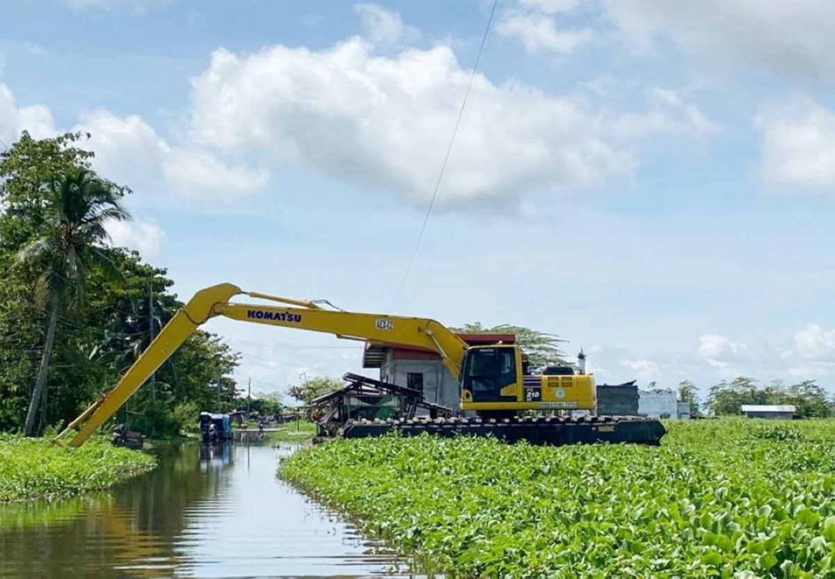
CLEARING operations in Pigcawayan. (Photo courtesy of Board Member Sittie Antao)
KIDAPAWAN CITY – The provincial government of Cotabato has stepped up efforts to minimize or totally stop the adverse impact of perennial flooding affecting agricultural lands in low-lying areas of the province.
The provincial government has deployed amphibious excavators to clear clogged waterways that contributed to flooding in low-lying areas in the towns of Kabacan, M’lang, Pigcawayan, and Tulunan.
Clearing operations kicked off on Oct. 28 in Barangay Bulucaon, one of the flood-prone villages of Pigcawayan, due to its proximity to the Ligawasan Marsh.
The local government of Pigcawayan said that the clearing of waterways could bring a sense of hope to local farmers whose rice production has been affected by perennial flooding.
Hundreds of hectares of rice fields in Pigcawayan are submerged in floodwater during the rainy season.
Mayor Juanito Agustin said that many waterways are clogged due to heavy siltation from denuded mountains.
Officials of Barangay Bulucaon said that amphibious clearing operations could help farmers reduce the backflow of water in the low-lying areas of the village.
Aside from Bulucaon, dredging operations will also be carried out in barangays Balogo, Banucagon, Cabpangi, Capayuran, Malagakit, and Tubon.
Board Member Shirly Macasarte said the provincial amphibious operation aims to address perennial flooding in flood-prone areas of the province.
“Ang programang ito ay inilunsad bilang tugon sa paulit-ulit na pagbaha hindi lamang tuwing panahon ng tag-ulan kundi dahil na rin sa lokasyon ng Cotabato bilang catch basin ng tubig mula sa mga karatig na lalawigan ng Bukidnon at Davao,” Macasarte said.
She added that amphibious excavators could fast-track the clearing of clogged waterways as well as desilting of rivers.
After Pigcawayan, Macasarte said clearing operations will move to the town of Pikit to drain several hectares of rice land submerged in floodwater.
She added that water outlets are also needed to drain floodwater that has submerged houses for months already.
“Hopefully, we could restore their rice production because many of them are now planting ‘kangkong’ (water spinach) to survive,” Macasarte said.
Clearing operations in waterways are being conducted in M’lang, a low-lying town that sits on the edge of the Ligawasan Marsh.
These dredging operations are part of the provincial government’s disaster mitigation efforts.
Like Pigcawayan, many farmers in M’lang have lost their livelihood due to perennial flooding.
Perennial flooding has been affecting the farmers as the province sits in the middle of the Mindanao River Basin.
Aside from Cotabato, the Mindanao River Basin spreads across the provinces of Bukidnon, Davao del Norte, Lanao del Sur, Maguindanao, Sultan Kudarat, South Cotabato, and some parts of Agusan del Sur and chartered cities Cotabato City and Davao City.
The Mindanao River Basin is the second largest river basin in the Philippines with a total area of 21,503-square kilometers and is the second largest river system in the Philippines next to Cagayan River in Luzon.