


Manila Bulletin
 Philippines
National
'Salome' continues to weaken, may become remnant low before exiting PAR
Philippines
National
'Salome' continues to weaken, may become remnant low before exiting PAR
Philippines
National
'Salome' continues to weaken, may become remnant low before exiting PAR
'Salome' continues to weaken, may become remnant low before exiting PAR
Published Oct 23, 2025 11:54 am


PAGASA
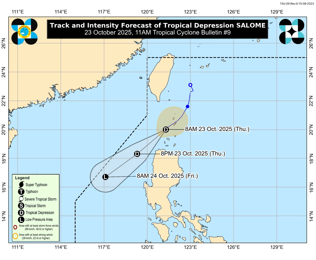
Tropical Depression Salome continued to weaken on Thursday morning, Oct. 23, and may dissipate into a remnant low before leaving the Philippine area of responsibility (PAR), the Philippine Atmospheric, Geophysical and Astronomical Services Administration (PAGASA) said.
In its 11 a.m. bulletin, PAGASA said Salome’s maximum sustained winds have decreased to 45 kilometers per hour (kph) near the center and gustiness to 55 kph, from 55 kph and 75 kph, respectively.
As of 10 a.m., the center of Salome was estimated at 115 kilometers northwest of Calayan, Cagayan.
It is forecast to move generally southwestward throughout the forecast period due to the presence of a high-pressure area over mainland China.
PAGASA said the tropical depression is expected to continue weakening due to unfavorable atmospheric conditions and may become a remnant low before it exits PAR on Friday, Oct. 24.
After passing close to the Babuyan Islands this morning, Salome may also pass near Ilocos Norte this afternoon.
Tropical Cyclone Wind Signal No. 1 remains hoisted over Batanes, the northern and western portions of Babuyan Islands (Calayan, Dalupiri, and Babuyan Islands), and the northwestern portion of Ilocos Norte (Bangui, Pagudpud, Burgos, Pasuquin, Bacarra, and Laoag City).
PAGASA warned of heavy to intense rains that may continue to affect Batanes, while moderate to heavy rains may persist over Ilocos Norte and the Babuyan Islands.
Cloudy skies with scattered rains and thunderstorms are also expected over Apayao, Abra, and mainland Cagayan.
Meanwhile, the intertropical convergence zone (ITCZ) will bring cloudy skies with scattered rain showers and thunderstorms over Mindanao, Negros Island Region, and Palawan.
The rest of the country will have partly cloudy to cloudy skies with isolated rain showers or thunderstorms.