


PAGASA raises Signal No. 1 as 'Salome' nears Northern Luzon
Published Oct 22, 2025 12:45 pm


At A Glance
- PAGASA raised Signal No. 1 over Batanes, parts of Babuyan Islands, and northwestern Ilocos Norte as Tropical Depression Salome neared Northern Luzon.
- Salome, with maximum sustained winds of 55 kph and gusts of up to 70 kph, was spotted 255 km north-northeast of Itbayat, Batanes, moving south-southwest at 15 kph.
- The tropical depression may pass close to or make landfall over Batanes between Wednesday evening and Thursday morning before heading toward Ilocos Norte.
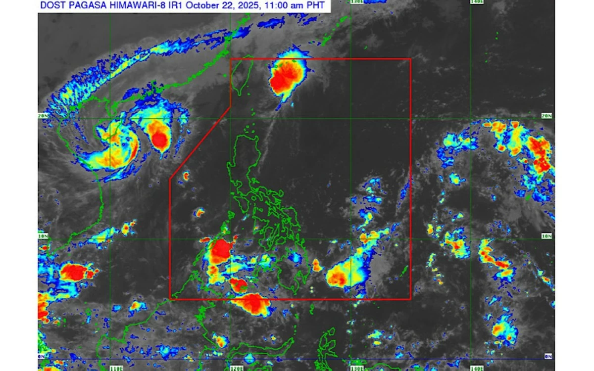
Satellite image of Tropical Depression Salome (PAGASA
The Philippine Atmospheric, Geophysical and Astronomical Services Administration (PAGASA) on Wednesday, Oct. 22 hoisted Tropical Cyclone Wind Signal No. 1 over parts of Luzon as Tropical Depression Salome moved closer to extreme Northern Luzon.
First monitored as a low-pressure area inside the Philippine Area of Responsibility (PAR) on Tuesday afternoon, Oct. 21, the weather disturbance intensified into a tropical depression at 8 a.m. on Wednesday and was given the local name “Salome.”
READ MORE:
As of 10 a.m., the center of Salome was located 255 kilometers north-northeast of Itbayat, Batanes, packing maximum sustained winds of 55 kilometers per hour (kph) near the center and gustiness of up to 70 kph.
It was moving south-southwestward at 15 kph.
Signal No. 1 was raised over Batanes, western portion of Babuyan Islands, including Calayan and Dalupiri Islands, and northwestern portion of Ilocos Norte (Bangui, Pagudpud, Burgos, Pasuquin, Bacarra, and Laoag City).
PAGASA weather specialist Benison Estareja said Salome may begin to affect extreme Northern Luzon by Wednesday evening as it approaches Batanes.
“Based on the initial track, Salome is moving generally southwestward, largely influenced by the strengthening of the northeasterly winds coming from East Asia,” Estareja said in a press conference.
He added that Salome may pass close to or make landfall over Batanes between Wednesday evening and Thursday morning, Oct. 23, then move near the Babuyan Islands by Thursday morning and approach Ilocos Norte by Thursday afternoon or evening.
By Friday, Oct. 24, Salome is expected to be over the West Philippine Sea, west of the Ilocos Region, before leaving the PAR by Friday afternoon or evening.
Estareja said Salome is likely to remain a tropical depression throughout the forecast period, although a slight intensification into a tropical storm is not ruled out, which could prompt the raising of Signal No. 2.
Starting Thursday, moderate to heavy rains are expected over Batanes due to Salome.
Meanwhile, Estareja pointed out that rains over parts of Visayas and Mindanao are caused by the Intertropical Convergence Zone (ITCZ) and not from the tropical depression.
The rest of Luzon and Visayas will experience partly cloudy to cloudy skies with isolated rain showers or thunderstorms due to easterlies.