


Manila Bulletin
 Philippines
National
TS Ramil to exit PAR on Oct. 20; several Luzon areas still under Signal No. 1
Philippines
National
TS Ramil to exit PAR on Oct. 20; several Luzon areas still under Signal No. 1
Philippines
National
TS Ramil to exit PAR on Oct. 20; several Luzon areas still under Signal No. 1
TS Ramil to exit PAR on Oct. 20; several Luzon areas still under Signal No. 1
Published Oct 19, 2025 11:33 pm


PAGASA
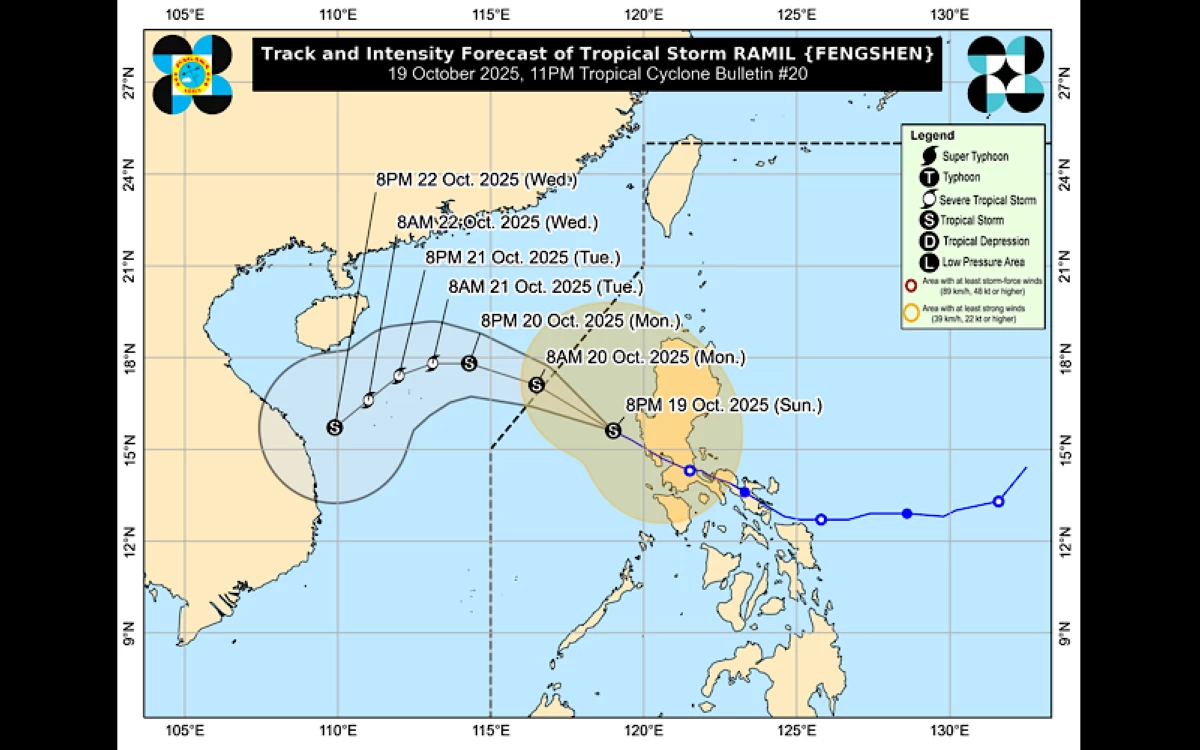
Tropical Storm Ramil (international name: Fengshen) continues to move away from the country’s landmass and is expected to exit the Philippine Area of Responsibility (PAR) by Monday morning, Oct. 20, the Philippine Atmospheric, Geophysical and Astronomical Services Administration (PAGASA) said on Sunday evening, Oct. 19.
As of 10 p.m., the center of the storm was located 155 kilometers west-northwest of Iba, Zambales, or 175 kilometers west of Dagupan City, Pangasinan.
Ramil has maintained its maximum winds of 65 kilometers per hour (kph) and gustiness of up to 80 kph.
Tropical Cyclone Wind Signal No. 2, the highest warning raised for Ramil, has been lifted as the storm moves farther from the country.
Only Signal No. 1 remains in effect over the following areas:
* Cagayan
* Babuyan Islands
* Isabela
* Quirino
* Nueva Vizcaya
* Apayao
* Abra
* Ifugao
* Mountain Province
* Kalinga
* Benguet
* Ilocos Norte
* Ilocos Sur
* La Union
* Pangasinan
* Zambales
* Bataan
* Tarlac
* Pampanga
* Bulacan
* Nueva Ecija
* Aurora
* Metro Manila
* Cavite
* Batangas
* Rizal
* Laguna
* Northern and western portions of Quezon (Lucena City, Pagbilao, Infanta, Tiaong, Unisan, Plaridel, San Antonio, Alabat, Candelaria, Lucban, Sampaloc, Padre Burgos, Sariaya, City of Tayabas, Mauban, Dolores, General Nakar, Perez, Agdangan, Atimonan, Real, Polillo Islands)
* Northern and central portions of Occidental Mindoro (Abra de Ilog, Sablayan, Mamburao, Santa Cruz, Paluan, Lubang Islands)
* Northern portion of Oriental Mindoro (Socorro, Naujan, Puerto Galera, Victoria, San Teodoro, Baco, City of Calapan, Pola)
Residents in affected areas were advised to remain vigilant and prepare for possible moderate rainfall and gusty winds.
Ramil is expected to continue moving west-northwestward over the West Philippine Sea until it exits the PAR.