ADVERTISEMENT

'Ramil' continues to lash Luzon; Signal No. 2 raised over northern Metro Manila, 16 areas

Published Oct 19, 2025 06:00 am
PAGASA
PAGASA
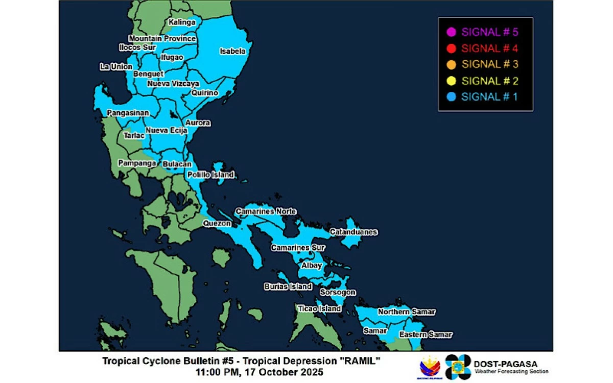
The Philippine Atmospheric, Geophysical and Astronomical Services Administration (PAGASA) raised Tropical Cyclone Wind Signal No. 2 over the northern part of Metro Manila and 16 other areas in Luzon as Tropical Storm Ramil (international name: Fengshen) continued to traverse the landmass on Sunday, Oct. 19.
In its 5 a.m. bulletin, PAGASA said Signal No. 2 is in effect over the following areas:
* Southeastern portion of Quirino (Nagtipunan, Maddela, Aglipay)
* Central and southern portions of Nueva Vizcaya (Alfonso Castañeda, Dupax del Sur, Dupax del Norte, Bambang, Aritao, Kayapa, Santa Fe, Kasibu)
* Central and southern portions of Benguet (Itogon, Bokod, Atok, Kapangan, Tublay, La Trinidad, Baguio City, Tuba, Sablan)
* Central and southern portions of La Union (Rosario, Pugo, Tubao, Santo Tomas, Agoo, Aringay, Caba, Naguilian, Burgos, Bagulin, Bauang, City of San Fernando, San Juan, San Gabriel, Bacnotan, Santol, Balaoan, Luna)
* Pangasinan
* Aurora
* Nueva Ecija
* Bulacan
* Tarlac
* Pampanga
* Northern and central portions of Zambales (Santa Cruz, Candelaria, Masinloc, Palauig, Iba, Botolan, Cabangan)
* Northern portion of Metro Manila (Caloocan City, Quezon City, City of Valenzuela, City of Marikina, City of Malabon, City of Navotas)
* Northern and central portions of Rizal (Rodriguez, San Mateo, City of Antipolo, Tanay, Baras)
* Northern portion of Laguna (Santa Maria, Famy, Siniloan)
* Northern and eastern portions of Quezon (General Nakar, Calauag, Tagkawayan, Guinayangan, Quezon, Alabat, Perez, Mauban, Real, Infanta, Atimonan, Plaridel, Gumaca, Lopez) including Pollilo Islands
* Camarines Norte
* Northwestern portion of Camarines Sur (Del Gallego, Ragay, Lupi, Sipocot)
Meanwhile, Signal No. 1 remains hoisted over the following areas:
* Cagayan including Babuyan Islands
* Isabela
* Rest of Quirino
* Rest of Nueva Vizcaya
* Apayao
* Abra
* Kalinga
* Mountain Province
* Ifugao
* Rest of Benguet
* Ilocos Norte
* Ilocos Sur
* Rest of La Union
* Rest of Zambales
* Bataan
* Rest of Metro Manila
* Rest of Quezon
* Rest of Rizal
* Rest of Laguna
* Cavite
* Batangas
* Occidental Mindoro including Lubang Islands
* Oriental Mindoro
* Marinduque
* Romblon
* Rest of Camarines Sur
* Catanduanes
* Albay
* Sorsogon
* Northern and central portions of Masbate (Aroroy, Baleno, Mandaon, Milagros, Balud, City of Masbate, Mobo, Uson, Dimasalang, Palanas, Cawayan) including Ticao and Burias Islands
* Northern Samar
* Northern portion of Eastern Samar (Jipapad, San Policarpo, Oras, Arteche, Maslog)
* Northern portion of Samar (Matuguinao, Calbayog City, Gandara, Santa Margarita, Pagsanghan, Tagapul-An, Almagro, Santo Niño, San Jose de Buan)
Forecast track and intensity
As of 4 a.m., PAGASA said the center of the eye of Ramil was located over the coastal waters of Alabat, Quezon, moving west-northwestward at 25 kilometers per hour (kph).
The storm has maintained its maximum sustained winds of 65 kph near the center and gustiness of up to 90 kph.
On its latest forecast track, Ramil will continue moving west-northwestward or northwestward and make landfall over Quezon province Sunday morning.
After landfall, it will cross the Southern-Central Luzon landmass before emerging over the coastal waters of Pangasinan or Zambales by afternoon or evening.
It will then continue moving generally northwestward until it exits the Philippine Area of Responsibility on Monday morning or noon, Oct. 20.
During its passage over land, Ramil is expected to maintain its strength or slightly weaken due to the frictional effects of the mountainous terrain.
Once over the West Philippine Sea, further re-intensification is highly likely, with Ramil is expected to reach the severe tropical storm category outside the PAR.
Heavy rainfall forecast
On Sunday, PAGASA warned of heavy to intense rainfall (100-200 mm) over Camarines Norte, Romblon, Marinduque, Oriental Mindoro, Occidental Mindoro, Quezon, Batangas, Aurora, Quirino, Nueva Vizcaya, Aklan, and Antique.
Moderate to heavy rainfall (50-100 mm) may also prevail over Cagayan, Kalinga, Mountain Province, Ifugao, and Isabela, Ilocos Sur, Ilocos Norte, Apayao, Abra, Benguet, La Union, Pangasinan, Zambales, Bataan, Tarlac, Nueva Ecija, Bulacan, Pampanga, Metro Manila, Rizal, Laguna, Cavite, Sorsogon, Albay, Catanduanes, Camarines Sur, Masbate, Iloilo, Capiz, and Palawan
Rains are expected to ease on Monday, with moderate to heavy rainfall likely over Pangasinan, La Union, and Zambales.
Other areas that experienced heavy rains will have gradually improving weather during this period.

Related Tags

PAGASA SIGNAL NO. 2 METRO MANILA TROPICAL STORM RAMIL FENGSHEN
ADVERTISEMENT
.most-popular .layout-ratio{ padding-bottom: 79.13%; } @media (min-width: 768px) and (max-width: 1024px) { .widget-title { font-size: 15px !important; } }

{{ articles_filter_1561_widget.title }}

.most-popular .layout-ratio{ padding-bottom: 79.13%; } @media (min-width: 768px) and (max-width: 1024px) { .widget-title { font-size: 15px !important; } }

{{ articles_filter_1562_widget.title }}

.most-popular .layout-ratio{ padding-bottom: 79.13%; } @media (min-width: 768px) and (max-width: 1024px) { .widget-title { font-size: 15px !important; } }

{{ articles_filter_1563_widget.title }}

{{ articles_filter_1564_widget.title }}

.mb-article-details { position: relative; } .mb-article-details .article-body-preview, .mb-article-details .article-body-summary{ font-size: 17px; line-height: 30px; font-family: "Libre Caslon Text", serif; color: #000; } .mb-article-details .article-body-preview iframe , .mb-article-details .article-body-summary iframe{ width: 100%; margin: auto; } .read-more-background { background: linear-gradient(180deg, color(display-p3 1.000 1.000 1.000 / 0) 13.75%, color(display-p3 1.000 1.000 1.000 / 0.8) 30.79%, color(display-p3 1.000 1.000 1.000) 72.5%); position: absolute; height: 200px; width: 100%; bottom: 0; display: flex; justify-content: center; align-items: center; padding: 0; } .read-more-background a{ color: #000; } .read-more-btn { padding: 17px 45px; font-family: Inter; font-weight: 700; font-size: 18px; line-height: 16px; text-align: center; vertical-align: middle; border: 1px solid black; background-color: white; } .hidden { display: none; }
function initializeAllSwipers() { // Get all hidden inputs with cms_article_id document.querySelectorAll('[id^="cms_article_id_"]').forEach(function (input) { const cmsArticleId = input.value; const articleSelector = '#article-' + cmsArticleId + ' .body_images'; const swiperElement = document.querySelector(articleSelector); if (swiperElement && !swiperElement.classList.contains('swiper-initialized')) { new Swiper(articleSelector, { loop: true, pagination: false, navigation: { nextEl: '#article-' + cmsArticleId + ' .swiper-button-next', prevEl: '#article-' + cmsArticleId + ' .swiper-button-prev', }, }); } }); } setTimeout(initializeAllSwipers, 3000); const intersectionObserver = new IntersectionObserver( (entries) => { entries.forEach((entry) => { if (entry.isIntersecting) { const newUrl = entry.target.getAttribute("data-url"); if (newUrl) { history.pushState(null, null, newUrl); let article = entry.target; // Extract metadata const author = article.querySelector('.author-section').textContent.replace('By', '').trim(); const section = article.querySelector('.section-info ').textContent.replace(' ', ' '); const title = article.querySelector('.article-title h1').textContent; // Parse URL for Chartbeat path format const parsedUrl = new URL(newUrl, window.location.origin); const cleanUrl = parsedUrl.host + parsedUrl.pathname; // Update Chartbeat configuration if (typeof window._sf_async_config !== 'undefined') { window._sf_async_config.path = cleanUrl; window._sf_async_config.sections = section; window._sf_async_config.authors = author; } // Track virtual page view with Chartbeat if (typeof pSUPERFLY !== 'undefined' && typeof pSUPERFLY.virtualPage === 'function') { try { pSUPERFLY.virtualPage({ path: cleanUrl, title: title, sections: section, authors: author }); } catch (error) { console.error('ping error', error); } } // Optional: Update document title if (title && title !== document.title) { document.title = title; } } } }); }, { threshold: 0.1 } ); function showArticleBody(button) { const article = button.closest("article"); const summary = article.querySelector(".article-body-summary"); const body = article.querySelector(".article-body-preview"); const readMoreSection = article.querySelector(".read-more-background"); // Hide summary and read-more section summary.style.display = "none"; readMoreSection.style.display = "none"; // Show the full article body body.classList.remove("hidden"); } document.addEventListener("DOMContentLoaded", () => { let loadCount = 0; // Track how many times articles are loaded const offset = [1, 2, 3, 4, 5, 6, 7, 8, 9, 10]; // Offset values const currentUrl = window.location.pathname.substring(1); let isLoading = false; // Prevent multiple calls if (!currentUrl) { console.log("Current URL is invalid."); return; } const sentinel = document.getElementById("load-more-sentinel"); if (!sentinel) { console.log("Sentinel element not found."); return; } function isSentinelVisible() { const rect = sentinel.getBoundingClientRect(); return ( rect.top < window.innerHeight && rect.bottom >= 0 ); } function onScroll() { if (isLoading) return; if (isSentinelVisible()) { if (loadCount >= offset.length) { console.log("Maximum load attempts reached."); window.removeEventListener("scroll", onScroll); return; } isLoading = true; const currentOffset = offset[loadCount]; window.loadMoreItems().then(() => { let article = document.querySelector('#widget_1690 > div:nth-last-of-type(2) article'); intersectionObserver.observe(article) loadCount++; }).catch(error => { console.error("Error loading more items:", error); }).finally(() => { isLoading = false; }); } } window.addEventListener("scroll", onScroll); });

Sign up by email to receive news.