


Manila Bulletin
 Philippines
National
Tropical storm Nakri to skirt PAR's northeastern boundary; no direct threat to Philippines
Philippines
National
Tropical storm Nakri to skirt PAR's northeastern boundary; no direct threat to Philippines
Philippines
National
Tropical storm Nakri to skirt PAR's northeastern boundary; no direct threat to Philippines
Tropical storm Nakri to skirt PAR's northeastern boundary; no direct threat to Philippines
Published Oct 9, 2025 11:31 am


PHIVOLCS
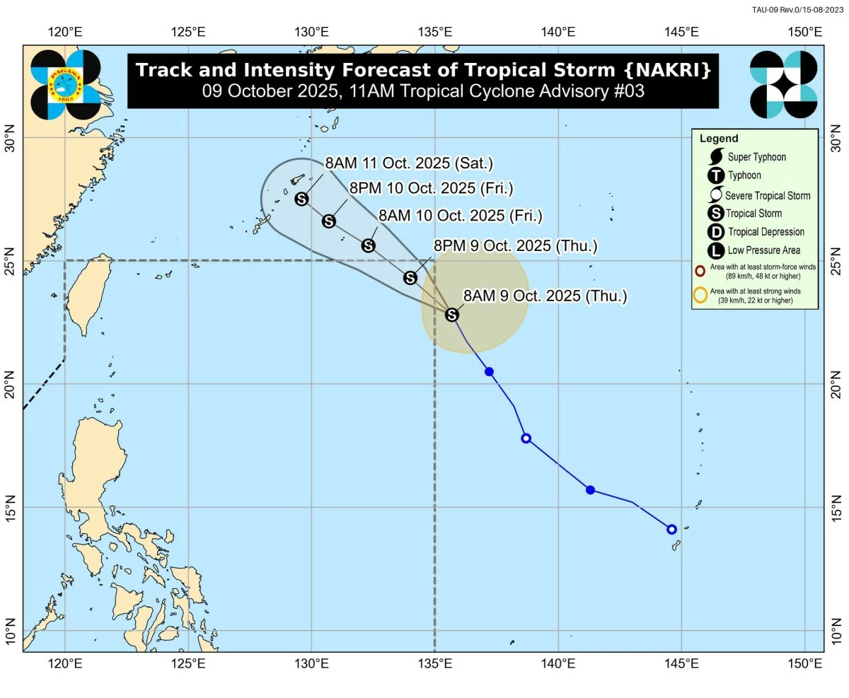
The tropical storm with the international name “Nakri” may remain near the northeastern boundary of the Philippine Area of Responsibility (PAR), posing no direct threat to the country, the Philippine Atmospheric, Geophysical and Astronomical Services Administration (PAGASA) said on Thursday, Oct. 9.
As of 11 a.m., the center of Nakri was located 1,415 kilometers east-northeast of extreme Northern Luzon, outside PAR, with maximum sustained winds of 75 kilometers per hour near the center and gustiness of up to 90 kph.
The storm is moving north-northwestward at 25 kph.
PAGASA weather specialist Chenel Dominguez said Nakri may enter PAR Thursday afternoon or evening and will be locally named “Quedan.”
However, it is expected to stay along the northeastern boundary before exiting by Thursday evening or early Friday morning, Oct. 10.
While Nakri may enter PAR, it is not expected to have a direct effect on any part of the Philippines, Dominguez said.
Nakri is expected to continue intensifying while approaching the Ryukyu Islands in Japan but is unlikely to trigger any tropical cyclone wind signals in the Philippines.
Dominguez said the southwesterly winds will be the dominant weather system that will bring cloudy skies with scattered rains and thunderstorms over Metro Manila, Calabarzon, Mimaropa, Bicol Region, and Visayas.
The rest of Luzon will experience partly cloudy skies with isolated rain showers due to localized thunderstorms.