


Manila Bulletin
 Philippines
National
Tropical storm seen to enter PAR on Oct. 9, to be called 'Quedan' — PAGASA
Philippines
National
Tropical storm seen to enter PAR on Oct. 9, to be called 'Quedan' — PAGASA
Philippines
National
Tropical storm seen to enter PAR on Oct. 9, to be called 'Quedan' — PAGASA
Tropical storm seen to enter PAR on Oct. 9, to be called 'Quedan' — PAGASA
May not directly affect Philippine weather
Published Oct 8, 2025 07:37 pm


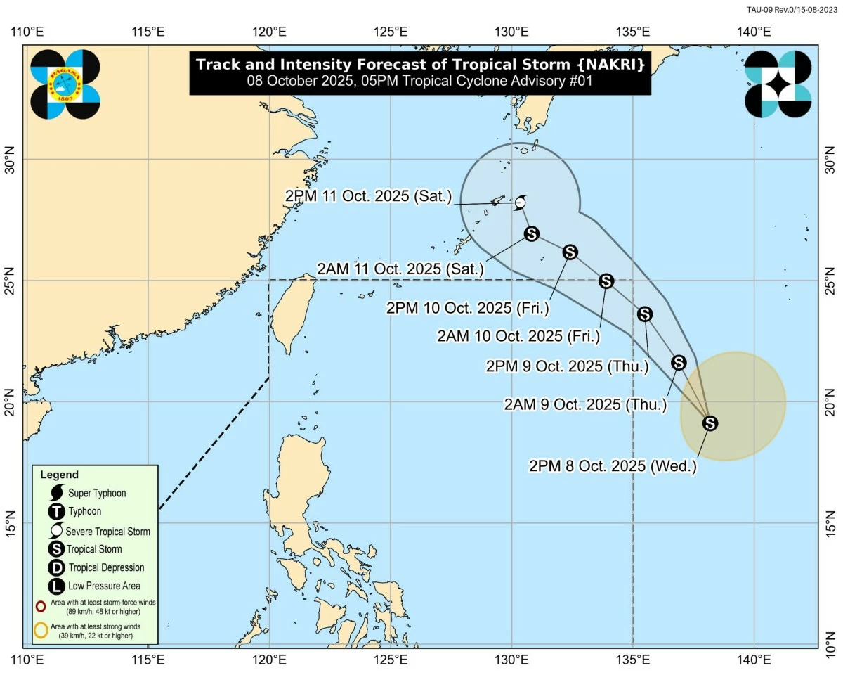
PAGASA
A tropical storm with the international name “Nakri” may enter the Philippine Area of Responsibility (PAR) on Thursday afternoon or evening, Oct. 9, the Philippine Atmospheric, Geophysical and Astronomical Services Administration (PAGASA) said on Wednesday, Oct. 8.
As of 4 p.m. the center of Nakri was estimated at 1,725 kilometers east of extreme northern Luzon or still outside PAR.
It had maximum sustained winds of 65 kilometers per hour (kph) near the center and gustiness of up to 80 kph. The storm was moving north-northwestward at 25 kph.
PAGASA said the tropical cyclone may enter PAR on Thursday and will be given the local name “Quedan.”
Once inside, it is seen to continue moving northwestward and may exit PAR by early Friday morning, Oct. 10.
The storm could intensify into a severe tropical storm by Saturday, Oct. 11, as it moves toward Ryukyu Islands, Japan.
Despite its possible entry into PAR, PAGASA said Nakri is less likely to directly affect the weather or sea conditions in the country.
No tropical cyclone wind signal will be raised, it added.
However, the combined effects of the intertropical convergence zone and the northeasterly windflow may bring strong to gale-force gusts over several parts of the country, particularly in coastal and upland areas of Northern Luzon, Palawan, Visayas, and Mindanao from Thursday through Saturday.