


DENR sends geologists to assess post-quake geohazards in Cebu
By Jel Santos
Published Oct 6, 2025 10:58 am


(DENR PHOTO)
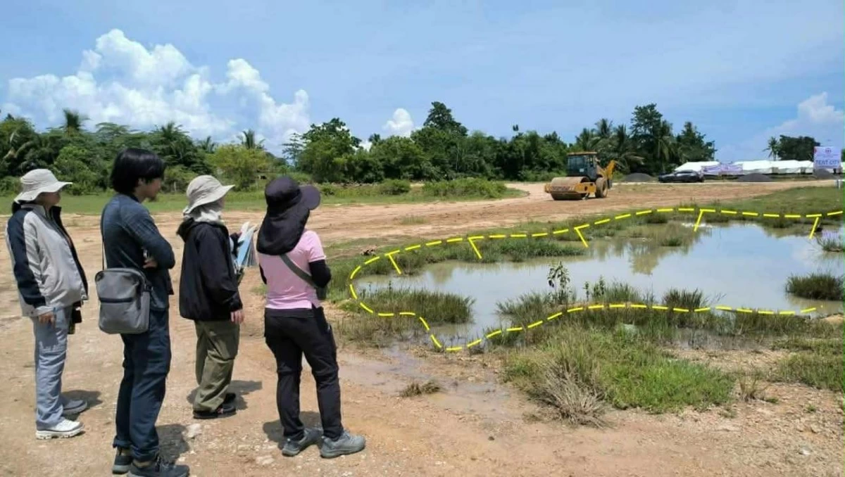
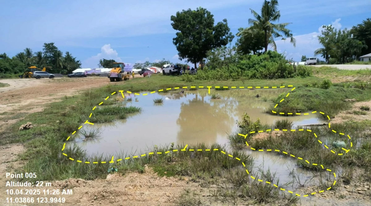
An eight-member team of geologists from the Mines and Geosciences Bureau (MGB) was sent to conduct a comprehensive Post-Disaster Geohazards Assessment in several areas across Cebu following the 6.9 quake that jolted the province, the Department of Environment and Natural Resources (DENR) said.
On Sept. 30, a powerful magnitude 6.9 earthquake rocked Cebu and nearby provinces, sending residents rushing out of their homes as strong tremors were felt across parts of Central Visayas.
The agency said the team, comprised of six geologists from the Central Office and two from Regional Office VII, will identify zones susceptible to flooding, rain-induced landslides, ground subsidence, and sinkhole formation.
According to Assistant Secretary and MGB Director Michael V. Cabalda, the assessment involves both ground validation and detailed geohazard data analysis.
“This study will enable us to pinpoint areas susceptible to flooding, rain-induced landslides, and those areas with high potential for ground subsidence and provide technical recommendations to LGUs for proper zoning, building regulation, and emergency preparedness,” he said in a statement on Monday, Oct. 6.
(DENR PHOTO)
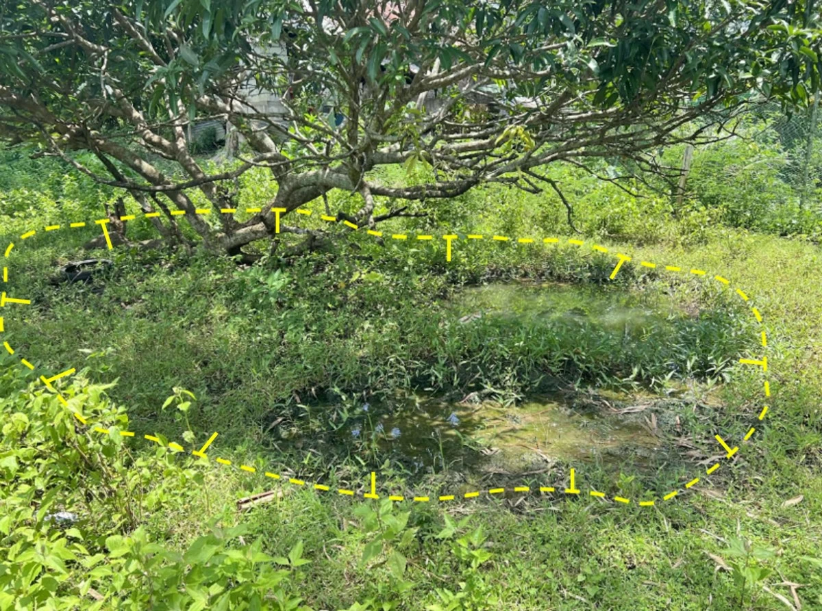
He added that the initiative seeks to enhance public safety and guide local government units (LGUs) in land-use planning and disaster risk reduction, particularly in communities situated on karst terrains characterized by limestone formations that are prone to dissolution and collapse.
DENR said preliminary surveys have already been conducted in the proposed Tent City in Barangay Cogon, Bogo City, where several sinkhole-prone zones have been identified.
It added that initial assessment results were presented by the MGB Geohazards Operations Center during the National Incident Assessment and Coordination Center (NIACC) meeting held on October 5, 2025, at Camp Aguinaldo.
Currently, MGB geologists are coordinating closely with the NIACC, Department of Human Settlements and Urban Development (DHSUD), and the Office of Civil Defense (OCD).
(DENR PHOTO)
The bureau also reminded the public that human activities, such as uncontrolled development and improper drainage, can accelerate the occurrence of subsidence in karst areas.
“This assessment is part of our continuing efforts to protect lives and properties by ensuring that communities are aware of their geological risks,” the bureau emphasized.
DENR said the results of the Post-Disaster Geohazards Assessment will be shared with local officials, the National Disaster Risk Reduction and Management Council (NDRRMC), and other concerned agencies, and will be made available to the public through MGB’s National Geohazard Mapping and Assessment Program.