


Manila Bulletin
 Philippines
National
'Paolo' weakens into severe tropical storm, now over West Philippine Sea
Philippines
National
'Paolo' weakens into severe tropical storm, now over West Philippine Sea
Philippines
National
'Paolo' weakens into severe tropical storm, now over West Philippine Sea
'Paolo' weakens into severe tropical storm, now over West Philippine Sea
By Jel Santos
Published Oct 3, 2025 05:39 pm


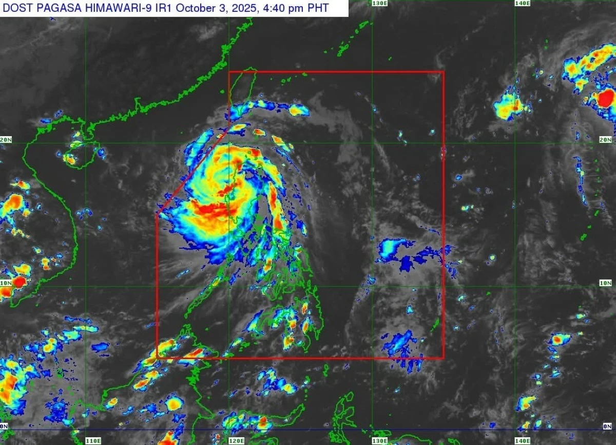
(DOST-PAGASA)
“Paolo” has weakened into a severe tropical storm as it moved over the West Philippine Sea on Friday afternoon, Oct. 3, Philippine Atmospheric, Geophysical and Astronomical Services Administration (PAGASA) reported.
In its 5 p.m. Tropical Cyclone Bulletin No. 15, the PAGASA said, “‘Paolo’ weakens into severe tropical storm and is now over the West Philippine Sea.”
At 4 p.m., the center of Paolo was estimated over the coastal waters of Santa Cruz, Ilocos Sur , packing maximum sustained winds of 110 kilometers per hour (kph) near the center, gustiness of up to 165 kph.
It was moving west-northwestward at 35 kph, the agency added.
PAGASA said “strong to storm-force winds extend outwards up to 480 km from the center.”
As of 5 p.m., Tropical Cyclone Wind Signal (TCWS) No. 3 was hoisted over Ilocos Sur, La Union, the southwestern portion of Abra, parts of Kalinga, Mountain Province, Ifugao, and Benguet.
Areas under TCWS No. 2 include the southern portion of Ilocos Norte, Pangasinan, the rest of Abra, Kalinga, Mountain Province, Ifugao, western Isabela, northwestern Quirino, parts of Nueva Vizcaya, and the northernmost portion of Nueva Ecija.
Meanwhile, TCWS No. 1 remains up in the rest of Ilocos Norte, Apayao, Batanes, mainland Cagayan including Babuyan Islands, the rest of Isabela, Quirino, Nueva Vizcaya, Aurora, Nueva Ecija, Tarlac, Zambales, Pampanga, Bulacan, and northern Quezon including Polillo Islands.
“Moderate to significant impacts from storm-force winds are possible within any of the areas under Wind Signal No. 3. Minor to moderate impacts from gale-force winds are possible within any of the areas under Wind Signal No. 2. Minimal to minor impacts from strong winds are possible within any of the areas under Wind Signal No. 1,” the state weather bureau warned:
Rain, storm surge threats
The state weather bureau said the outer rain bands of “Paolo” may bring strong to gale-force gusts over Bataan, Metro Manila, CALABARZON, Bicol Region, Panay Island, Occidental Mindoro, Oriental Mindoro, Northern Samar, and Eastern Samar.
On Saturday, Oct. 4, gusts may also affect Batanes, Cagayan including Babuyan Islands, Ilocos Region, Zambales, and Bataan, it added.
Also, PAGASA raised the alarm over coastal hazards.
“There is a moderate to high risk of life-threatening storm surge with peak heights reaching 1.0 to 3.0 m within 24 hours over the low-lying or exposed coastal localities of Ilocos Norte, Ilocos Sur, La Union, Pangasinan, Zambales, Cagayan, Isabela, and Aurora,” it stated.
Sea travel risky
The state weather bureau said gale warning remains in effect over the seaboards of Northern Luzon and the eastern seaboard of Central Luzon.
“Sea travel is risky for all types or tonnage of vessels. All mariners must remain in port or, if underway, seek shelter or safe harbor as soon as possible until winds and waves subside,” it stressed.
According to PAGASA, “Paolo” is forecast to move generally west northwestward and exit the Philippine Area of Responsibility (PAR) “tomorrow (04 October) morning.”