


'Paolo' to exit PAR on Oct. 4 — PAGASA
Published Oct 3, 2025 11:05 pm


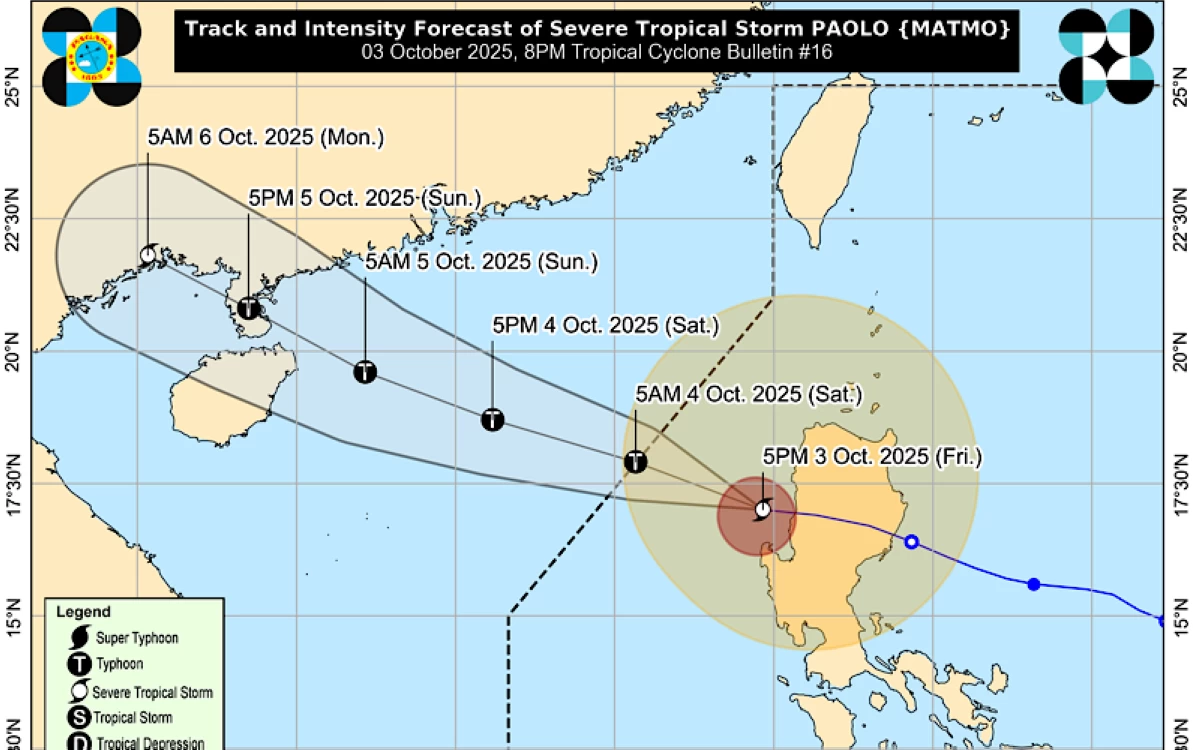
Severe Tropical Storm Paolo (international name: Matmo) is expected to exit the Philippine Area of Responsibility (PAR) on Saturday morning, Oct. 4, the Philippine Atmospheric, Geophysical and Astronomical Services Administration (PAGASA) said.
As of 10 p.m., Friday, Oct. 3, Paolo was located 160 km west-northwest of Bacnotan, La Union, or 150 km west-southwest of Sinait, Ilocos Sur, moving west-northwestward at 25 kilometers per hour (kph).
The storm had maximum sustained winds of 110 kph near the center and gustiness reaching up to 135 kph.
PAGASA said Paolo may to re-intensify over the West Philippine Sea and reach typhoon strength within the next 12 hours.
Residents in areas under possible storm effects are urged to remain alert as Paolo continues to bring heavy rains and strong winds in parts of Northern and Central Luzon.
In the PAGASA’s 11 p.m. bulletin, the following tropical cyclone wind signals are still in effect:
Signal No. 2
* Ilocos Sur
* Western portion of Abra (Manabo, Pidigan, Tayum, Langiden, Luba, Danglas, Villaviciosa, La Paz, Pilar, Peñarrubia, San Isidro, San Quintin, Dolores, Bangued, Bucay, Tubo)
* Northern portion of La Union (Luna, Santol, City of San Fernando, San Juan, Bagulin, Bangar, San Gabriel, Bacnotan, Sudipen, Balaoan)
* Northwestern portion og Pangasinan (Anda, Bolinao, Bani)
Signal No. 1
* Southern portion of Batanes (Mahatao, Uyugan, Basco, Ivana, Sabtang)
* Cagayan, including Babuyan Islands
* Isabela
* Quirino
* Nueva Vizcaya
* Apayao
* Kalinga
* The rest of Abra
* Mountain Province
* Ifugao
* Benguet
* Ilocos Norte
* The rest of La Union
* The rest of Pangasinan
* Aurora
* Nueva Ecija
* Northern portion of Bulacan (Doña Remedios Trinidad, San Miguel, San Ildefonso, San Rafael)
* Tarlac
* Northern and central portions of Pampanga (Mexico, Porac, Angeles City, San Luis, Santa Rita, Santa Ana, Guagua, Mabalacat City, Arayat, Candaba, Santo Tomas, San Simon, City of San Fernando, Bacolor, Floridablanca, Magalang)
* Zambales