


Manila Bulletin
 Philippines
National
Signal No. 3 raised over 7 areas as 'Paolo' intensifies into severe tropical storm
Philippines
National
Signal No. 3 raised over 7 areas as 'Paolo' intensifies into severe tropical storm
Philippines
National
Signal No. 3 raised over 7 areas as 'Paolo' intensifies into severe tropical storm
Signal No. 3 raised over 7 areas as 'Paolo' intensifies into severe tropical storm
Published Oct 2, 2025 11:32 pm


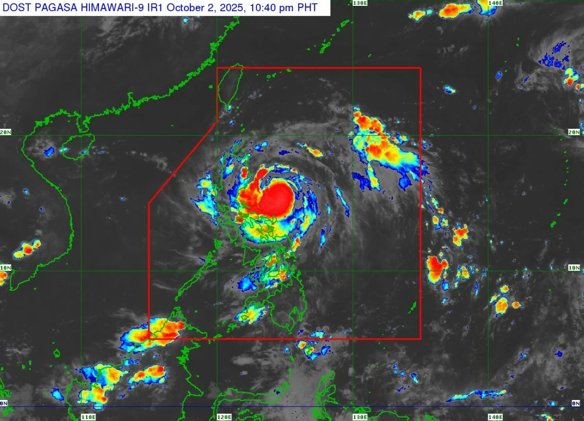
PAGASA
The Philippine Atmospheric, Geophysical and Astronomical Services Administration (PAGASA) raised Tropical Cyclone Wind Signal No. 3 over parts of Luzon on Thursday evening, Oct. 2, as Tropical Storm Paolo (international name: Matmo) intensified into a severe tropical storm
In its 11 p.m. bulletin, PAGASA said Paolo was packing maximum sustained winds of 95 kilometers per hour (kph) near the center and gusts of up to 115 kph while moving westward at 30 kph.
“Further intensification into a typhoon prior to landfall is not ruled out. However, based on the intensity forecast, intensification into typhoon is highly likely once Paolo emerges over the West Philippine Sea,” PAGASA said.
As Paolo intensified into a severe tropical storm and moved closer to land, higher wind signals were raised over several areas in Northern and Central Luzon.
Signal No. 3
Areas under Signal No. 3 may experience winds of 89 to 117 kilometers per hour within 18 hours. These include:
* Extreme northern portion of Aurora (Dilasag, Casiguran)
* Central and southern portions of Isabela (Dinapigue, San Mariano, San Guillermo, Echague, Jones, San Agustin, Cordon, City of Santiago, Ramon, San Isidro, Alicia, Angadanan, City of Cauayan, Benito Soliven, Naguilian, Luna, Reina Mercedes, Cabatuan, San Mateo, Aurora, San Manuel, Burgos, Gamu, Roxas, Palanan)
* Northern portion of Quirino (Maddela, Cabarroguis, Aglipay, Saguday, Diffun)
* Northern portion of Nueva Vizcaya (Diadi, Bagabag, Villaverde, Ambaguio, Quezon, Solano, Bayombong)
* Mountain Province
* Ifugao
* Northern portion of Benguet (Mankayan, Buguias, Kabayan, Bakun)
Signal No. 2
Areas under Signal No. 2 may experience winds of 62 to 88 kilometers per hour within 24 hours. These include:
* Southern portion of mainland Cagayan (Peñablanca, Tuguegarao City, Enrile, Solana, Iguig, Tuao, Piat, Rizal)
* The rest of Isabela
* The rest of Quirino
* The rest of Nueva Vizcaya
* Northern and central portions of Aurora (Dinalungan, Dipaculao, Baler, Maria Aurora)
* Northeastern portion of Nueva Ecija (Carranglan, Pantabangan)
* Southern portion of Apayao (Conner)
* Kalinga
* Abra
* The rest of Benguet
* Southern portion of Ilocos Norte (Nueva Era, Badoc, Pinili, City of Batac, Paoay, Currimao, Banna)
* Ilocos Sur
* La Union
Signal No. 1
Areas under Signal No. 1 may experience winds of 39 to 61 kilometers per hour within 36 hours. These include:
* The rest of mainland Cagayan including Babuyan Islands
* The rest of Aurora
* Northern portion of Quezon (General Nakar, Infanta) including Polillo Islands
* Camarines Norte
* Northern portion of Camarines Sur (Siruma, Tinambac, Lagonoy, Garchitorena, Caramoan, Goa, San Jose, Presentacion)
* Catanduanes
* The rest of Apayao
* The rest of Ilocos Norte
* Pangasinan
* The rest of Nueva Ecija
* Northern portion of Bulacan (Doña Remedios Trinidad, San Miguel, San Ildefonso, Norzagaray, San Rafael)
* Tarlac
* Northeastern portion of Pampanga (Magalang, Arayat, Candaba, Mabalacat City)
* Northern portion of Zambales (Palauig, Masinloc, Candelaria, Santa Cruz)
Forecast track
The center of the severe tropical storm was located 320 km east of Baler, Aurora, at 10 p.m.
PAGASA said Paolo is expected to move generally west northwestward throughout the forecast period and may make landfall over Isabela or northern Aurora on Friday morning, Oct. 3.
A southward shift in the track remains possible depending on the strength of the high pressure area located north of the storm.
After crossing the landmass of Northern Luzon, Paolo will emerge over the West Philippine Sea by Friday afternoon and may exit the Philippine Area of Responsibility by Saturday morning, Oct. 4.