


Manila Bulletin
 Philippines
National
'Paolo' intensifies into tropical storm; Signal No. 1 up in several parts of Luzon
Philippines
National
'Paolo' intensifies into tropical storm; Signal No. 1 up in several parts of Luzon
Philippines
National
'Paolo' intensifies into tropical storm; Signal No. 1 up in several parts of Luzon
'Paolo' intensifies into tropical storm; Signal No. 1 up in several parts of Luzon
By Jel Santos
Published Oct 2, 2025 07:54 am


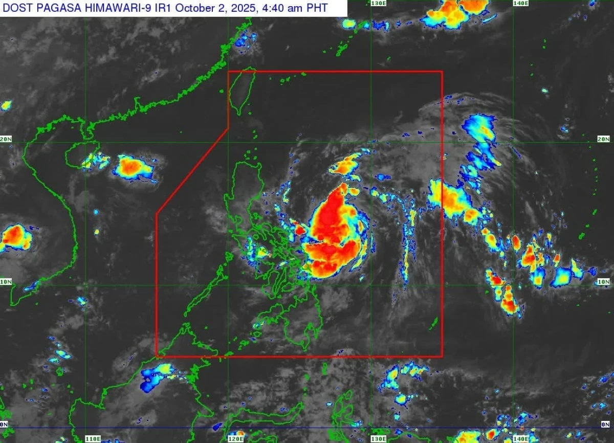
(DOST-PAGASA)
“Paolo” has intensified into a tropical storm as it moved closer to Northern and Central Luzon, prompting the Philippine Atmospheric, Geophysical and Astronomical Services Administration (PAGASA) to raise Tropical Cyclone Wind Signal (TCWS) No. 1 in several provinces as of early Thursday, Oct. 2.
Per the state weather bureau, “Paolo” was located 705 kilometers east of Infanta, Quezon, at 4 a.m., with 65 kph winds and moving west-northwest at 20 kph.
“PAOLO will continue to intensify while over the Philippine Sea and may reach severe tropical storm category tomorrow early morning,” PAGASA said.
“Further intensification into a typhoon prior to landfall is not ruled out.”
Signal No. 1 is now in effect in Cagayan, Isabela, Quirino, Nueva Vizcaya, Apayao, Abra, Kalinga, Mountain Province, Ifugao, Benguet, Ilocos Norte, Ilocos Sur, La Union, Pangasinan, the northern portion of Zambales (Palauig, Masinloc, Candelaria, Santa Cruz), Tarlac, Nueva Ecija, Aurora, the northern portion of Bulacan (Doña Remedios Trinidad, San Miguel, San Ildefonso), the northern portion of Pampanga (Magalang, Arayat, Candaba, Mabalacat City), the northern portion of Quezon (General Nakar) including Polillo Islands, and the northern portion of Catanduanes (Pandan, Bagamanoc, Panganiban, Viga), the agency said.
PAGASA warned that “minimal to minor impacts from strong winds are possible within any of the areas under Wind Signal No. 1.”
It added that the highest wind signal likely to be raised during Paolo’s passage is Signal No. 3.
“However, since the possibility of reaching typhoon category before landfall is not ruled out, the worst case scenario is Wind Signal No. 4,” the agency noted.
Rainfall, storm surge threats
Meanwhile, the weather bureau said “Paolo” poses “a moderate risk of life-threatening storm surge with peak heights reaching 1.0 to 2.0 m within 36 hours over the low-lying or exposed coastal localities of Cagayan, Isabela, Aurora, Quezon, Camarines Norte, Camarines Sur, and Catanduanes.”
It warned fisherfolk and operators of small seacraft that gale warning may be raised over the seaboards of Northern and Central Luzon this afternoon due to rough to very rough sea conditions.
On its current path, Paolo may make landfall over Isabela or northern Aurora by Friday morning, Oct. 3, PAGASA said.
After crossing Northern Luzon, it is expected to emerge over the West Philippine Sea by Thursday afternoon and exit the Philippine Area of Responsibility by Saturday morning, Oct. 4.
“It must be emphasized that heavy rainfall, severe winds, and storm surge may still be experienced in localities outside the landfall point and the forecast confidence cone,” the agency added.