


Parts of Catanduanes placed under Signal No. 1 due to 'Paolo'
Published Oct 1, 2025 07:13 pm


PAGASA
The Philippine Atmospheric, Geophysical and Astronomical Services Administration (PAGASA) on Wednesday afternoon, Oct. 1, raised Tropical Cyclone Wind Signal No. 1 over parts of Catanduanes as Tropical Depression Paolo continues to move closer to the country.
As of 5 p.m., Signal No. 1 was up over the northern portion of Catanduanes (Pandan, Bagamanoc, Panganiban, and Viga).
Areas under Signal No. 1 may experience strong winds within 36 hours, with minimal to minor impacts.
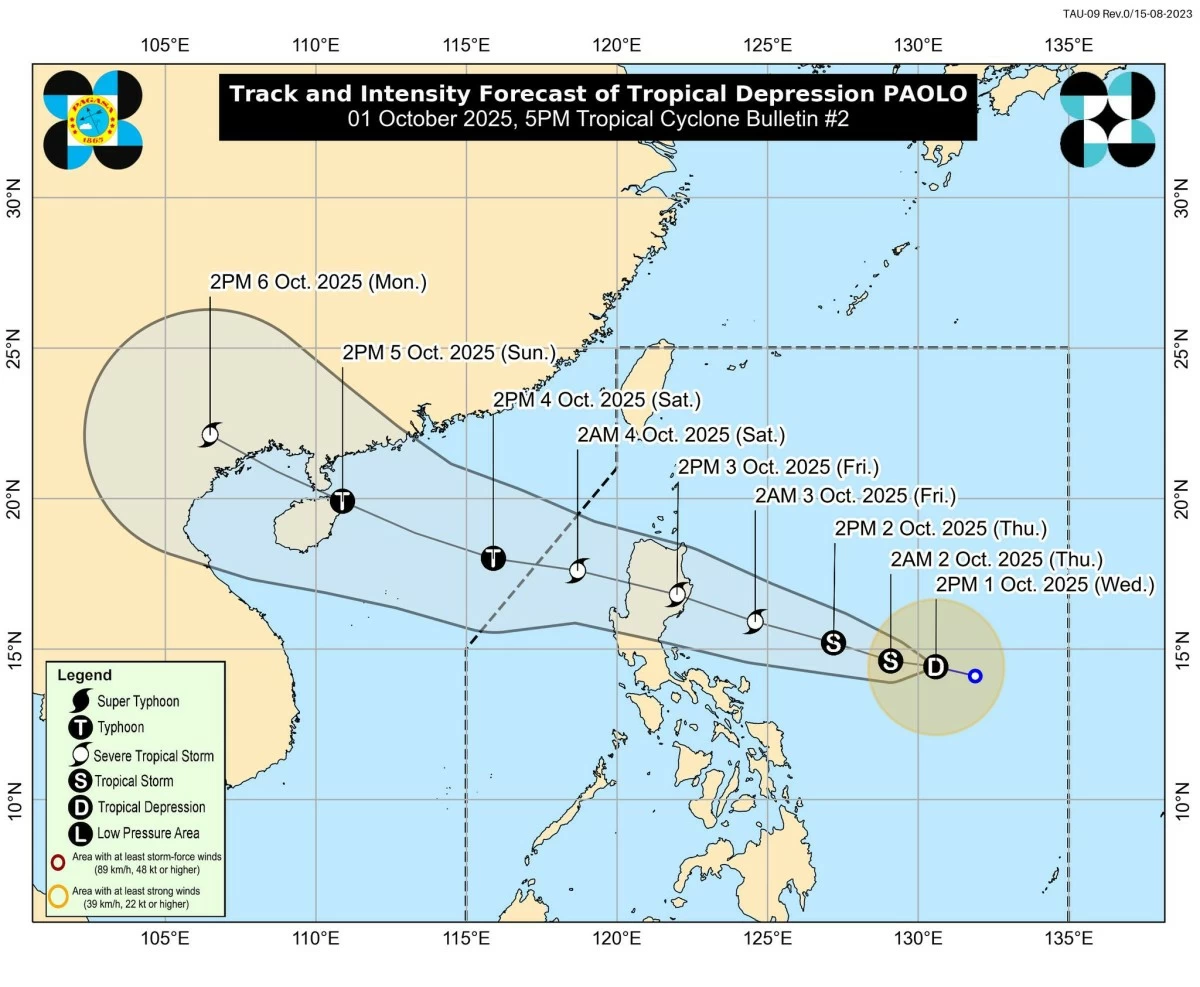
PAGASA said the highest wind signal that may be hoisted throughout Paolo’s passage is Signal No. 3. However, it warned that the system could still reach typhoon category before landfall, in which case Signal No. 4 may be raised.
Paolo slighlty intensified on Wednesday afternoon, with maximum sustained winds of 55 kilometers per hour (kph) near the center and gustiness of up to 70 kph.
Its center was located 665 kilometers east of Virac, Catanduanes at 4 p.m., moving west-northwestward at kph over the Philippine Sea.
Paolo is expected to continue moving westward to west-northwestward and make landfall over Isabela or northern Aurora on Friday, Oct. 3.
However, PAGASA said a more southward shift in its track is possible depending on the strength of the high pressure area north of Paolo.
Paolo is expected to exit the Philippine Area of Responsibility by Saturday morning, Oct. 4.