


Manila Bulletin
 Philippines
National
New LPA outside PAR may develop into tropical depression — PAGASA
Philippines
National
New LPA outside PAR may develop into tropical depression — PAGASA
Philippines
National
New LPA outside PAR may develop into tropical depression — PAGASA
New LPA outside PAR may develop into tropical depression — PAGASA
Published Sep 30, 2025 11:16 am
|
Updated Sep 30, 2025 01:26 pm


PAGASA
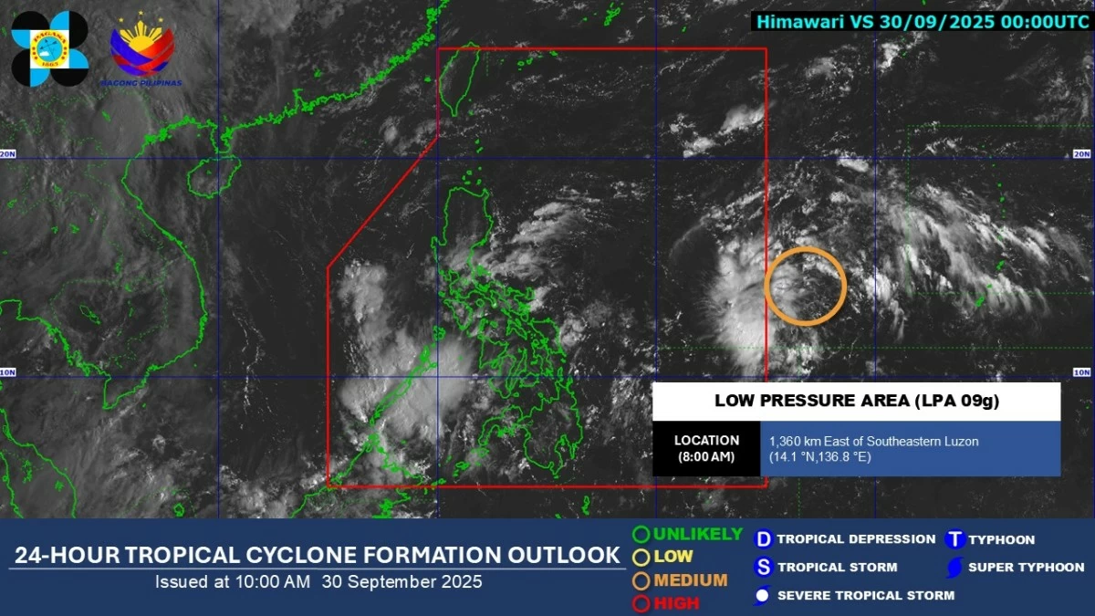
A low-pressure area (LPA) spotted outside the Philippine Area of Responsibility (PAR) has a medium chance of developing into a tropical depression within the next 24 hours, the Philippine Atmospheric, Geophysical and Astronomical Services Administration (PAGASA) said on Tuesday, Sept. 30.
As of 8 a.m., the LPA was located 1,360 kilometers east of southeastern Luzon.
If it develops into a tropical cyclone and enters PAR, it will be given the local name Paolo.
PAGASA said the weather disturbance has no direct effect yet on any part of the country.
Meanwhile, the easterlies, or warm winds from the Pacific Ocean, will remain the dominant weather system over the next 24 hours.
These winds may bring cloudy skies with scattered rains and thunderstorms over Metro Manila, Bicol Region, Bulacan, Rizal, and Quezon, while isolated rain showers or thunderstorms are expected over the rest of the country.
PAGASA advised the public to stay alert for possible flash floods and landslides, particularly during moderate to heavy rainfall or severe thunderstorms.