


PAGASA: Typhoon Opong exits PAR, all wind signals now lifted
Published Sep 27, 2025 11:17 am
|
Updated Sep 27, 2025 01:11 pm


Typhoon Opong exits PAR on Sept. 27, 2025, but PAGASA warns of monsoon winds, rough seas, and rains over Luzon, Visayas, and Palawan. (PAGASA)
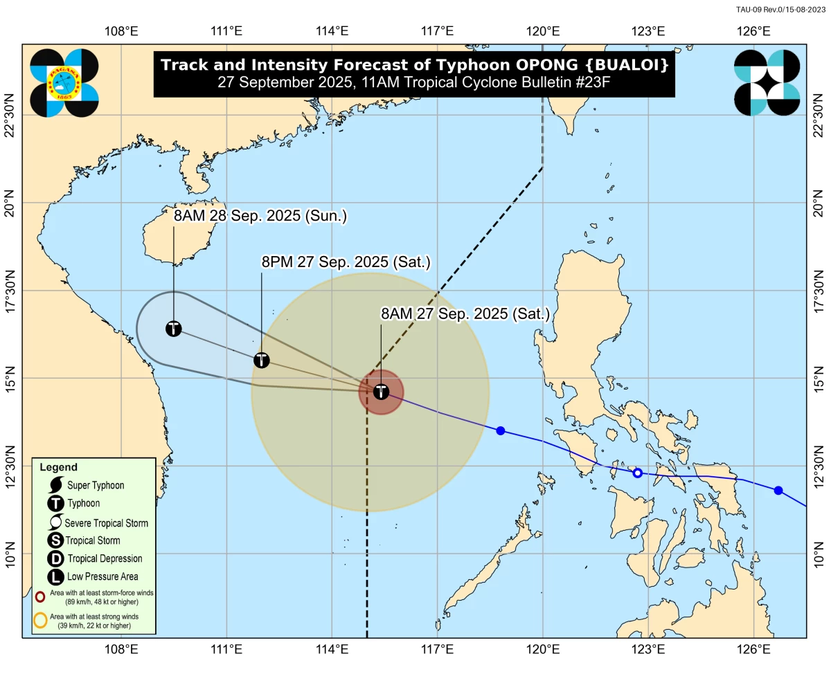
Typhoon Opong (international name: Bualoi) exited the Philippine Area of Responsibility (PAR) on Saturday morning, September 27, according to the Philippine Atmospheric, Geophysical and Astronomical Services Administration (PAGASA).
In its 11 a.m. tropical cyclone bulletin, PAGASA said the center of "Opong" was last located 645 kilometers west of Sangley Point, Cavite City. It was moving west-northwestward at 35 kilometers per hour (km/h).
The typhoon maintained maximum sustained winds of 120 km/h near the center, gustiness of up to 150 km/h, and a central pressure of 970 hPa. Its strong typhoon-force winds extended outward up to 400 kilometers from the center.
PAGASA said that no Tropical Cyclone Wind Signal (TCWS) is currently in effect anywhere in the country following "Opong’s" exit from PAR.
Monsoon-enhanced winds, rains
Despite leaving PAR, PAGASA said "Opong" continues to enhance the southwest monsoon (habagat), bringing strong to gale-force winds over Luzon, Western Visayas, and Negros Occidental, particularly in coastal and upland areas exposed to winds.
PAGASA also warned of rough sea conditions over the seaboards of Lubang Island, Kalayaan Islands, Batanes, Babuyan Islands, Isabela, Ilocos Norte, Zambales, Bataan, Calamian Islands, and northern Palawan, with wave heights reaching up to 3.5 meters.
Moderate seas (up to 2.5 meters) are expected over the eastern seaboards of Aurora and Polillo Islands, as well as the western seaboards of Occidental Mindoro and Palawan.
Mariners of small vessels, including motorbancas, are strongly advised against sea travel under these conditions, PAGASA said.
On its forecast track, PAGASA said "Opong" will continue to move west-northwestward toward northern Vietnam, where it is expected to intensify further.
READ: