


'Nando' moves farther away; wind signals lowered
Published Sep 23, 2025 06:06 pm


PAGASA
Super Typhoon Ragasa (formerly “Nando”) continued to move farther from the Philippine Area of Responsibility (PAR) on Tuesday, Sept. 23, prompting the Philippine Atmospheric, Geophysical and Astronomical Services Administration to lower tropical cyclone wind signals over parts of Northern Luzon.
As of 4 p.m., the center of Ragasa was spotted 540 kilometers west of Basco, Batanes, or outside the PAR.
It was packing maximum sustained winds of 185 kilometers per hour (kph) near the center and gustiness of up to 230 kph, while moving west-northwestward at 20 kph.
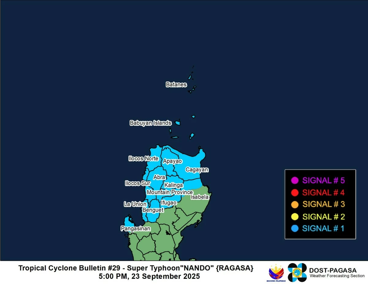
PAGASA said only Signal No. 1 remains hoisted over Batanes, Cagayan, northern portion of Isabela (San Manuel, Roxas, Mallig, Quezon, Santa Maria, Cabagan, Santo Tomas, Delfin Albano, Quirino, Tumauini, San Pablo, and Maconacon), Apayao, Abra, Kalinga, Mountain Province, Ifugao, Benguet, Ilocos Norte, Ilocos Sur, La Union, and northwestern portion of Pangasinan (Bolinao, Anda, Agno, Dasol, Sual, Burgos, City of Alaminos, Bani, and Mabini).
All wind signals are expected to be lifted tonight or Wednesday, Sept. 24, as Nando continues to move away from the country.
The typhoon continues to enhance the southwest monsoon (habagat), which will bring occasional rains and strong winds over most of Luzon, Western Visayas, Surigao del Norte, and Dinagat Islands through Wednesday.
By Thursday, Sept. 25, gusty conditions may also affect Batanes, Babuyan Islands, Cagayan, Ilocos Norte, Palawan, Siquijor, Camiguin, and parts of Mindanao including Surigao del Norte, Dinagat Islands, Davao Oriental, Davao del Sur, and Davao Occidental.
PAGASA said Nando will likely maintain its strength within the next 24 hours before weakening as it nears southern China, where it is forecast to make landfall by Wednesday evening or early Thursday.