


6 areas remain under Signal No. 1 due to STY Ragasa
Published Sep 23, 2025 11:49 pm


PAGASA
Despite Super Typhoon “Ragasa” (formerly “Nando”) already outside the Philippine Area of Responsibility, six areas in Northern Luzon remained under Tropical Cyclone Wind Signal No. 1 as of Tuesday evening, Sept. 23, said the Philippine Atmospheric, Geophysical and Astronomical Services Administration (PAGASA).
As of 10 p.m., the center of the eye of Ragasa was located 630 kilometers west of Itbayat, Batanes.
It was packing maximum sustained winds of 185 kilometers per hour (kph) near the center and gustiness of up to 230 kph.
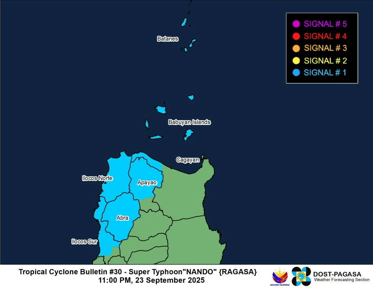
Signal No. 1 remained hoisted over Batanes, northwestern portion of Cagayan (Pamplona, Claveria, Abulug, Sanchez-Mira, Santa Praxedes), including the western Babuyan Islands (Panuitan, Calayan, Dalupiri, Irao, Mabaag, Barit, Fuga), northern and central portions of Apayao (Kabugao, Pudtol, Luna, Santa Marcela, Calanasan, Flora), Abra, Ilocos Norte, and northern and central portions of Ilocos Sur (Gregorio del Pilar, Magsingal, San Esteban, Banayoyo, Burgos, Candon City, Santa Lucia, Santiago, San Vicente, Santa Catalina, Lidlidda, Nagbukel, Sinait, Suyo, Sigay, San Ildefonso, Galimuyod, Quirino, Vigan City, San Emilio, Cabugao, Caoayan, San Juan, Santa, Bantay, Santo Domingo, Tagudin, Santa Cruz, Santa Maria, Narvacan, Salcedo).
These areas may still experience strong winds, with minimal to minor threats to life and property.
PAGASA said all wind signals are likely to be lifted by Wednesday, Sept. 24, as Ragasa moves farther away.
A gale warning also remained in effect over the northern and western seaboards of Northern Luzon, where sea travel is risky due to very rough seas reaching up to 4.5 meters.
Ragasa is forecast to continue west-northwestward over the West Philippine Sea before turning more westward toward southern China.
It may make landfall in China by Wednesday evening or early Thursday morning, Sept. 25, and begin weakening thereafter.