


TD Mirasol crosses Ifugao; PAGASA issues heavy rain warnings
Published Sep 17, 2025 12:49 pm


(PAGASA)
Tropical Depression Mirasol continues to move across Northern Luzon, with its center spotted over Ifugao province on Wednesday morning, September 17, according to the Philippine Atmospheric, Geophysical and Astronomical Services Administration (PAGASA).
In its latest bulletin, PAGASA said the center of "Mirasol" was located at 10 a.m. in the vicinity of Alfonso Lista, Ifugao, packing maximum sustained winds of 55 km/h, gusts of up to 90 km/h, and moving northwestward at 15 km/h.
PAGASA has also raised Tropical Cyclone Wind Signal (TCWS) No. 1 in several areas across Northern and Central Luzon due to the threat of strong winds (39–61 km/h).
These winds may cause minimal to minor damage to life and property, PAGASA said.
Luzon provinces under TCWS No. 1 include: Batanes, Cagayan including Babuyan Islands, Isabela, Quirino, Nueva Vizcaya, the northern and central portions of Aurora (Dilasag, Casiguran, Dinalungan, Dipaculao, Baler, Maria Aurora), Apayao, Abra, Kalinga, Mountain Province, Ifugao, Benguet, Ilocos Norte, Ilocos Sur, La Union, the northeastern portion of Pangasinan (San Nicolas, Natividad, San Manuel, Sison, San Quintin, Tayug), and the northern portion of Nueva Ecija (Carranglan, Pantabangan).
Heavy rainfall and wind outlook
PAGASA warned that "Mirasol" may bring heavy rains over parts of Northern and Central Luzon, with possible flooding and landslides in high-risk areas.
September 17 – Southern Quezon, Camarines Norte, Camarines Sur, MIMAROPA, Western Visayas, and Negros Occidental may experience strong to gale-force gusts.
September 18 – Metro Manila, Isabela, Cagayan, Batanes, Ilocos Region, Zambales, Bataan, Cavite, Quezon, Bicol Region, MIMAROPA, and Western Visayas.
September 19 – Ilocos Region, Zambales, and Bataan remain under threat of strong winds.
PAGASA also warned of coastal hazards due to TD Mirasol. Moderate to rough seas (up to 3.0 meters) are expected along the eastern seaboard of Cagayan and the seaboard of Isabela.
PAGASA advised small boats and fishing vessels to avoid sailing in risky waters.
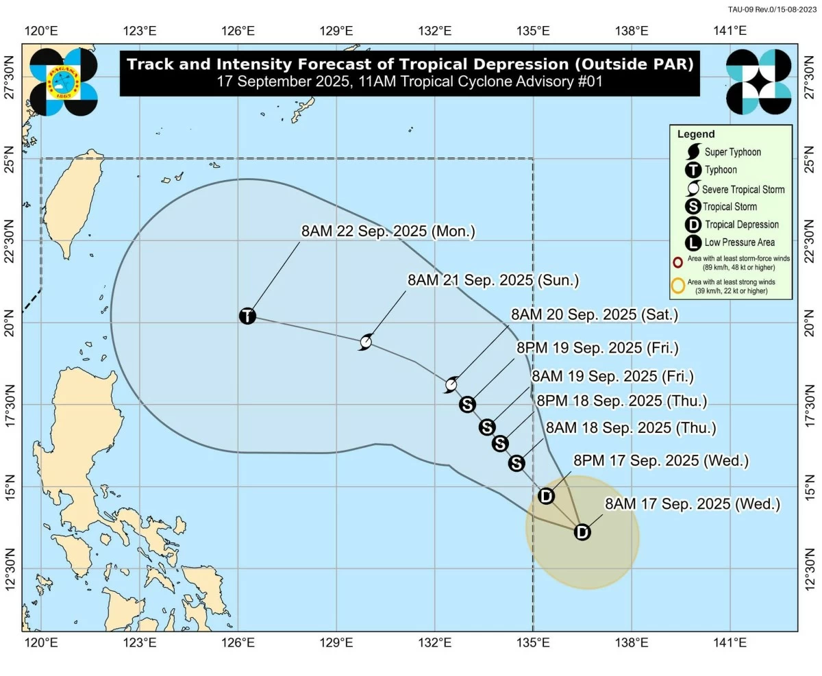
Forecast track and intensity
PAGASA said "Mirasol" is expected to cross Northern Luzon within the day and re-emerge over the Luzon Strait by tonight.
"Mirasol" is also expected to intensify into a tropical storm once it returns over water and could exit the Philippine Area of Responsibility (PAR) by Thursday, September 18.
Although currently classified as a tropical depression, the weather bureau noted that "Mirasol" could strengthen further into a tropical storm or even a severe tropical storm while over the Luzon Strait.
PAGASA urged authorities and residents in areas affected by heavy rainfall, floods, and landslides to remain alert and follow evacuation orders from local officials.
RELATED STORY: