


PAGASA: 'Lannie' slightly intensifies as it exits PAR
Rains may continue due to tropical depression-enhanced 'habagat'
Published Sep 6, 2025 12:39 pm


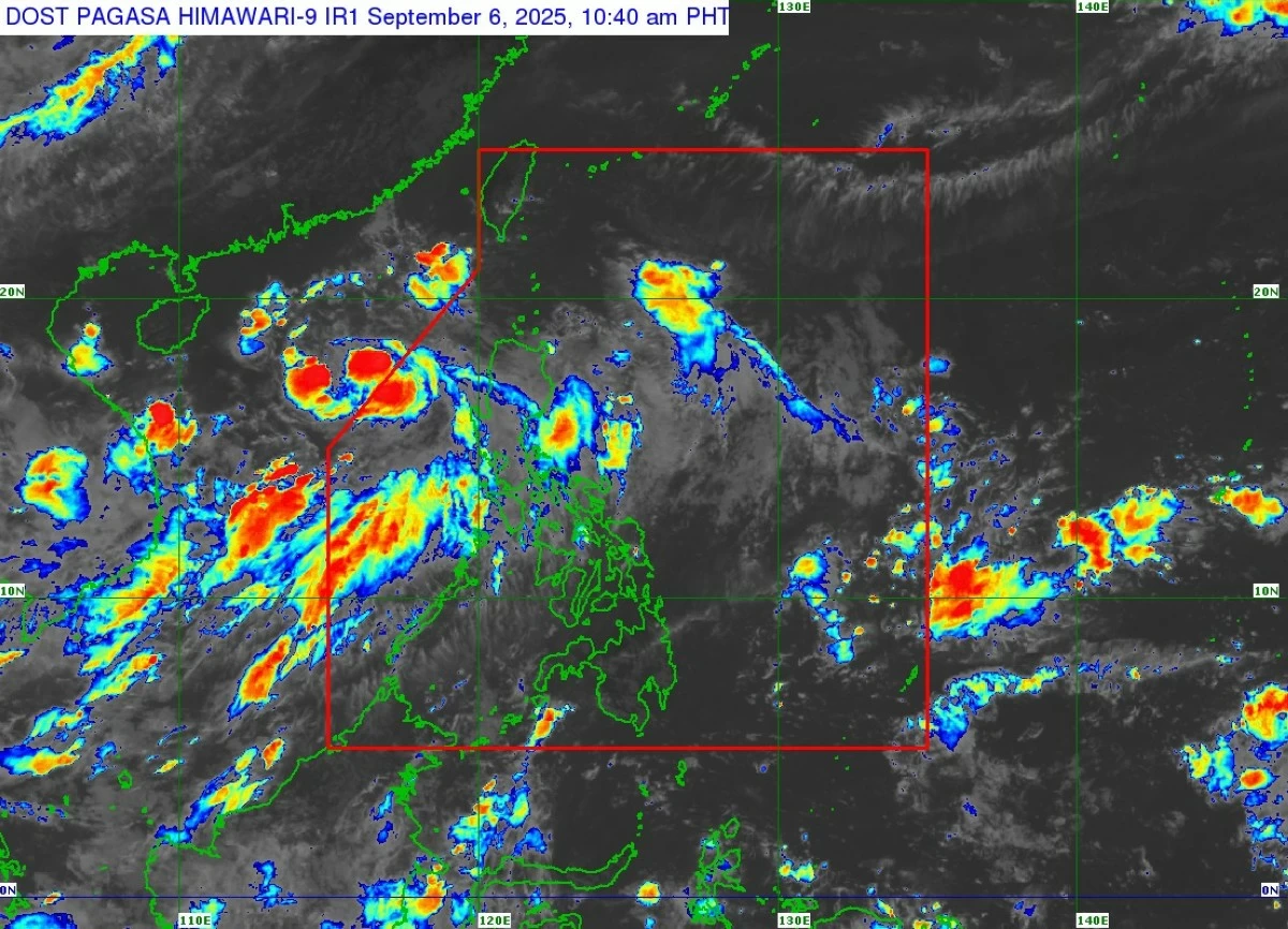
PAGASA said Tropical Depression Lannie has slightly intensified as it exited the Philippine Area of Responsibility on September 6, 2025. The cyclone may strengthen into a tropical storm while the enhanced southwest monsoon continues to bring rains and strong winds in parts of Luzon. (PAGASA)
Tropical Depression Lannie has slightly intensified as it exited the Philippine Area of Responsibility (PAR) on Saturday, September 6, according to the Philippine Atmospheric, Geophysical and Astronomical Services Administration (PAGASA).
As of 10 a.m., the weather bureau said TD Lannie’s center was estimated at 400 km west of Sinait, Ilocos Sur.
PAGASA said “Lannie” is currently packing maximum sustained winds of 55 km/h near the center, gusts of up to 70 km/h, and a central pressure of 1002 hPa. The cyclone is moving west-northwestward at 15 km/h toward southern China.
No Tropical Cyclone Wind Signals raised
PAGASA said no Tropical Cyclone Wind Signal (TCWS) is currently in effect over any part of the country.
However, the southwest monsoon (habagat), slightly enhanced by “Lannie,” will continue to bring strong to gale-force gusts in the following areas:
- September 6: Ilocos Region, Cagayan, and Isabela
- September 7: Ilocos Region, Cagayan, and Isabela
Sea conditions
While no gale warning is currently in effect, moderate seas with waves of up to 2.5 meters are expected over the seaboards of the Ilocos Region and Zambales.
PAGASA advised mariners of small vessels, such as motorbancas, to take precautionary measures or avoid sea travel if possible.
Track and outlook
PAGASA said “Lannie” is forecast to intensify into a tropical storm tonight or by early Sunday, September 7, as it moves across the West Philippine Sea toward southern China.
The weather bureau reminded the public, especially those in high-risk areas, to remain alert and follow the guidance of local disaster risk reduction and management offices.
Residents are also urged to monitor thunderstorm and rainfall advisories from their respective PAGASA Regional Services Divisions.
With TD Lannie’s exit from the PAR, PAGASA said this will be the final tropical cyclone bulletin for the system unless it re-enters the country’s monitoring area.
Updates on its movement and effects will be included in the agency’s 24-hour public weather forecasts.