


LPA develops into tropical depression 'Kiko'
To exit Philippine area of responsibility this afternoon
Published Sep 3, 2025 11:26 am


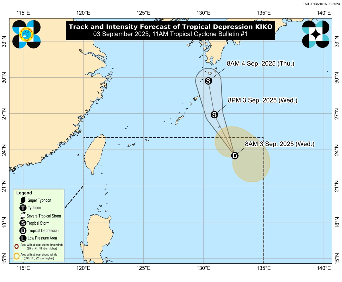
A low-pressure area (LPA) east of extreme Northern Luzon has developed into a tropical depression and was given the local name “Kiko,” the Philippine Atmospheric, Geophysical and Astronomical Services Administration (PAGASA) said on Wednesday, Sept. 3.
Kiko is the 11th tropical cyclone to form within the Philippine Area of Responsibility (PAR) this year and the first for the month of September.
As of 10 a.m., the center of the tropical depression was located 1,170 kilometers east-northeast of extreme Northern Luzon.
It has maximum sustained winds of 55 kilometers per hour (kph) near the center and gusts of up to 70 kph.
PAGASA said Kiko is not expected to directly affect any part of the country due to its distance from land.
It may move generally northward or north-northwestward over the next 24 hours toward southern Japan and is expected to exit the PAR later today.
However, the southwest monsoon or “habagat” continues to bring cloudy skies with scattered rain showers and thunderstorms over Ilocos Region, Batanes, Babuyan Islands, Apayao, Zambales, Bataan, and Occidental Mindoro.
Partly cloudy to cloudy skies with isolated rain showers or thunderstorms may also prevail over Metro Manila, Tarlac, Pampanga, Nueva Ecija, Aurora, Bulacan, Cavite, Laguna, Batangas, Rizal, Quezon, Oriental Mindoro, Marinduque, Romblon, Palawan, Bicol Region, and Western Visayas.
The rest of the country may experience similar weather conditions due to localized thunderstorms.
PAGASA advised the public to remain vigilant against possible flash floods and landslides, especially during moderate to heavy rainfall or severe thunderstorms.