


Manila Bulletin
 Philippines
National
'Kiko' exits PAR; 'habagat' may bring scattered rains, thunderstorms over some Luzon areas
Philippines
National
'Kiko' exits PAR; 'habagat' may bring scattered rains, thunderstorms over some Luzon areas
Philippines
National
'Kiko' exits PAR; 'habagat' may bring scattered rains, thunderstorms over some Luzon areas
'Kiko' exits PAR; 'habagat' may bring scattered rains, thunderstorms over some Luzon areas
Published Sep 3, 2025 05:35 pm


PAGASA
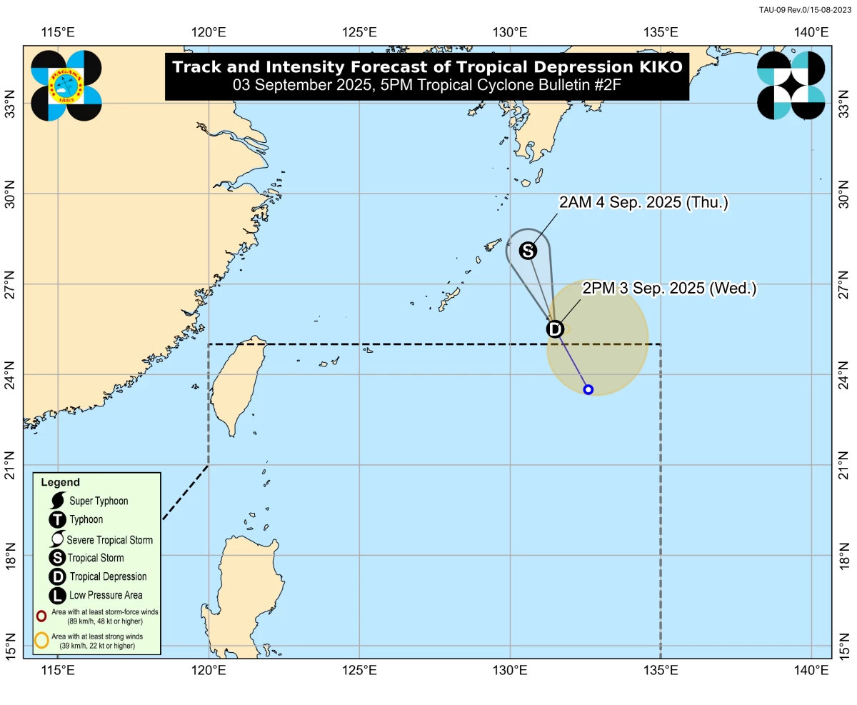
Tropical depression Kiko left the Philippine Area of Responsibility (PAR) at 1 p.m. on Wednesday, Sept. 3, just five hours after it intensified into a tropical cyclone.
The Philippine Atmospheric, Geophysical and Astronomical Services Administration (PAGASA) last located the center of the tropical depression 1,100 kilometers east-northeast of extreme Northern Luzon.
Kiko is not expected to directly affect any part of the country.
However, PAGASA said the southwest monsoon or “habagat” may bring cloudy skies with scattered rains and thunderstorms over Ilocos Region, Cordillera Administrative Region, Batanes, Babuyan Islands, Cagayan, Isabela, Zambales, and Bataan.
Meanwhile, Metro Manila, the rest of Luzon, and Western Visayas may experience partly cloudy to cloudy skies with isolated rain showers or thunderstorms.
PAGASA said similar conditions may prevail over the rest of the country due to localized thunderstorms.
The public is advised to remain vigilant against possible flash floods and landslides, especially during moderate to heavy rainfall or severe thunderstorms.