


Manila Bulletin
 Philippines
National
LPA east of Eastern Samar, 'habagat' to bring widespread rains—PAGASA
Philippines
National
LPA east of Eastern Samar, 'habagat' to bring widespread rains—PAGASA
Philippines
National
LPA east of Eastern Samar, 'habagat' to bring widespread rains—PAGASA
LPA east of Eastern Samar, 'habagat' to bring widespread rains—PAGASA
By Jel Santos
Published Aug 25, 2025 07:01 pm


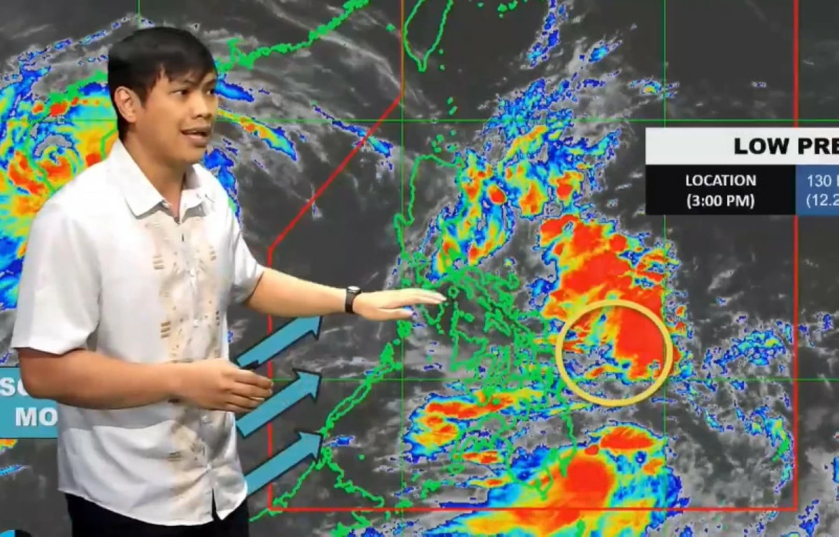
(PHOTO: DOST-PAGASA FACEBOOK PAGE)
Large parts of the country will experience cloudy skies and heavy rains due to a low-pressure area (LPA) east of Eastern Samar and the prevailing “habagat” or southwest monsoon, the Philippine Atmospheric, Geophysical and Astronomical Services Administration (PAGASA) said Monday, August 25.
“Kasalukuyan na may mino-monitor tayo na low-pressure area at ito ay nasa 130 kilometers east northeast ng Borongan City Eastern Samar (We are currently monitoring a low-pressure area located 130 kilometers east northeast of Borongan City, Eastern Samar),” PAGASA weather specialist John Manalo said during the 5 p.m. forecast.
According to Manalo, the LPA will cause widespread rains, affecting the Visayas, Bicol Region, and most parts of Luzon, sparing only the Ilocos Region.
“Samantala, dahil po sa low-pressure area na ito, malaking bahagi ng ating bansa ‘yung magiging maulap at may mataas na tyansa ng mga pag-ulan kasama dyan ‘yung Visayas, Bicol Region, malaking bahagi ng Luzon except lang dito sa Ilocos Region (Meanwhile, because of this low-pressure area, much of the country will be cloudy with high chances of rain, including the Visayas, Bicol Region, and most of Luzon except the Ilocos Region),” he said.
Meanwhile, the weather specialist noted that the southwest monsoon continues to affect the country, with its impact strongest over the western part of Visayas and western Mindanao, including the Zamboanga Peninsula, BARMM, and SOCCSKSARGEN.
PAGASA also issued a heavy rainfall outlook due to the southwest monsoon:
• Today until tomorrow afternoon (Aug. 26): Moderate to heavy rains (50–100 mm) in Palawan and Antique.
• Tomorrow afternoon to Wednesday afternoon (Aug. 27): Moderate to heavy rains (50–100 mm) in Occidental Mindoro, Palawan, Antique, and Negros Occidental.
• Wednesday afternoon to Thursday afternoon (Aug. 28): Moderate to heavy rains (50–100 mm) in Palawan, Antique, and Occidental Mindoro.
The state weather bureau said forecast rainfall may be higher in mountainous and elevated areas, and impacts could worsen in locations already affected by significant antecedent rainfall.
PAGASA said there are two possible scenarios for the low-pressure area’s path.
“‘Yung unang scenario ay mag-mo-move ito pa-northwest babaybayin niya ‘yung east coast ng Eastern Visayas ganundin sa Bicol Region. And then, dito sa Central Luzon siya mag-cro-cross papunta rito sa West Philippine Sea (The first scenario is that it will move northwest, skirting the east coast of Eastern Visayas as well as the Bicol Region. Then, it will cross Central Luzon before heading toward the West Philippine Sea),” said Manalo.
“At iyong pangalawang scenario naman natin ay dito sa Eastern Visayas, papasok na siya, at dito niya babaybaying ‘yung Southern Luzon bago siya makarating sa Western Visayas (The second scenario is that it will enter through Eastern Visayas, move along Southern Luzon, and then reach Western Visayas),” he added.
While the chance of development remains low for now because of land interaction, Manalo warned that conditions may change once the system reaches open waters.
“‘Yung development nitong low-pressure area na ating mino-monitor ay nananatiling mababa… Pero nakikita rin natin na kapag nandito na siya sa Western Philippine Sea ay mas tataas na ‘yung tiyansa niya na mag-develop sa isang ganap na bagyo or tropical depression (The development of this low-pressure area remains low… But once it reaches the West Philippine Sea, the chances of developing into a tropical depression will increase),” he said.