


Manila Bulletin
 Philippines
National
'Huaning' slightly intensifies, unlikely to affect Philippines — PAGASA
Philippines
National
'Huaning' slightly intensifies, unlikely to affect Philippines — PAGASA
Philippines
National
'Huaning' slightly intensifies, unlikely to affect Philippines — PAGASA
'Huaning' slightly intensifies, unlikely to affect Philippines — PAGASA
Published Aug 18, 2025 12:11 pm


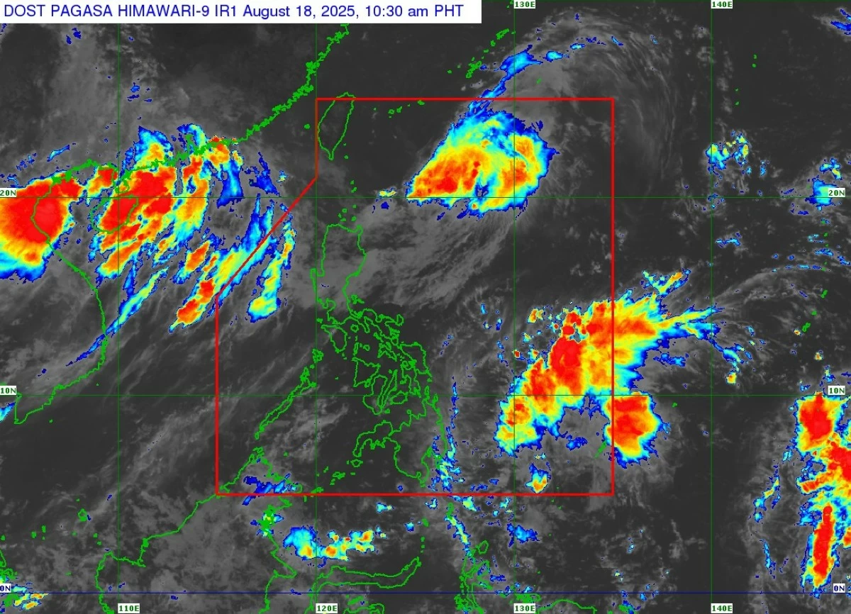
Satellite image of Tropical Depression Huaning (PAGASA)
Tropical depression Huaning has slightly intensified but remains unlikely to directly affect the Philippines, the Philippine Atmospheric, Geophysical and Astronomical Services Administration (PAGASA) said on Monday, Aug. 18.
As of 11 a.m., Huaning has maximum sustained winds of 55 kilometers per hour (kph) near its center and gusts of up to 70 kph.
Forecast track
The tropical depression was located 535 kilometers east-northeast of Itbayat, Batanes, and was moving slowly north-northwestward.
It is expected to continue moving northward and exit the Philippine Area of Responsibility (PAR) tonight or by Tuesday morning, Aug. 19.
It may pass close to or over the Okinawa Islands in Japan by Tuesday morning or afternoon.
While Huaning is expected to remain a tropical depression, PAGASA noted that a possible intensification into a tropical storm is not entirely ruled out, though it is not the most likely scenario at this time.
PAGASA added that the tropical depression is unlikely to affect sea conditions in the coastal waters of the country.
Weather outlook
By Tuesday, the Intertropical Convergence Zone (ITCZ) may start to bring scattered rains and thunderstorms over the eastern sections of Visayas and Mindanao.
The ITCZ is a weather system formed by the convergence of winds from the northern and southern hemispheres, leading to the development of rain clouds.
From Wednesday to Friday, Aug. 20 to 22, Southern Luzon, Visayas, and Mindanao may also experience scattered rains and thunderstorms due to the ITCZ.
The rest of the country is expected to experience generally fair weather, with isolated rain showers or thunderstorms in the afternoon or evening.