


Manila Bulletin
 Philippines
National
'Huaning' may exit Philippine area of responsibility on August 19, says PAGASA
Philippines
National
'Huaning' may exit Philippine area of responsibility on August 19, says PAGASA
Philippines
National
'Huaning' may exit Philippine area of responsibility on August 19, says PAGASA
'Huaning' may exit Philippine area of responsibility on August 19, says PAGASA
Published Aug 18, 2025 05:43 pm


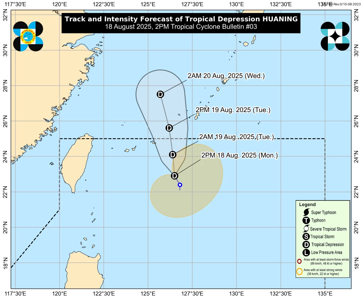
Forecast track of Tropical Depression Huaning (PAGASA)
Tropical depression Huaning is moving slowly northward and is expected to leave the Philippine Area of Responsibility (PAR) by Tuesday morning, Aug. 19, based on the latest forecast from the Philippine Atmospheric, Geophysical and Astronomical Services Administration (PAGASA).
As of 5 p.m., Monday, Aug. 18, the center of Huaning was located 555 kilometers east-northeast of Itbayat, Batanes.
“Huaning is forecast to move generally northward and exit the PAR tomorrow morning (Aug. 19). On the track forecast, the tropical depression may pass near or over the Ryukyu Islands tomorrow morning or afternoon,” PAGASA said.
The tropical depression maintained maximum winds of 55 kilometers per hour (kph) near the center and gusts of up to 70 kph.
PAGASA said Huaning poses no direct threat to the country and is unlikely to affect coastal sea conditions.
However, its trough or extension may bring cloudy skies with scattered rains and thunderstorms over Ilocos Region, Zambales, and Bataan.
Meanwhile, the southwest monsoon or “habagat” may bring partly cloudy to cloudy skies with isolated rain showers or thunderstorms over Palawan.
The rest of the country may experience similar weather conditions due to localized thunderstorms.
PAGASA advised the public to remain vigilant for possible flash floods and landslides during moderate to heavy rainfall or severe thunderstorms.