


Manila Bulletin
 Philippines
National
'Gorio' intensifies into typhoon, still poses no immediate threat to Philippines
Philippines
National
'Gorio' intensifies into typhoon, still poses no immediate threat to Philippines
Philippines
National
'Gorio' intensifies into typhoon, still poses no immediate threat to Philippines
'Gorio' intensifies into typhoon, still poses no immediate threat to Philippines
Published Aug 12, 2025 08:33 am


PAGASA
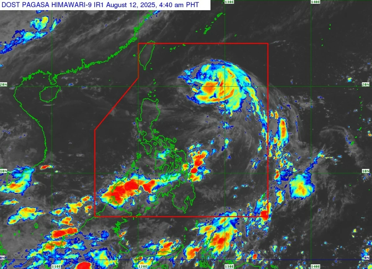
Tropical cyclone “Gorio” (international name: Podul) intensified into a typhoon over the Philippine Sea on Tuesday, Aug. 12, but remains far from land and is not expected to bring any immediate effects, the Philippine Atmospheric, Geophysical and Astronomical Services Administration (PAGASA).
As of 5 a.m., the center of typhoon Gorio was located 745 kilometers east of Itbayat, Batanes, with maximum sustained winds of 120 kilometers per hour (kph) near the center and gusts of up to 150 kph.
The typhoon is moving westward at 25 kph.
PAGASA weather specialist Obet Badrina said Gorio is still unlikely to directly affect any part of the country within the next three days.
However, he noted that a slight southward shift in its track could lead to the possible issuance of tropical cyclone wind signal over extreme Northern Luzon, particularly Batanes on Tuesday or Wednesday, Aug. 13.
Gorio is expected to maintain its strength before making landfall on the eastern coast of Taiwan by Wednesday afternoon and exit the Philippine Area of Responsibility later that day.
Despite the presence of Gorio, Badrina said the southwest monsoon (habagat) is not expected to be enhanced, and most parts of the Philippines will experience generally fair weather over the next several days.
On Wednesday, cloudy skies with scattered rains and thunderstorms may prevail over extreme Northern Luzon, Mimaropa, Western Visayas, Negros Island Region, and the western part of Mindanao.
From Thursday to Friday, Aug. 14 to 15, cloudy skies with scattered rains and thunderstorms may persist in Visayas, Mimaropa, and the western section of Mindanao.
By Saturday, Aug. 16, cloudy skies with scattered rains and thunderstorms may affect Cavite, Laguna, Batangas, Rizal, Quezon, Oriental Mindoro, Occidental Mindoro, Marinduque, Romblon, Palawan, and the western part of Visayas.
Throughout the forecast period, Metro Manila and the rest of the country will have mostly fair weather with isolated afternoon or evening rain showers or thunderstorms lasting one to two hours.
Meanwhile, PAGASA warned that sea conditions remain hazardous in northern coastal waters.
Very rough seas with waves up to 5.5 meters are expected along the seaboards of Batanes.
PAGASA said sea travel is considered risky for all types and sizes of vessels.
Mariners are advised to stay in port or, if already at sea, to seek immediate until sea conditions improve.