


Manila Bulletin
 Philippines
National
PAGASA warns of flood, landslide risks as LPA may bring widespread rains over parts of Luzon
Philippines
National
PAGASA warns of flood, landslide risks as LPA may bring widespread rains over parts of Luzon
Philippines
National
PAGASA warns of flood, landslide risks as LPA may bring widespread rains over parts of Luzon
PAGASA warns of flood, landslide risks as LPA may bring widespread rains over parts of Luzon
Published Aug 7, 2025 10:09 am


PAGASA
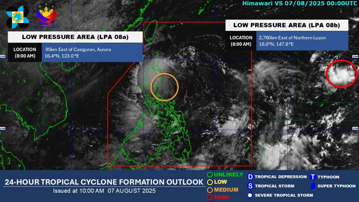
The Philippine Atmospheric, Geophysical and Astronomical Services Administration (PAGASA) on Thursday, Aug. 7 said the low-pressure area (LPA) inside the Philippine Area of Responsibility (PAR) may bring widespread rains over parts of Luzon within the next 24 hours.
As of 8 a.m., the LPA was located 95 kilometers east of Casiguran, Aurora.
PAGASA weather specialist Chenel Dominguez said it is expected to cross Luzon between Thursday evening and Friday, Aug. 8, bringing moderate to heavy rains particularly over Cagayan Valley, Cordillera Administrative Region, and Aurora.
Cloudy skies with scattered rains and thunderstorms are also expected over Metro Manila, Ilocos Region, the rest of Central Luzon, Cavite, Laguna, Batangas, Rizal, Quezon, Bicol Region, Occidental Mindoro, Oriental Mindoro, Marinduque, Romblon, and Northern Samar.
PAGASA said the chance of this LPA intensifying into a tropical cyclone within 24 hours has increased from low to moderate.
Dominguez said it could intensify into a tropical depression after crossing Luzon or over the West Philippine Sea.
Residents in affected areas are advised to remain vigilant for possible flash floods and landslides, especially in mountainous and flood-prone communities.
Meanwhile, another LPA located 2,760 kilometers east of Northern Luzon, outside the PAR, currently has a high chance of developing into a tropical cyclone within the next 24 hours.
Dominguez said the possibility of it entering the PAR cannot be ruled out.
However, it is not expected to directly affect the country at this time.
In addition to the LPAs, the southwest monsoon or “habagat” continues to bring cloudy skies with scattered rains and thunderstorms over the rest of Visayas, Zamboanga Peninsula, Northern Mindanao, Caraga, Bangsamoro Autonomous Region in Muslim Mindanao, and Palawan.
The rest of Mindanao will experience partly cloudy to cloudy skies with isolated rain showers or thunderstorms.