


Manila Bulletin
 Philippines
National
LPA may bring significant rainfall as it crosses Luzon, PAGASA warns
Philippines
National
LPA may bring significant rainfall as it crosses Luzon, PAGASA warns
Philippines
National
LPA may bring significant rainfall as it crosses Luzon, PAGASA warns
LPA may bring significant rainfall as it crosses Luzon, PAGASA warns
Published Aug 6, 2025 08:46 am
|
Updated Aug 6, 2025 01:22 pm


PAGASA
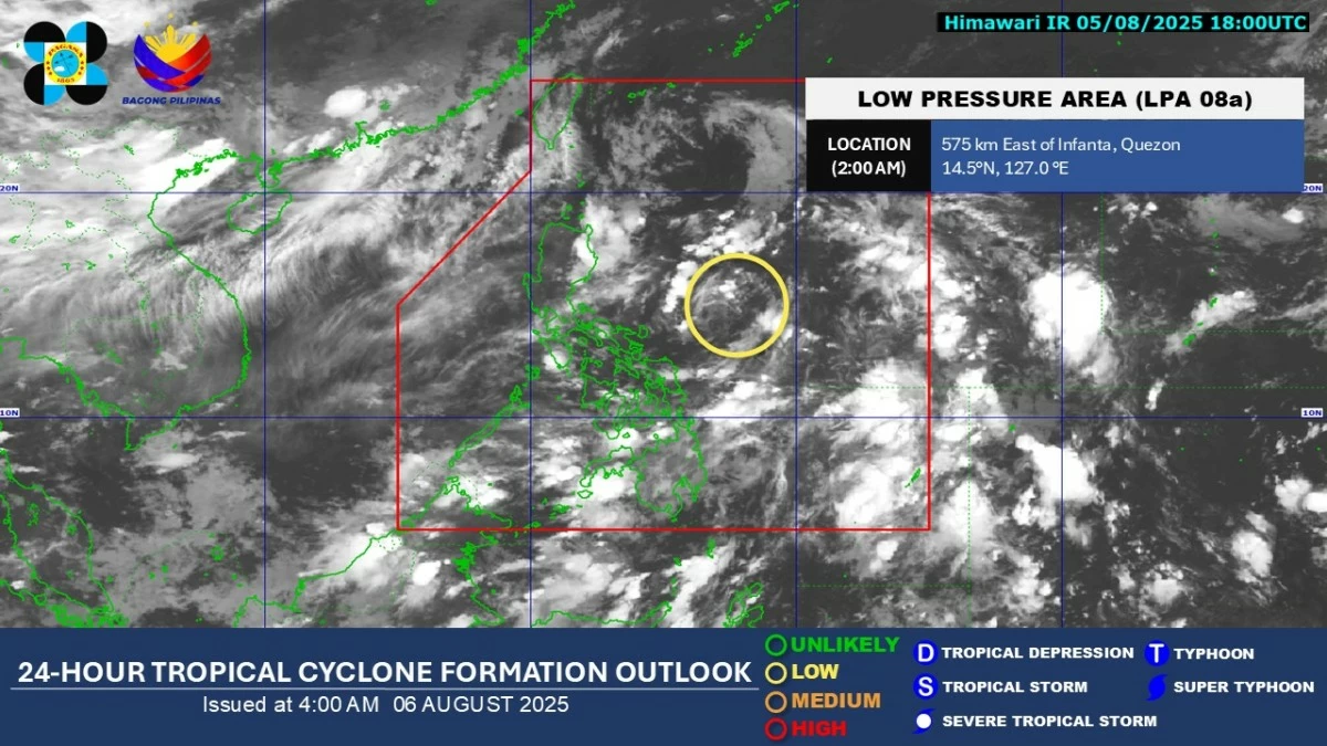
The low-pressure area (LPA) east of Luzon has started bringing rains over the eastern parts of the country and is expected to cause significant rainfall as it crosses Luzon within the next two days, the Philippine Atmospheric, Geophysical and Astronomical Services Administration (PAGASA) said on Wednesday, Aug. 6.
As of 3 a.m., the LPA was located 550 kilometers east of Infanta, Quezon.
PAGASA weather specialist Loriedin de la Cruz-Galicia said the weather system remains over the sea but is projected to cross Luzon by Thursday, Aug. 7, and exit by Friday, Aug. 8.
Although the LPA does not bring strong winds, de la Cruz-Galicia said it carries significant moisture that could result in moderate to heavy rainfall, increasing the risk of localized flooding and landslides, especially in vulnerable areas.
Scattered rains and thunderstorms associated with the LPA are currently affecting Cagayan Valley, Bicol, Aurora, Quezon, Marinduque, Romblon, Northern Samar, Samar, Eastern Samar, Biliran, and Leyte.
Meanwhile, PAGASA said the southwest monsoon or “habagat” continues to bring scattered rains and thunderstorms over Zamboanga Peninsula, Negros Island Region, Basilan, Tawi-Tawi, Sultan Kudarat, and Sarangani.
The habagat may also cause partly cloudy to cloudy skies with isolated rain showers or thunderstorms over the rest of Mindanao, the rest of Visayas, and Palawan.
PAGASA said Metro Manila and the rest of Luzon will experience partly cloudy to cloudy skies with isolated rain showers due to localized thunderstorms.