


Manila Bulletin
 Philippines
National
Monsoon break continues; scattered rain showers due to LPA to return midweek — PAGASA
Philippines
National
Monsoon break continues; scattered rain showers due to LPA to return midweek — PAGASA
Philippines
National
Monsoon break continues; scattered rain showers due to LPA to return midweek — PAGASA
Monsoon break continues; scattered rain showers due to LPA to return midweek — PAGASA
LPA to enter PAR today
Published Aug 4, 2025 10:36 am


PAGASA
The Philippine Atmospheric, Geophysical and Astronomical Services Administration (PAGASA) on Monday, Aug. 4 said the monsoon break continues, causing warm and humid weather across most parts of the country.
PAGASA weather specialist Daniel James Villamil said partly cloudy to cloudy skies will prevail until Wednesday, Aug. 6, with localized thunderstorms possible in the afternoon or evening.
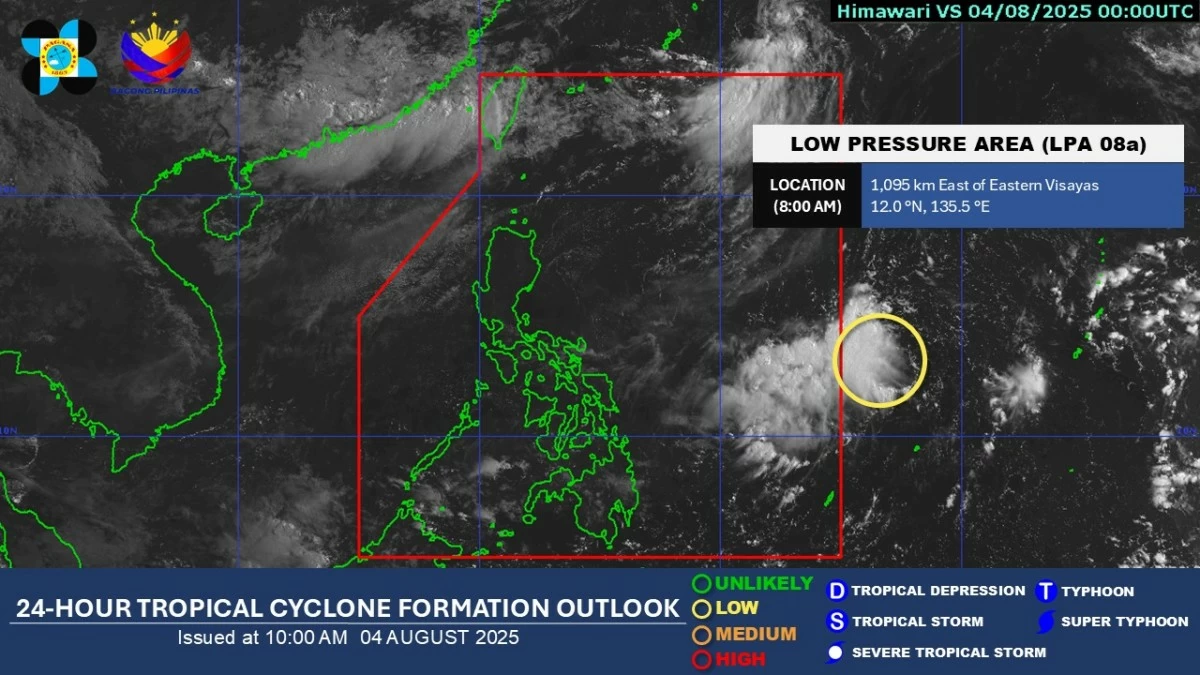
However, Villamil said a low-pressure area (LPA) east of the Visayas is expected to enter the Philippine Area of Responsibility (PAR) today.
As of 3 a.m., the LPA was located 1,445 kilometers east of Eastern Visayas and is seen to move generally northwest over the sea east of Luzon.
He noted that the chance of the system developing into a tropical cyclone within the next 24 hours remains low, and there are currently no impacts on any part of the country.
While the LPA is not expected to have an immediate effect, Villamil said it may bring scattered rain showers and thunderstorms by Thursday, Aug. 7, especially over the eastern sections of Southern Luzon and Eastern Visayas.
He said PAGASA will continue to closely monitor the weather disturbance for possible development into a tropical cyclone in the coming days.
If it intensifies into a tropical depression, it will be named “Fabian,” the next name on PAGASA’s list.