


Manila Bulletin
 Philippines
National
Up to 3 tropical cyclones may enter or form within PAR in August – PAGASA
Philippines
National
Up to 3 tropical cyclones may enter or form within PAR in August – PAGASA
Philippines
National
Up to 3 tropical cyclones may enter or form within PAR in August – PAGASA
Up to 3 tropical cyclones may enter or form within PAR in August – PAGASA
Published Aug 1, 2025 12:42 pm
|
Updated Aug 1, 2025 01:22 pm


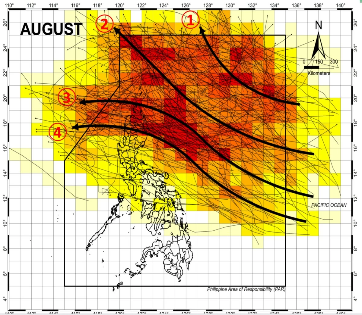
Tracks showing typical paths of tropical cyclones during August. (PAGASA)
The Philippine Atmospheric, Geophysical and Astronomical Services Administration (PAGASA) on Friday, Aug. 1 said that two or three tropical cyclones may enter or form within the Philippine Area of Responsibility (PAR) this month.
Based on historical patterns, tropical cyclones in August typically follow one of four tracks.
Some recurve toward the northern or northwestern parts of PAR without making landfall, moving toward Japan or Taiwan, and may enhance the southwest monsoon (habagat).
Others may make landfall in the extreme northern Philippines or cross the northern and central parts of Luzon before heading toward Vietnam or Hong Kong.
As of 10 a.m., PAGASA is monitoring a low-pressure area located 1,225 kilometers east-northeast of extreme Northern Luzon.
The weather system has a high chance of developing into a tropical depression within 24 hours.
If it enters the PAR as a tropical depression, it will be given the local name Fabian.
Based on the latest analysis, the potential cyclone may briefly enter PAR, move northeastward, and exit.
The next names on PAGASA’s tropical cyclone list after Fabian are Gorio and Huaning.