


Potential cyclone may briefly enter PAR — PAGASA
Published Aug 1, 2025 08:27 am


PAGASA
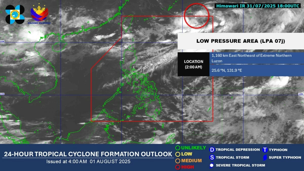
A low-pressure area (LPA) outside the Philippine Area of Responsibility (PAR) may develop into a tropical depression and briefly enter the country’s monitoring area, said the Philippine Atmospheric, Geophysical and Astronomical Services Administration (PAGASA) on Friday, Aug. 1.
As of 4 a.m., the LPA was spotted 1,160 kilometers east-northeast of extreme Northern Luzon.
Although still far from land, PAGASA weather specialist Loriedin dela Cruz-Galicia said the weather system has a high chance of developing into a tropical cyclone within the next 24 hours.
“Based on our latest analysis, there is a high chance for this system to become a tropical cyclone, which is why we are closely monitoring it,” dela Cruz-Galicia said.
She added that if the weather system enters PAR and intensifies into a cyclone, it will be named Fabian.
It is expected to move northeast and exit PAR shortly after entering, without making landfall.
At present, the system poses no direct threat to the country.
However, dela Cruz-Galicia said the weather disturbance may enhance the southwest monsoon or habagat, which could bring rains across parts of Luzon and the Visayas.
Within the next 24 hours, cloudy skies with scattered rain showers and thunderstorms are expected over Ilocos Region, Batanes, Babuyan Islands, Abra, Benguet, and Zambales
Meanwhile, the rest of Luzon and Visayas may experience isolated rain showers due to the habagat.
Localized thunderstorms may also bring isolated rain showers over Mindanao.