


Manila Bulletin
 Philippines
National
Between two Koreas: A tour in one of the world's most heavily-fortified borders
Philippines
National
Between two Koreas: A tour in one of the world's most heavily-fortified borders
Philippines
National
Between two Koreas: A tour in one of the world's most heavily-fortified borders
Between two Koreas: A tour in one of the world's most heavily-fortified borders
Published Jul 30, 2025 11:13 am
|
Updated Aug 4, 2025 12:32 pm


At A Glance
- GANGHWA ISLAND, South Korea—Near the demilitarized zone (DMZ) between the two Koreas lies this island, where the tension between the militaries of the two countries silently simmers.
GANGHWA ISLAND, South Korea—Near the demilitarized zone (DMZ) between the two Koreas lies this island, where the tension between the militaries of the two countries silently simmers.
The connecting waters of Yesong and Han Rivers is the only thing that borders this island from North Korea. This makes it one of South Korea's closest frontiers to its neighboring communist state, just 1.8 kilometers away.
But it also feels one the farthest, as one local who also works as a docent put it. It's because the silent tension at the border is always at risk of escalating into conflict.
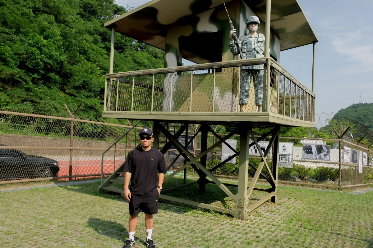
On this island there are military observation posts. Day and night, they watch every move of their North Korean counterparts across the other side, and vice versa.
One mistake could trigger an instance of violence, which for decades has been contained thanks to an armistice agreement signed by both sides in 1953. The pact led to the establishment of the DMZ, a 248-kilometer long, four-kilometer wide buffer zone serving as the de facto border of the two Koreas.
In 2022, there was a momentary tension between the two countries. South Korea said it fired warning shots to repel a North Korean merchant vessel crossing the Northern Limit Line (NLL), and the latter said it retaliated by launching rockets into the maritime buffer zone as a countermeasure.
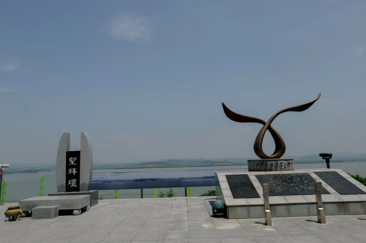
Manila Bulletin was given rare access into one of South Korean military-controlled areas. It also visited the Ganghwa Peace Observatory Course, one of the 10 DMZ Peace Trail courses, and was able to cover a significant section of the 62.5-km course with the cooperation of the Ministry of National Defense and Gangwa County.
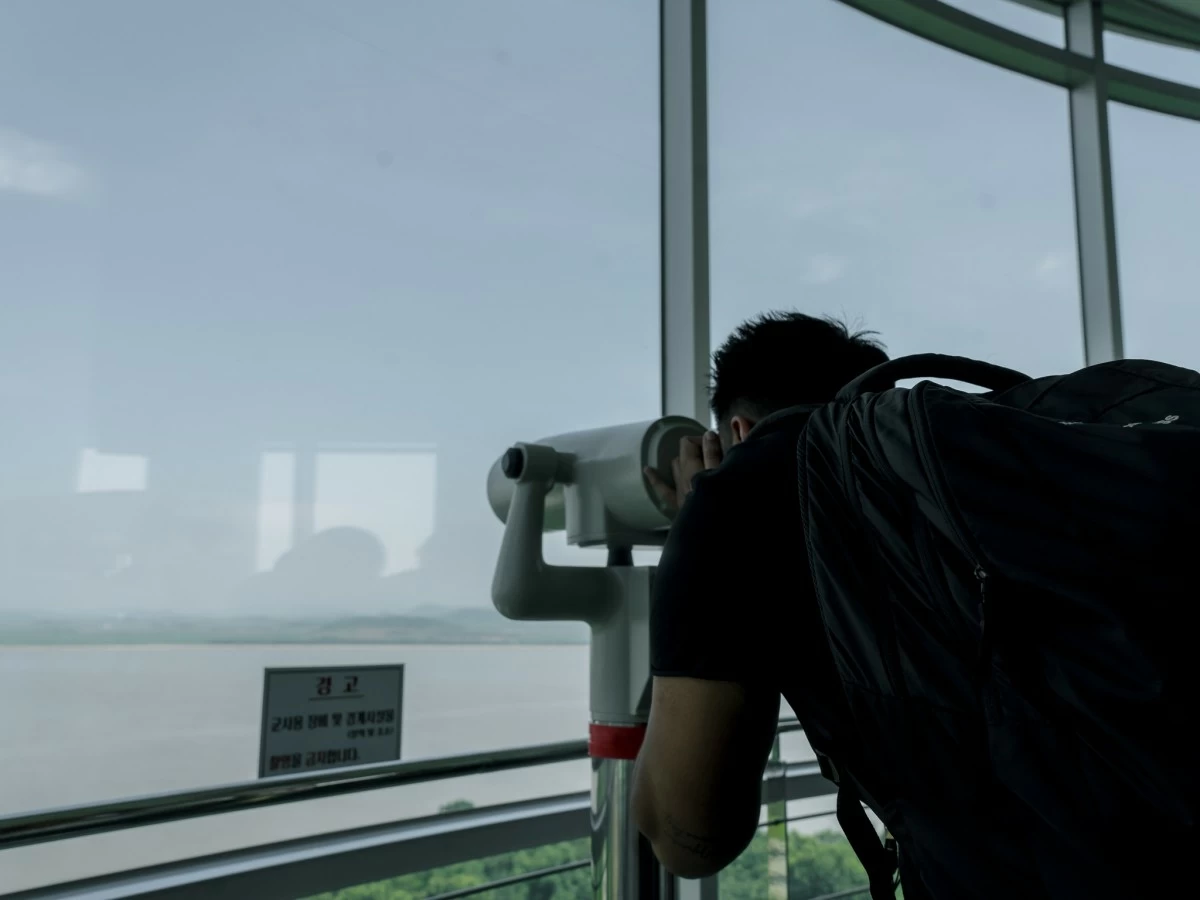
Upon entry into the area, mobile phones were quickly confiscated from the journalists. It was only at the nearby Ganghwa Peace Observatory that the use of mobile phones and the taking of photos were allowed, but on certain conditions.
A South Korean official declined to provide details on the cases of North Korean defectors entering the area.
Last April, the South Korean Unification Ministry said that around 38 defectors from the North entered South in the first quarter of 2025. It is not publicly shared how many defectors made it to the South through Ganghwa Island or if there were any at all.
The military area
The military-controlled area is Uido Dondae, a watchtower made of huge bricks that were the same as those used on the Gyeongbokgung Palace--a famous historical site in Seoul.
Uido Dondae was used to defend the Joseon Dynasty—the dynasty that had led Korea from 1392 to 1910. It has since been repurposed for the current South Korean military. It is off-limits to the public.
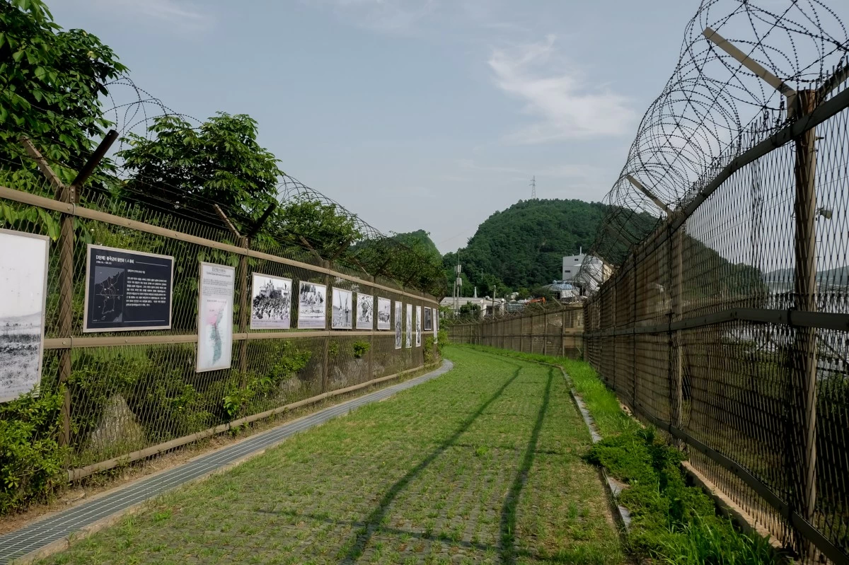
Ganghwa can be accessed from the mainland via a connecting bridge. But the roads, particularly those leading to the DMZ Peace Trail, are heavily guarded.
There is a checkpoint prior to entering the vicinity, and military personnel are tasked to check the ingress and egress as well as the necessary documents of the people.
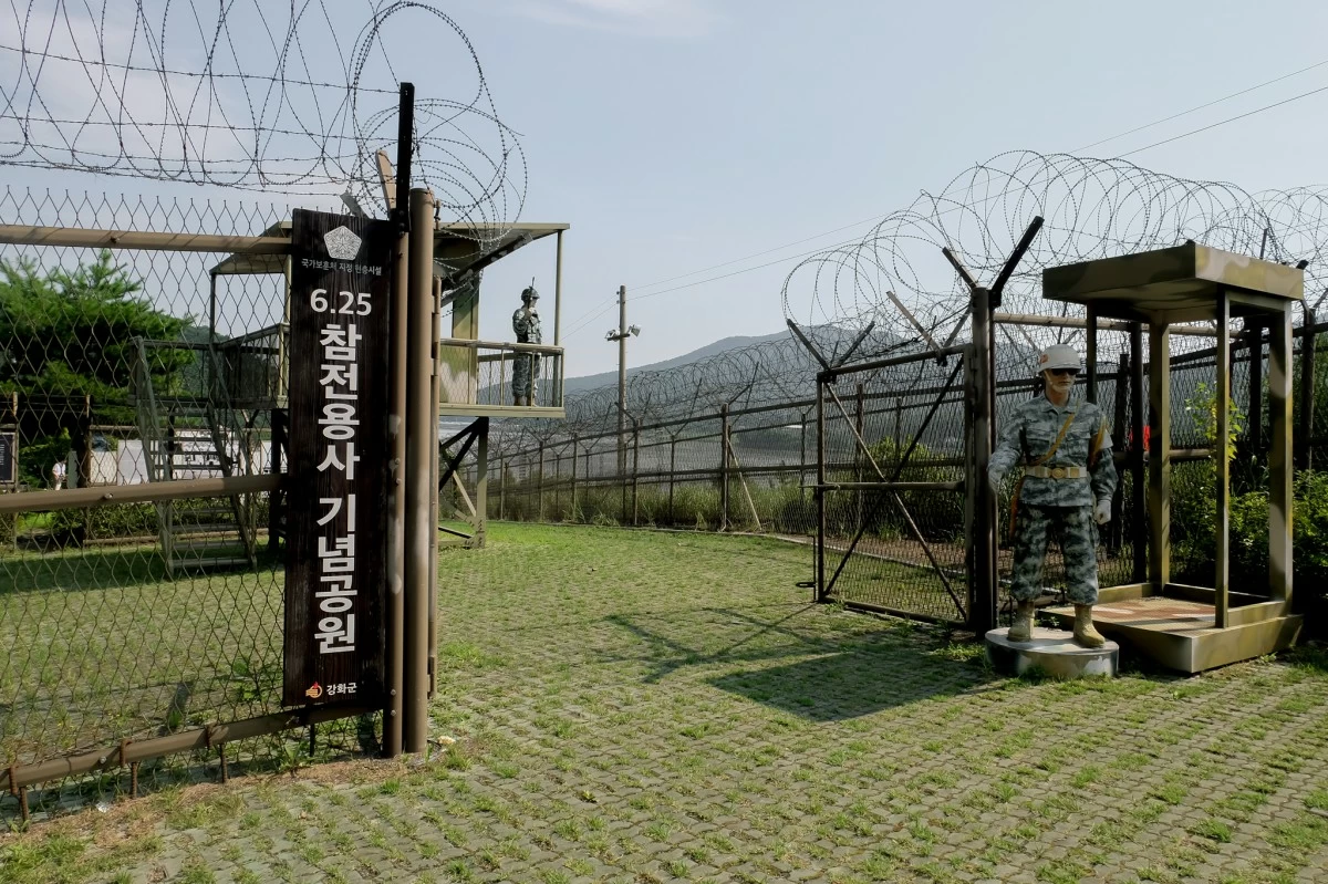
Various types of barbed-wires—some narrow, some as wide as the mouth of a water drum—are coiled over the eight to 10-feet tall fences installed all over the area. There are two rows of fences that are equally fortified. Between them is a walkway.
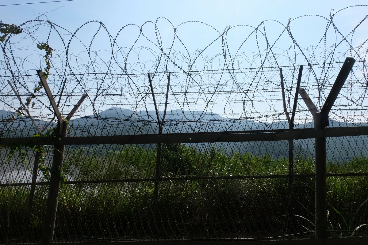
In Uido Dondae, there is a breathtaking panoramic view of North Korea’s Songaksan Mountain. But before one could get excited, a sign posted on the fence reminds those who have been granted access: "No photography allowed".
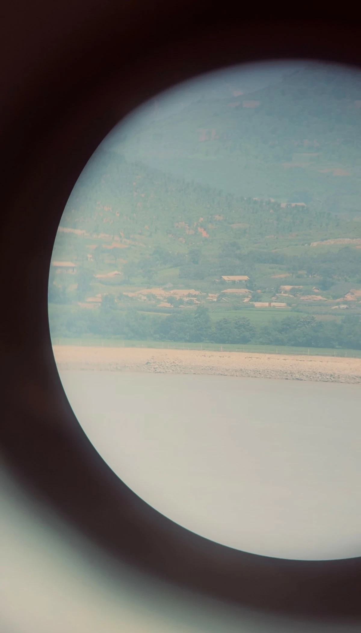
Just across the waters by Uidu Dondae is the North Korean village of Samdal-ri in Kaepung County.
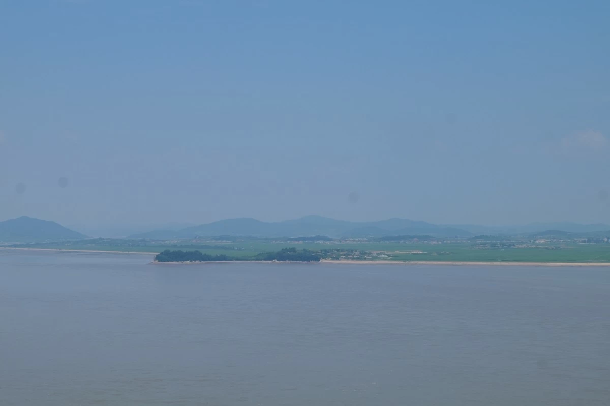
Notable in this village are tiny homes painted in white, a school, military posts and an industrial zone—one to three-levels-high.
The use of binoculars will offer a glimpse of the North Korean way of life—a communal one—as they till land, plow rice, and transport their harvest by bus.
The DMZ Peace Trail
The DMZ Peace Trail is the main attraction on this island. There are proposals to turn it into a tourist spot, especially for foreigners. But talks were halted, and only South Koreans could access the trail.
Access by foreigners, except by those whose identities have undergone screening, were restricted, a South Korean government official said. However, talks among relevant ministries to open it to outsiders are already ongoing.
Spanning 62.5 kilometers, the DMZ Peace Trail opened in 2019 to commemorate the first anniversary of the 2018 inter-Korean summit—a summit where the two Korean leaders meet.
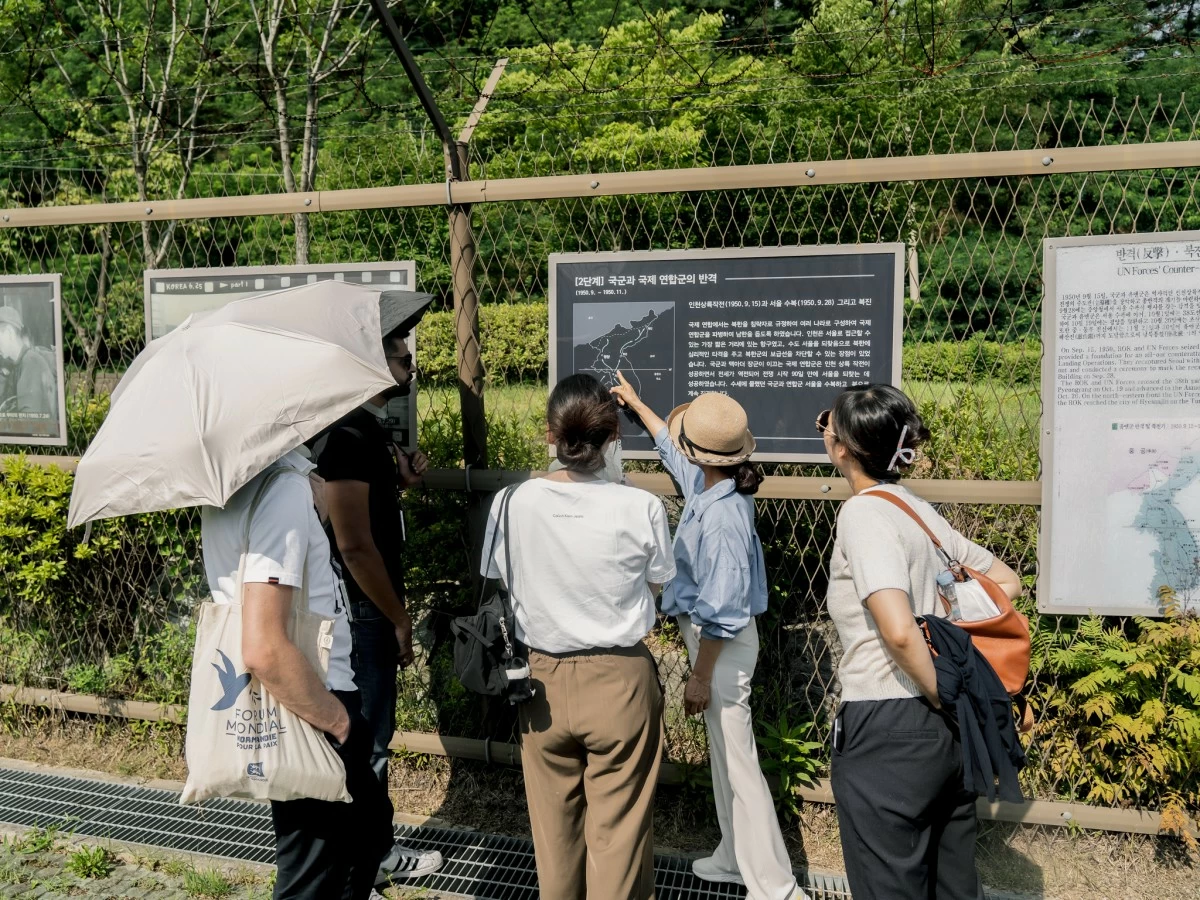
The tour of the DMZ Peace Trail on this island starts at the Veterans Memorial Park, where a docent tells brief stories related to the Korean War.
The Korean War broke out in 1950 when a then-united Korea was liberated from imperial Japan. The country's backers—the Soviet Union and China as well as the US—did not yield their respective grips of control over different parts of Korea, eventually dividing it militarily and politically.
About 300 meters away is the Ganghwa Observatory Park, which has an indoor museum that features a bit about North Korea.
There is also the "Room to Wish for Unification", where thousands of people have posted written notes about their wishes for Korean reunification.
The brutal conditions of hunger and forced labor experienced by people in the North following the division forced many to defect to the South, separating them from their families.
Living on the island are such families as well as the last few surviving first defectors. They managed to endure displacement due to the political and military conflict 80 years back.
From here, they see the skylines of their hometowns, where they are so close yet still feel so far.