


'Emong' weakens into tropical depression, exits PAR— PAGASA
By Jel Santos
Published Jul 26, 2025 08:06 am


(PHOTO: DOST-PAGASA FACEBOOK PAGE)
Tropical Cyclone Emong has weakened further into a tropical depression and is now moving away from the country, the Philippine Atmospheric, Geophysical and Astronomical Services Administration (PAGASA) said early Saturday, July 26.
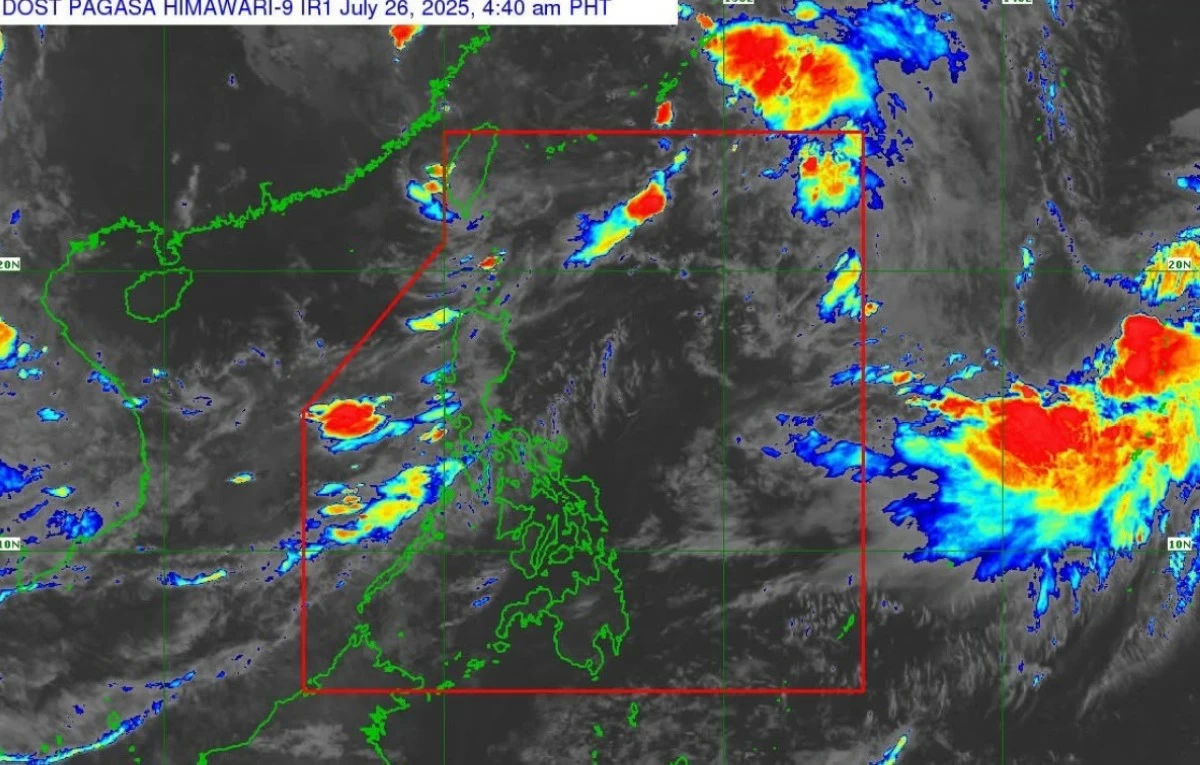
“Mas humina pa at nag-downgrade na into a tropical depression si Bagyong Emong at huli itong namataan sa layong 500 kilometers northeast ng Itbayat, Batanes (Emong has weakened and was downgraded into a tropical depression. It was last seen 500 kilometers northeast of Itbayat, Batanes),” PAGASA weather specialist Grace Castañeda said.
She said the cyclone is packing maximum winds of 55 kilometers per hour near the center and gustiness of up to 70 kph.
“Ito ay kumikilos pahilaga, hilagang silangan sa bilis na 45 kph, and mapapansin nga po natin na mas bumilis ang pagkilos nito and ine-expect po natin between this 5 a.m. to 7 a.m. at nasa labas na ito ng ating area of responsibility (It is moving north northeast at 45 kph. We’ve observed it speeding up, and we expect that between 5 a.m. and 7 a.m., it will already be outside our area of responsibility),” said Castañeda.
The state weather bureau said that "Emong" no longer has any effect on any part of the country.
“Sa kasalukuyan, wala na pong epekto si Bagyong Emong sa ano mang bahagi ng ating bansa (As of now, Emong has no more impact on any part of the country),” she said.
Meanwhile, Castañeda said PAGASA is also monitoring two more tropical systems, one of them previously known as "Dante."
“‘Yung isa pang bagyo na mino-monitor natin, ‘yung si dating Bagyong Dante ay huling namataan sa layong 600 kilometers hilaga ng Itbayat, Batanes. At gaya po bagyong Emong, wala na rin po itong epekto sa anomang bahagi ng ating bansa (We are also monitoring a second cyclone, formerly Bagyong Dante, last spotted 600 kilometers north of Itbayat, Batanes. Like Emong, it no longer affects any part of the country),” the weather specialist said.
PAGASA said a third tropical system is also under watch but remains far from Philippine territory.
“Mayroon pa po tayong isang bagyo na mino-monitor sa labas ng ating area of responsibility, ito ay isang tropical storm na may international name na Krosa, huli po ito namataan sa layong 2,315 kilometers silangan ng northern Luzon. At gaya po ni Bagyong Emong at Bagyong Dante, wala po itong epekto sa anomang bahagi ng ating bansa and less likely rin po na pumasok sa ating area of responsibility (We’re also monitoring another cyclone outside our area of responsibility, a tropical storm named Krosa, last seen 2,315 kilometers east of northern Luzon. Like Emong and Dante, it has no effect on the country and is unlikely to enter the PAR),” Castañeda said.
No tropical cyclone wind signal currently in effect
However, PAGASA said enhanced southwest monsoon continues to whip up strong to gale-force winds in several regions including Metro Manila, Luzon provinces from Ilocos to Bicol, parts of the Visayas, and even as far south as Davao Oriental.
“The enhanced Southwest Monsoon will bring strong to gale-force gusts over the following areas… especially in coastal and upland areas exposed to winds,” the agency stated.
Among the areas affected by strong winds today are Batanes, Babuyan Islands, Ilocos Region, Cordillera Administrative Region, Nueva Vizcaya, Quirino, Central Luzon, Metro Manila, CALABARZON, MIMAROPA, Bicol Region, Northern Samar, Western Visayas, Negros Occidental, and Davao Oriental.
PAGASA said rough seas remain a threat to coastal communities and maritime operations.
Waves of up to 4.0 meters are expected along the seaboards of Batanes and Babuyan Islands, and the northern coast of Ilocos Norte, it added.
“Mariners of small seacrafts, including all types of motorbancas, are advised not to venture out to sea under these conditions, especially if inexperienced or operating ill-equipped vessels,” PAGASA said.