


Manila Bulletin
 Philippines
National
LPA east of Luzon develops into tropical depression Crising — PAGASA
Philippines
National
LPA east of Luzon develops into tropical depression Crising — PAGASA
Philippines
National
LPA east of Luzon develops into tropical depression Crising — PAGASA
LPA east of Luzon develops into tropical depression Crising — PAGASA
Published Jul 16, 2025 10:56 am
|
Updated Jul 16, 2025 01:15 pm


PAGASA
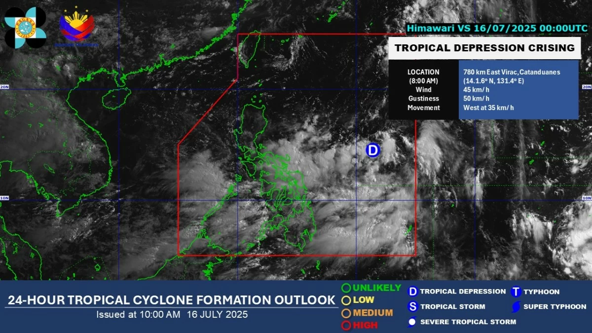
The Low-Pressure Area (LPA) being monitored east of Luzon developed into a tropical depression at 8 a.m. on Wednesday, July 16, and was named “Crising,” said the Philippine Atmospheric, Geophysical and Astronomical Services Administration (PAGASA).
As of 11 a.m., Crising was located 725 kilometers east of Virac, Catanduanes.
It has maximum sustained winds of 45 kilometers per hour (kph) and gusts of up to 55 kph, and is moving westward at 35 kph.
PAGASA said Crising is expected to move generally west-northwest to northwest in the coming days.
Due to the tropical depression and the southwest monsoon (habagat), most of the country may experience moderate to heavy rainfall, PAGASA warned.
By Friday evening, July 18, Crising may approach or make landfall over the Babuyan Islands.
However, any slight shift in its track could result in a landfall over mainland Cagayan.
PAGASA said Crising may intensify into a tropical storm on Thursday morning, July 17, and could further strengthen while traversing the Philippine Sea.
It may reach severe tropical storm category by Friday afternoon or evening, prior to its approach to Northern Luzon.
PAGASA added that Crising may intensify further and reach typhoon status before its approach.
Crising is the third tropical cyclone to develop within or enter the Philippine Area of Responsibility this year, and the second for the month of July.