


Manila Bulletin
 Philippines
National
Trough of 'Bising' to bring rains over extreme N. Luzon; 'habagat' to prevail over rest of the Philippines
Philippines
National
Trough of 'Bising' to bring rains over extreme N. Luzon; 'habagat' to prevail over rest of the Philippines
Philippines
National
Trough of 'Bising' to bring rains over extreme N. Luzon; 'habagat' to prevail over rest of the Philippines
Trough of 'Bising' to bring rains over extreme N. Luzon; 'habagat' to prevail over rest of the Philippines
Published Jul 6, 2025 10:41 am
|
Updated Jul 6, 2025 01:36 pm


PAGASA
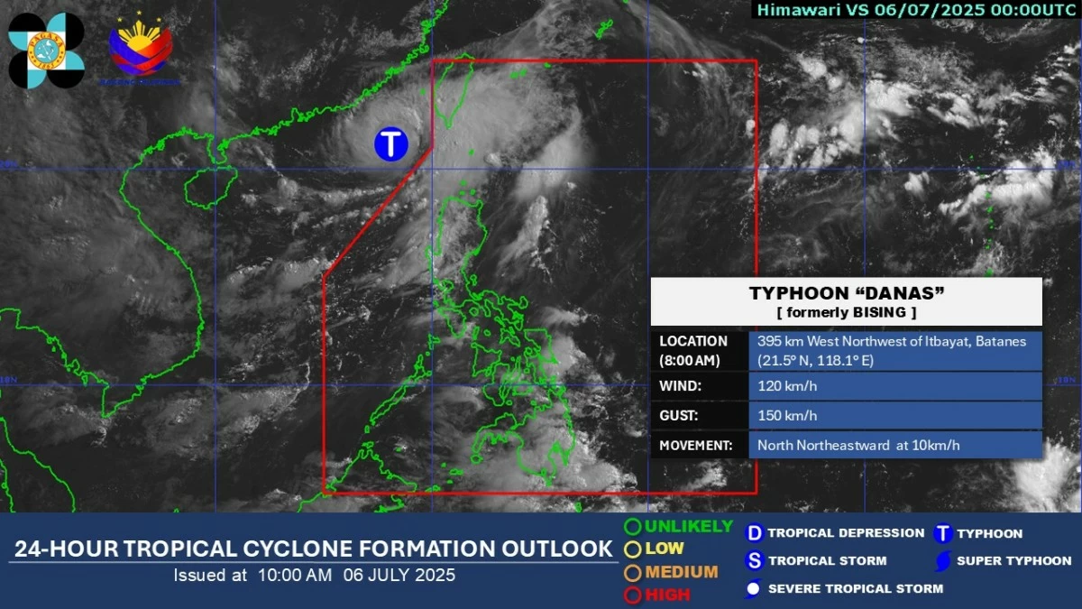
Scattered rain showers are expected in parts of extreme Northern Luzon due to the trough or extension of Typhoon “Danas” (formerly “Bising”), while the southwest monsoon (habagat) will continue to affect much of the country, the Philippine Atmospheric, Geophysical and Astronomical Services Administration (PAGASA) said on Sunday, July 6.
PAGASA weather specialist Obet Badrina explained that although the typhoon is moving away from the country, its trough will bring scattered light to occasionally heavy rains over Batanes and Babuyan Islands.
As of 8 a.m., the center of Typhoon Danas was located 395 kilometers west-northwest of Itbayat, Batanes, or outside the Philippine Area of Responsibility (PAR), and is moving towards Taiwan.
Meanwhile, the habagat will continue to bring occasional rains over Ilocos Region, Zambales, and Bataan.
Scattered monsoon rain showers and thunderstorms are also expected to persist in Metro Manila, Calabarzon, Mimaropa, Cordillera Administrative Region, Western Visayas, Negros Island Region, Zamboanga Peninsula, Bangsamoro Autonomous Region in Muslim Mindanao, and the rest of Cagayan Valley and Central Luzon.
The rest of the country will experience partly cloudy to cloudy skies with isolated rain showers or thunderstorms.
Badrina noted the possibility that “Bising” may briefly reenter PAR by Sunday evening or early Monday morning but is expected to move quickly and exit shortly after.
He added that no tropical cyclone wind signalss are currently expected to be raised.