


'Bising' exits PAR; tropical cyclone wind signal lifted
Published Jul 4, 2025 06:12 pm


PAGASA
Tropical depression “Bising” exited the Philippine Area of Responsibility (PAR) on Friday afternoon, July 4, said the Philippine Atmospheric, Geophysical and Astronomical Services Administration (PAGASA).
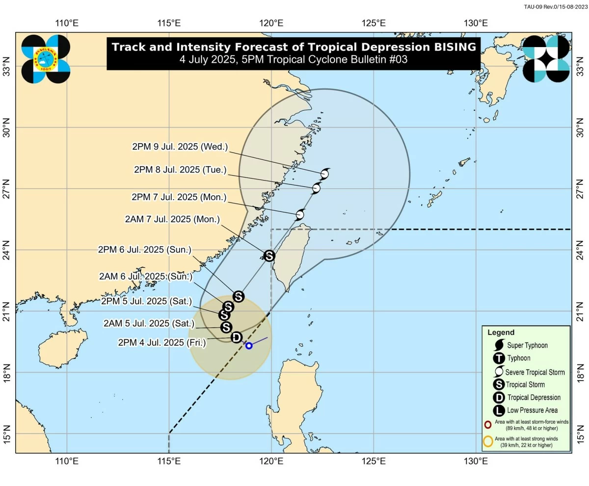
As of 4 p.m., the center of Bising was located 345 kilometers west-northwest of Calayan, Cagayan.
It was moving northwestward at 15 kilometers per hour (kph), with maximum sustained winds of 55 kph and gusts of up to 70 kph.
PAGASA has lifted Tropical Cyclone Wind Signal No. 1 previously raised due to Bising.
However, the weather bureau warned that Bising’s enhancement of the southwest monsoon (habagat) will bring strong to gale-force winds over several parts of Luzon in the coming days.
In addition to strong winds, moderate to heavy rains are expected across parts of Northern Luzon due to the combined effects of the trough or extension of Bising and the habagat.
From Friday until Saturday afternoon, July 5, moderate to heavy rainfall (50-100 mm) is expected over Ilocos Norte and Batanes due to Bising’s trough.
From Saturday afternoon until Sunday afternoon, July 6, Batanes will continue to experience moderate to heavy precipitation.
Meanwhile, the habagat is expected to bring moderate to heavy rains over Ilocos Sur and La Union from Friday to Saturday afternoon.
From Saturday afternoon through Sunday afternoon, Ilocos Norte and Ilocos Sur may receive moderate to heavy rains.
PAGASA advised residents in affected areas to remain vigilant against possible flooding and landslides, especially in low-lying and mountainous regions.
Coastal communities are also warned of hazardous sea conditions.
Rough seas with wave heights of up to 3 meters are expected along the western seaboards of Babuyan Islands and Ilocos Norte.
Surrounding coastal areas may experience moderate seas, with small vessels advised to take precautionary measures or avoid venturing out to sea.
PAGASA said Bising may intensify into a tropical storm within the next 12 hours as it moves over the sea north of Taiwan.
It is expected to shift northeastward over the waters west of extreme Northern Luzon and could reenter PAR on Monday, July 7, before exiting again later that day.
While the track remains uncertain, PAGASA noted that a southward shift closer to the country has become increasingly unlikely.