


A Low-Pressure Area (LPA) spotted east of extreme Northern Luzon has a high chance of developing into a tropical depression within the next 24 hours, said the Philippine Atmospheric, Geophysical and Astronomical Services Administration (PAGASA) on Thursday, June 12.
Manila Bulletin
 Philippines
National
LPA near extreme N. Luzon likely to develop into tropical depression
Philippines
National
LPA near extreme N. Luzon likely to develop into tropical depression
Philippines
National
LPA near extreme N. Luzon likely to develop into tropical depression
LPA near extreme N. Luzon likely to develop into tropical depression
Published Jun 12, 2025 08:31 am


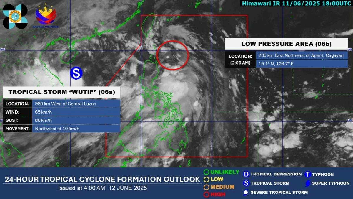
As of 3 a.m., the LPA was located 235 kilometers east of Calayan, Cagayan. Based on PAGASA’s monitoring, the weather disturbance is moving north-northwestward and showing signs of intensification.
If it becomes a tropical depression within the Philippine Area of Responsibility (PAR), it will be named “Auring,” PAGASA weather specialist Grace Castañeda said.
Castañeda added that the weather disturbance is moving relatively quickly and may approach Taiwan once it intensifies.
It could also exit the PAR or weaken within 48 hours or less.
Regardless of whether it develops into a tropical cyclone, Castañeda said the LPA is expected to bring rains over extreme Northern Luzon, particularly in Batanes and Cagayan.
Meanwhile, the southwest monsoon (habagat) will continue to bring moderate to heavy rains to Pangasinan, Zambales, Bataan, and Occidental Mindoro within the next 24 hours.
Light to occasional heavy monsoon rains may also affect Metro Manila, La Union, Benguet, Tarlac, Pampanga, Bulacan, Cavite, Batangas, Palawan, and Antique.
The rest of Luzon and Visayas, as well as Zamboanga Peninsula, Dinagat Islands, and Surigao del Norte, will experience cloudy skies with scattered rain showers and thunderstorms.
Meanwhile, partly cloudy to cloudy skies with isolated rain showers or localized thunderstorms will prevail over the rest of Mindanao.
PAGASA advised the public to remain vigilant for possible localized flooding, especially in urbanized, low-lying, and river-adjacent areas, as well as landslides in highly susceptible areas.