


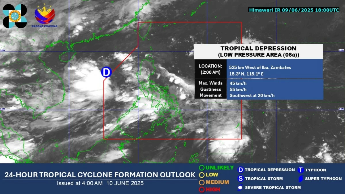
The Low-Pressure Area (LPA) that exited the Philippine Area of Responsibility (PAR) has intensified into a tropical depression but is no longer expected to directly affect any part of the country, the Philippine Atmospheric, Geophysical and Astronomical Services Administration (PAGASA) said on Tuesday, June 10.
Manila Bulletin
 Philippines
National
LPA leaves PAR, now a tropical depression; 'habagat' to bring more rain
Philippines
National
LPA leaves PAR, now a tropical depression; 'habagat' to bring more rain
Philippines
National
LPA leaves PAR, now a tropical depression; 'habagat' to bring more rain
LPA leaves PAR, now a tropical depression; 'habagat' to bring more rain
Published Jun 10, 2025 09:38 am


PAGASA
PAGASA weather specialist Chenel Dominguez said the tropical depression was located 435 kilometers west of Iba, Zambales, as of 3 a.m.
She added that since the weather disturbance is now outside PAR, PAGASA did not assign it a local name.
However, the agency is not ruling out the possibility that it could reenter PAR, although it is still not expected to have a direct impact on the country.
‘Habagat’ rains to persist
Meanwhile, the southwest monsoon, locally known as “habagat,” will continue to bring rain over parts of the country, particularly in the western sections of Luzon.
Based on PAGASA’s heavy rainfall outlook, heavy rains may affect Zambales, Bataan, Occidental Mindoro, and Palawan on Tuesday.
On Wednesday, June 11, heavy rainfall may prevail over Metro Manila, Bataan, Pampanga, Cavite, Batangas, Quezon, Oriental Mindoro, Palawan, Romblon, Marinduque, and Antique.
On Thursday, June 12, heavy rains may persist in Metro Manila, Bataan, Zambales, Pampanga, Cavite, Batangas, Occidental Mindoro, and Palawan.
PAGASA warned of possible localized flooding, especially in urbanized, low-lying, and river-adjacent areas, as well as landslides in highly susceptible areas.
It added that forecast rainfall may be heavier in mountainous and elevated areas, while impacts in some areas could be worsened by significant antecedent rainfall.
Meanwhile, the rest of the country will experience partly cloudy to cloudy skies with isolated rain showers or localized thunderstorms.