


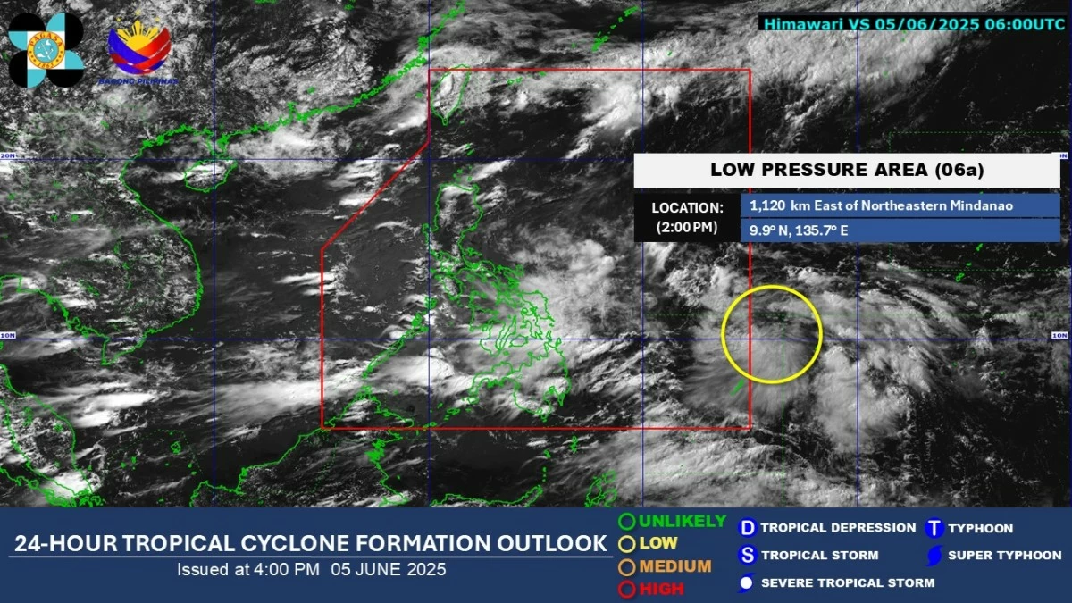
A low-pressure area (LPA) east of Mindanao is expected to enter the Philippine Area of Responsibility (PAR) within the next 24 hours, the Philippine Atmospheric, Geophysical and Astronomical Services Administration (PAGASA) said on Thursday, June 5.
LPA to enter PAR within 24 hours
Published Jun 5, 2025 05:51 pm


PAGASA
PAGASA weather specialist John Manalo said the LPA was located 1,120 kilometers east of northeastern Mindanao as of 3 p.m.
He noted that the weather disturbance has a low chance of developing into a tropical cyclone during this period.
However, its trough or extension may bring cloudy skies with scattered rain showers and thunderstorms over the eastern sections of the Visayas and Mindanao.
Meanwhile, the southwest monsoon, locally known as “habagat,” will affect other parts of the country.
Cloudy skies with scattered rain showers and thunderstorms are expected over Mimaropa, Bicol Region, Western Visayas, Negros Island Region, Zamboanga Peninsula, Bangsamoro Autonomous Region in Muslim Mindanao, and Quezon province.
Metro Manila and the rest of Luzon will experience partly cloudy to cloudy skies with isolated rain showers or thunderstorms.
PAGASA advised the public, especially those in vulnerable areas, to remain vigilant against possible flash floods.