


The Philippine Atmospheric, Geophysical and Astronomical Services Administration (PAGASA) said one or two tropical cyclones may form or enter the Philippine Area of Responsibility (PAR) in June.
Up to 2 cyclones may form or enter PAR in June, says PAGASA
Published May 28, 2025 01:23 pm


PAGASA
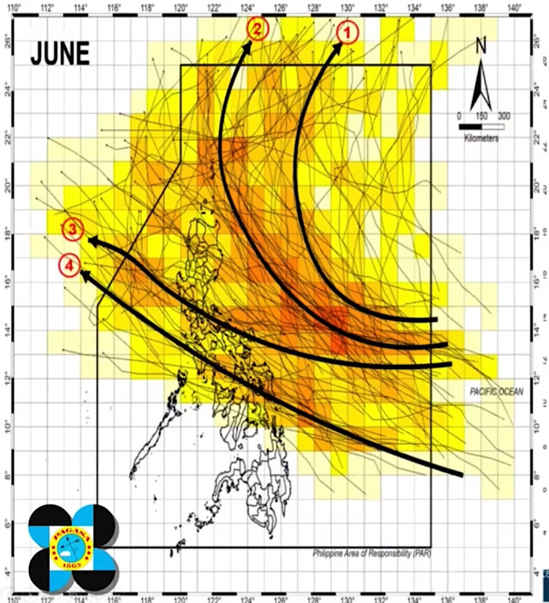
Citing historical data and climatological patterns, PAGASA weather specialist Joanne Mae Adelino said during a climate forum on Wednesday, May 28 that tropical cyclones in June typically follow one of four paths.
“Some tropical cyclones enter the PAR, move toward the Philippine landmass but then recurve before making landfall, heading toward Taiwan or Japan,” Adelino explained.
“Others enter the PAR but recurve afterward without making landfall, moving toward Japan,” she added.
Adelino also noted that some cyclones that make landfall either traverse the southern part of Luzon and move toward northern Vietnam or Hong Kong, or pass through the eastern to northern parts of the Visayas before heading toward the same areas.
If one or two tropical cyclones enter PAR next month, PAGASA will assign local names based on its official list for 2025. The first two names on the list are “Auring” and “Bising.”
There have been no tropical cyclones that have entered the PAR since the start of the year.