


Typhoon Julian en route to Taiwan; PAGASA lifts Signal No. 4


At A Glance
- The highest tropical cyclone wind warning currently in effect due to Julian is Signal No. 3.
- PAGASA said Julian may intensify into a super typhoon in 24 hours, although there is a possibility that the typhoon has already reached its peak intensity.
The Philippine Atmospheric, Geophysical and Astronomical Services Administration (PAGASA) has lifted Tropical Cyclone Wind Signal No. 4 on Monday evening, Sept. 30, as Typhoon “Julian” (international name “Krathon) moves toward Taiwan.
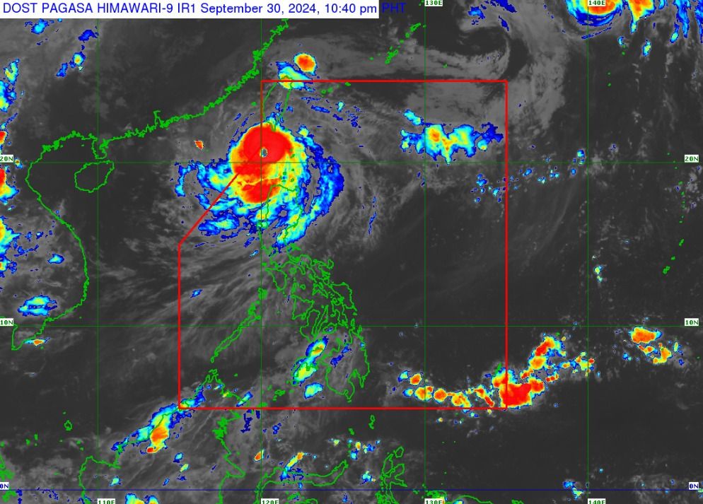
However, Signal No. 3 remains hoisted over Batanes, while Signal No. 2 is in effect over Babuyan Islands, Ilocos Norte, northern part of Apayao, and northwestern portion of mainland Cagayan.
Signal No. 1 remains hoisted over Ilocos Sur, La Union, Pangasinan, the rest of Apayao, Kalinga, Abra, Mountain Province, Ifugao, Benguet, the rest of mainland Cagayan, Isabela, Quirino, Nueva Vizcaya, northern portion of Aurora, and northern portion of Nueva Ecija.
Likewise, intense to torrential rainfall (more than 200 millimeters) may persist in Batanes, Babuyan Islands, and Ilocos Norte.
Heavy to intense rainfall (100 to 200 millimeters) may continue to affect mainland Cagayan, Abra, Benguet, and the rest of Ilocos Region, while moderate to heavy rainfall may prevail over the rest of Cordillera Administrative Region.
As of 11 p.m., the center of Julian was located 155 kilometers west-southwest of Itbayat, Batanes, and is expected to move westward at 15 kilometers per hour (kph) over the Luzon Strait en route to Taiwan.
The typhoon has maintained its maximum sustained winds of 175 kilometers per hour (kph) near the center and gusts of up to 215 kph.
PAGASA said Julian may intensify into a super typhoon in 24 hours, although there is a possibility that the typhoon has already reached its peak intensity.
Moreover, the typhoon may briefly leave the Philippine Area of Responsibility (PAR) by Tuesday, Oct. 1, before re-entering on Wednesday, Oct. 2.
Afterwards, the typhoon will accelerate northeastward towards the East China Sea and exit the PAR on Thursday morning or afternoon, Oct. 3.