


 Philippines
National
'Enteng' to exit Philippine area of responsibility within 24 hours; wind signals lowered from No. 2 to 1
Philippines
National
'Enteng' to exit Philippine area of responsibility within 24 hours; wind signals lowered from No. 2 to 1
'Enteng' to exit Philippine area of responsibility within 24 hours; wind signals lowered from No. 2 to 1


At A Glance
- If it maintains its west-northwestward track at 10 kilometers per hour (kph), Enteng will be outside the Philippine area of responsibility (PAR) by Wednesday morning, Sept. 4.
- Even after exiting the PAR, Enteng may still enhance the southwest monsoon, or "habagat."
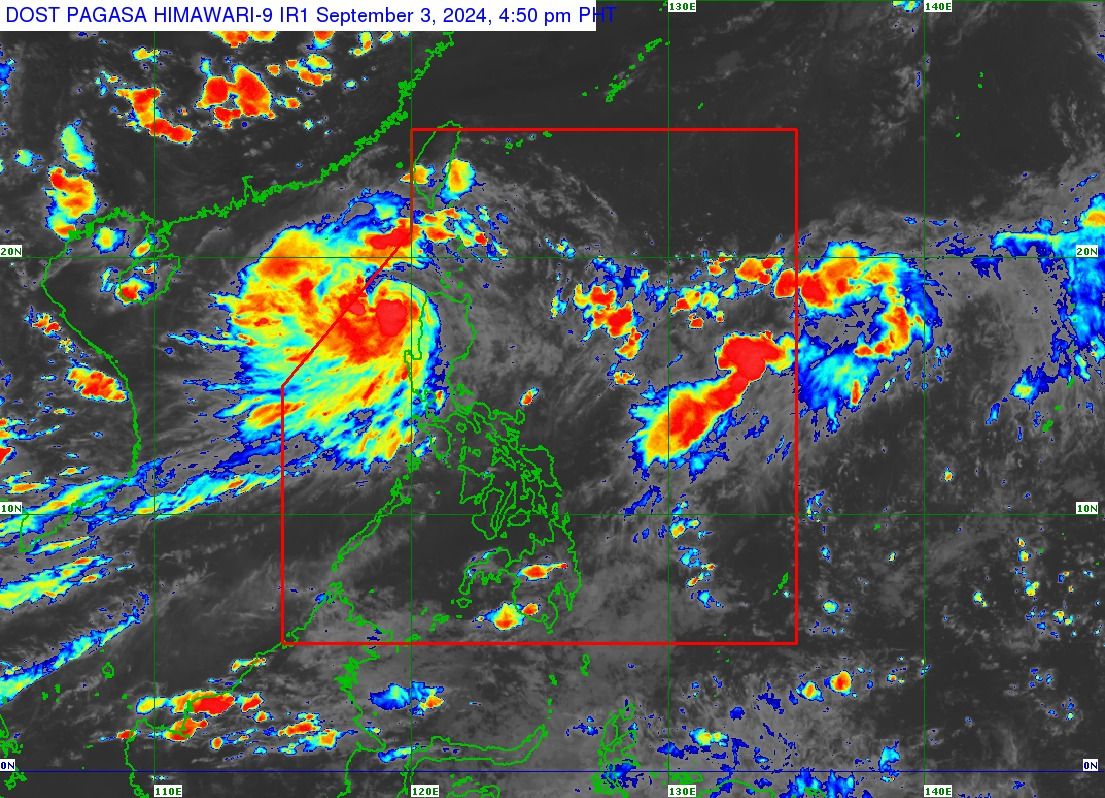
Severe Tropical Storm “Enteng” (international name “Yagi”) is expected to exit the country’s area of responsibility within 24 hours as it moves farther away, prompting the Philippine Atmospheric Geophysical and Astronomical Services Administration (PAGASA) to downgrade the Tropical Cyclone Wind Signals from No. 2 to 1 on Tuesday afternoon, Sept. 3.
Based on the PAGASA’s 5 p.m. bulletin, Enteng was located 165 kilometers west-northwest of Laoag City, Ilocos Norte.
If it maintains its west-northwestward track at 10 kilometers per hour (kph), it will be outside the Philippine area of responsibility (PAR) by Wednesday morning, Sept. 4.
While over the West Philippine Sea, Enteng intensified into a severe tropical storm, and now packing maximum sustained winds of 95 kph near the center and gusts reaching 115 kph.
However, as the severe tropical storm moves farther away, Signal No. 2 has been lifted, leaving only Signal No. 1 in effect for Ilocos Norte, Ilocos Sur, the northern portion of La Union, and Abra.
PAGASA said that 50 to 100 millimeters of rainfall (moderate to heavy) may continue in the Ilocos Region and Abra until Wednesday.
Storm-enhanced ‘habagat’
Even after exiting the PAR, Enteng may still enhance the southwest monsoon, or “habagat.”
In its 11 a.m. weather advisory, PAGASA warned that rainy weather may persist in the western parts of Luzon over the next two days.
On Wednesday, Pangasinan, Zambales, Bataan, and Occidental Mindoro may receive 100 to 200 millimeters of rainfall, which is considered “heavy to intense.”
Meanwhile, northern Palawan (including Calamian, Cuyo, and Cagayancillo Islands), Metro Manila, Cavite, Batangas, Rizal, Laguna, Bulacan, Pampanga, Tarlac, Nueva Ecija, La Union, and Benguet may experience moderate to heavy monsoon rains.
On Thursday, Sept. 5, heavy to intense rains may continue in Zambales, Bataan, and Occidental Mindoro, while moderate to heavy rains may affect northern Palawan (including Calamian, Cuyo, and Cagayancillo Islands), Cavite, Batangas, Bulacan, Pampanga, and Pangasinan.
PAGASA warned of flooding and rain-induced landslides, particularly in areas identified as "highly or very highly susceptible" to these hazards and regions that have received significant rainfall in the past few days.