


 Philippines
National
Signal No. 1 raised over parts of Cagayan province due to TD Julian
Philippines
National
Signal No. 1 raised over parts of Cagayan province due to TD Julian
Signal No. 1 raised over parts of Cagayan province due to TD Julian


At A Glance
- The highest wind warning that may be issued during the close approach of Tropical Depression Julian is Signal No. 3 or 4.
- PAGASA said there is an increasing chance that the track forecast will shift westward in the succeeding bulletins, bringing the projected path of Julian closer to extreme Northern Luzon.
- It may reach typhoon strength by Sunday, Sept. 29, as rapid intensification becomes increasingly likely.
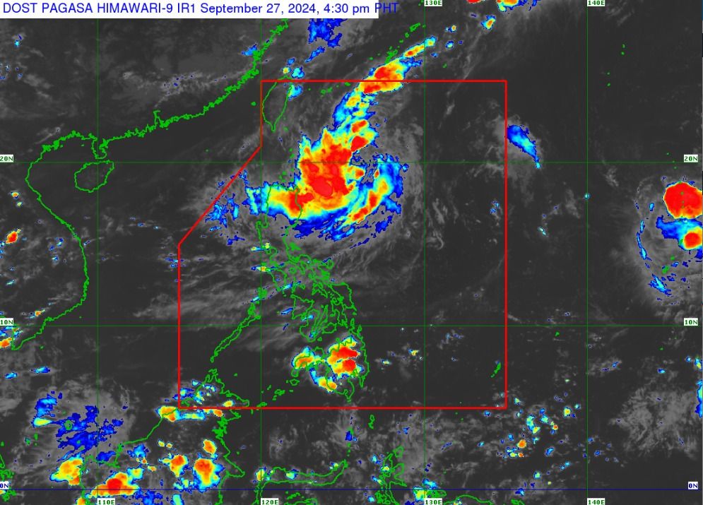
The Philippine Atmospheric, Geophysical and Astronomical Services Administration (PAGASA) raised Tropical Cyclone Wind Signal No. 1 over Babuyan Islands and the eastern part of mainland Cagayan on Friday afternoon, Sept. 27, due to the anticipated effects of Tropical Depression “Julian.”
PAGASA said “minimal to minor” impact from strong winds may occur in any area covered by Wind Signal No. 1.
It added that the highest wind warning that may be issued during the close approach of Julian is Signal No. 3 or 4.
Meanwhile, moderate to heavy rains may begin to affect Cagayan on Friday.
By Saturday, Sept. 28, moderate to heavy rainfall may prevail over Cagayan, Isabela, Batanes, Apayao, and Ilocos Norte.
By Sunday, Sept. 29, Cagayan, Batanes, Apayao, and Ilocos Norte will experience heavy to intense rainfall, while Isabela, the rest of Ilocos Region, and Cordillera Administrative Region may receive moderate to heavy rainfall.
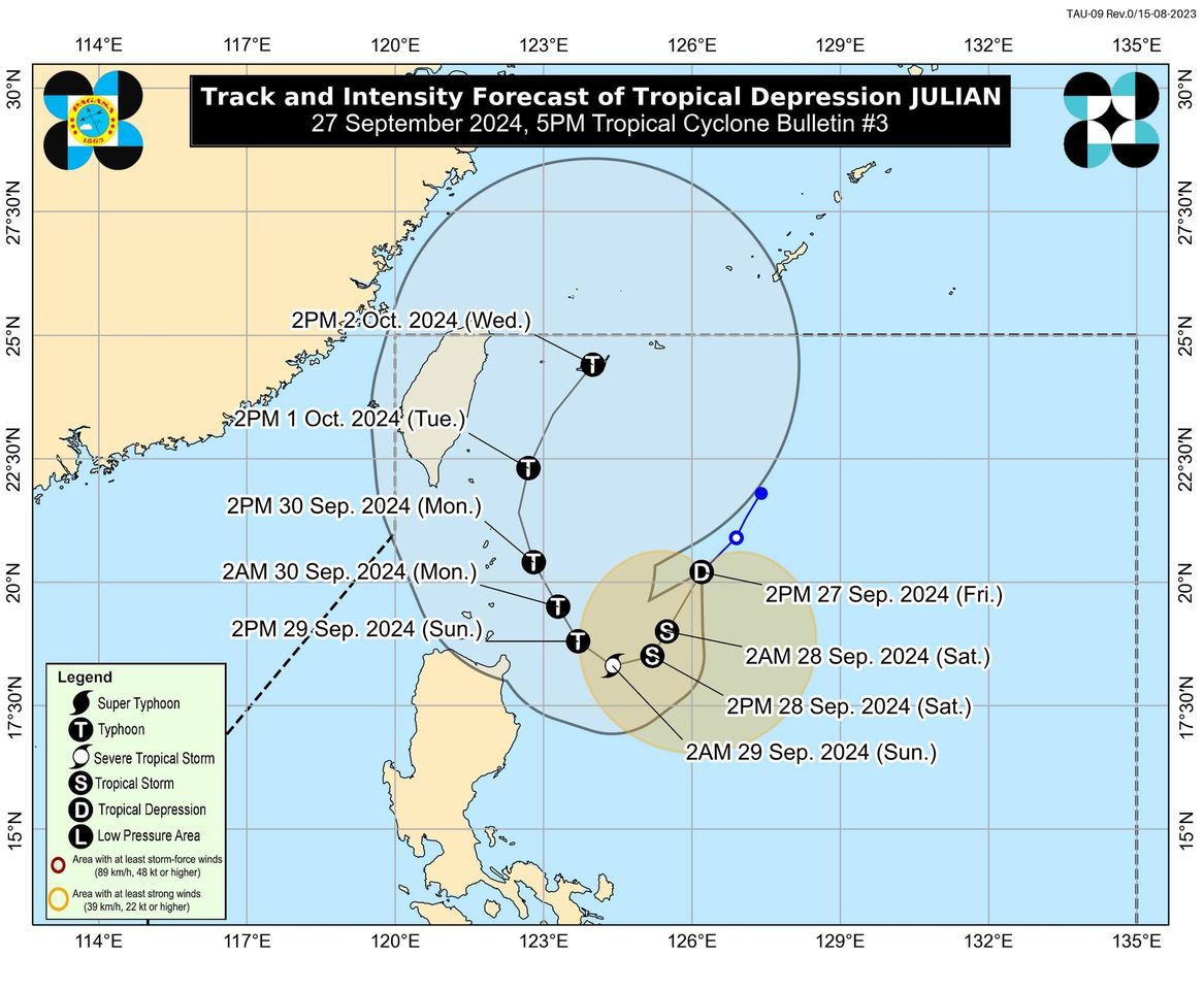
PAGASA said the tropical depression may follow a looping path while staying over the waters east of Batanes and Cagayan for the next five days.
“There is an increasing chance that the track forecast will shift westward in the succeeding bulletins, bringing the projected path of Julian closer to extreme Northern Luzon,” it added.
Julian may continue to intensify throughout the forecast period and could reach tropical storm status by Friday night or Saturday morning.
It may reach typhoon strength by Sunday, Sept. 29, as rapid intensification becomes increasingly likely.
As of 5 p.m. on Friday, Tropical Depression Julian was located 445 kilometers east-southeast of Itbayat, Batanes, or 425 kilometers east of Basco, Batanes.
It has maximum sustained winds of 55 kilometers per hour (kph) near the center and gusts of up to 70 kph and is expected to move southwestward at 20 kph.