LPA develops into tropical depression Julian — PAGASA

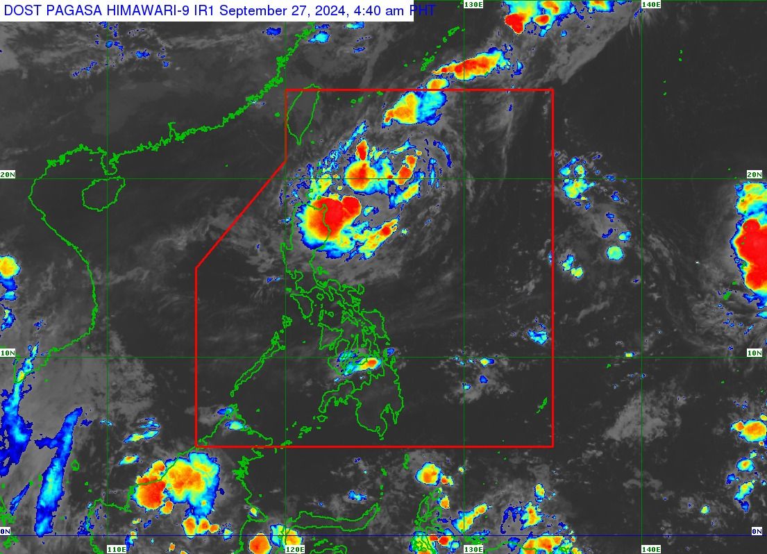
The Philippine Atmospheric, Geophysical and Astronomical Services Administration (PAGASA) said on Friday, Sept. 27 that the Low Pressure Area (LPA) east of Batanes has developed into a tropical depression and was given the local name “Julian,” the 10th tropical cyclone of 2024 and the sixth this month.
PAGASA located Julian 525 kilometers east of Itbayat, Batanes at 5 a.m., moving south-southwestward at 15 kilometers per hour (kph).
It has maximum sustained winds of 55 kph near the center and gusts of up to 15 kph.
PAGASA said Tropical Cyclone Wind Signal No. 1 may be hoisted over parts of Cagayan Valley on Friday, with the highest possible signal at No. 2 or 3.
Due to Julian, moderate to heavy rainfall may affect Ilocos Norte, Batanes, and Cagayan by Saturday, Sept. 28.
By Sunday, Sept. 29, heavy to intense rainfall may prevail over Batanes and Babuyan Islands, while moderate to heavy rains may persist in Ilocos Norte, Apayao, and mainland Cagayan.
Meanwhile, the rest of the country will be partly cloudy to cloudy with isolated rain showers due to localized thunderstorms.

Cyclone track
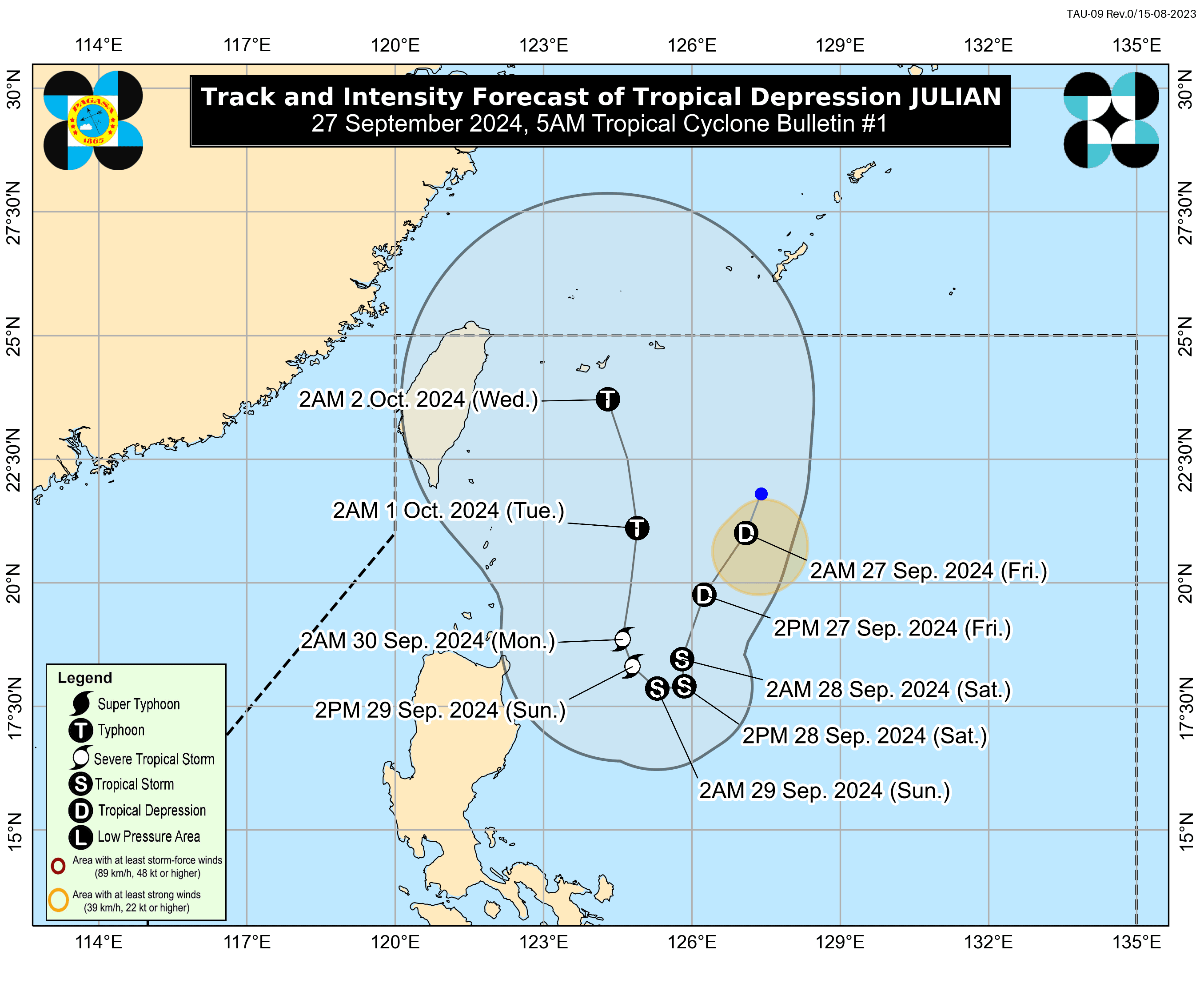
PAGASA said Julian may take a looping path over the waters east of Batanes and Cagayan in the next five days.
Initially, the tropical cyclone will move south-southwest while slowing down, then shift to a slow westward motion on Saturday and northwestward on Sunday.
It is expected to accelerate generally northward on Monday, Sept. 30, and Tuesday, Oct. 1.
PAGASA Weather Specialist Benison Estareja said Julian may remain inside the Philippine Area of Responsibility (PAR) over the next five days.
In addition, PAGASA said Julian will continue to intensify during this period, possibly reaching tropical storm status Friday or Saturday, and may reach severe tropical storm and typhoon categories by Sunday and Tuesday, respectively.
Estareja said another LPA was monitored east of Luzon, outside the PAR, and a tropical depression located about 2,600 kilometers away from the country, near Guam.
However, he added that neither of these weather disturbances is expected to enter the PAR or affect the country’s weather conditions.